TopoQuest Logo
Do you find TopoQuest useful?
Help keep TopoQuest running and adding new maps/features by donating!
Bitcoin:  19c7KJd3qBynnjoSw5npx9KScwjBe4ifkT
Litecoin:  LXs6TkuXGGXo1vDsWCkWVdjQX94eUKd6ui
Home View Maps Find Maps Find Places Resources & Links


Sedgwick, Kansas Topographic Map

USGS Map Title: Sedgwick, KS
USGS Map MRC: 37097H4
DRG (GeoTIFF) Download: o37097h4.tif


Neighboring USGS Topographic Map Quads:


  Halstead, KS  
38097A5
 

  Zimmerdale, KS  
38097A4
 

  Newton, KS  
38097A3
 

  Bentley, KS  
37097H5
 

  Sedgwick, KS  
37097H4
 

  Sedgwick NE, KS  
37097H3
 

  Colwich, KS  
37097G5
 

  Maize, KS  
37097G4
 

  Valley Center, KS  
37097G3


Map MRC Location:

N38°
W98°
N38°
W97°
H8 H7 H6 H5 H4 H3 H2 H1
G8 G7 G6 G5 G4 G3 G2 G1
F8 F7 F6 F5 F4 F3 F2 F1
E8 E7 E6 E5 E4 E3 E2 E1
D8 D7 D6 D5 D4 D3 D2 D1
C8 C7 C6 C5 C4 C3 C2 C1
B8 B7 B6 B5 B4 B3 B2 B1
A8 A7 A6 A5 A4 A3 A2 A1
N37°
W98°
N37°
W97°

Sedgwick, KS USGS 1:24K Topographic Map Preview:
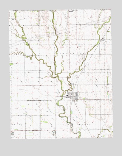
Sedgwick, KS USGS Topographic Map
Click on map above to begin viewing in our Map Viewer.

This topographic map contains these locations and features:
Feature Name Type Latitude Longitude GNIS ID View Map
City of SedgwickCivilN37.9157°W97.4214°2396570View Map
City of Sedgwick Administrative OfficesBuildingN37.9178°W97.4241°2509770View Map
City of Sedgwick Volunteer Ambulance DepartmentBuildingN37.9149°W97.4230°2696511View Map
East Emma CreekStreamN37.9978°W97.4462°477766View Map
Emma CreekStreamN37.9350°W97.4409°473684View Map
First Christian ChurchChurchN37.9179°W97.4252°2689739View Map
Halstead Wastewater Treatment FacilityLocaleN37.9917°W97.4937°2692147View Map
Hillside CemeteryCemeteryN37.9131°W97.4100°473681View Map
Kisiwa CreekStreamN37.9589°W97.4714°473683View Map
Lillian Tear LibraryBuildingN37.9174°W97.4248°2510398View Map
McKinley Mobile Home ParkPopulated PlaceN37.9116°W97.4235°2694124View Map
Mud CreekStreamN37.9806°W97.3895°473685View Map
Pleasant Valley CemeteryCemeteryN37.8840°W97.4842°2673364View Map
Pleasant Valley ChurchChurchN37.8836°W97.4826°473679View Map
Plymouth Congregational ChurchChurchN37.9160°W97.4241°2689740View Map
PutnamPopulated PlaceN37.9689°W97.3878°484649View Map
R L Wright Elementary SchoolSchoolN37.9164°W97.4312°2497299View Map
Sand CreekStreamN37.9181°W97.4359°473699View Map
SedgwickPopulated PlaceN37.9167°W97.4225°473680View Map
Sedgwick Community CenterBuildingN37.9181°W97.4242°2692697View Map
Sedgwick Elementary SchoolSchoolN37.9175°W97.4256°481246View Map
Sedgwick High SchoolSchoolN37.9167°W97.4301°481247View Map
Sedgwick Industrial ParkLocaleN37.9074°W97.4250°2509530View Map
Sedgwick Police DepartmentBuildingN37.9177°W97.4249°2504237View Map
Sedgwick Post OfficePost OfficeN37.9166°W97.4248°2509623View Map
Sedgwick Recreation CenterBuildingN37.9128°W97.4228°2510447View Map
Sedgwick Senior CenterBuildingN37.9176°W97.4266°2510316View Map
Sedgwick United Methodist ChurchChurchN37.9186°W97.4240°2689545View Map
Sedgwick Volunteer Fire DepartmentBuildingN37.9150°W97.4230°2111857View Map
Sedgwick Wastewater Treatment PlantLocaleN37.9273°W97.4236°2691947View Map
Sooter AirportAirportN37.9395°W97.4941°2651028View Map
Township of SedgwickCivilN37.9554°W97.4266°473687View Map
Van ArsdalePopulated PlaceN37.9992°W97.4270°484648View Map
West Emma CreekStreamN37.9978°W97.4462°477331View Map

Note: Coordinates in the location and feature list above are referenced to NAD83 datum.


Copyright (C) 2008-2025 Ryan Niemi / Sunset Dynamics ... All Rights Reserved