TopoQuest Logo
Do you find TopoQuest useful?
Help keep TopoQuest running and adding new maps/features by donating!
Bitcoin:  19c7KJd3qBynnjoSw5npx9KScwjBe4ifkT
Litecoin:  LXs6TkuXGGXo1vDsWCkWVdjQX94eUKd6ui
Home View Maps Find Maps Find Places Resources & Links


Aberdeen, Indiana Topographic Map

USGS Map Title: Aberdeen, IN
USGS Map MRC: 38084H8
DRG (GeoTIFF) Download: o38084h8.tif


Neighboring USGS Topographic Map Quads:


  Dillsboro, IN  
39085A1
 

  Aurora, IN  
39084A8
 

  Lawrenceburg, IN  
39084A7
 

  Bear Branch, IN  
38085H1
 

  Aberdeen, IN  
38084H8
 

  Rising Sun, IN  
38084H7
 

  Vevay North, IN  
38085G1
 

  Florence, IN  
38084G8
 

  Patriot, IN  
38084G7


Map MRC Location:

N39°
W85°
N39°
W84°
H8 H7 H6 H5 H4 H3 H2 H1
G8 G7 G6 G5 G4 G3 G2 G1
F8 F7 F6 F5 F4 F3 F2 F1
E8 E7 E6 E5 E4 E3 E2 E1
D8 D7 D6 D5 D4 D3 D2 D1
C8 C7 C6 C5 C4 C3 C2 C1
B8 B7 B6 B5 B4 B3 B2 B1
A8 A7 A6 A5 A4 A3 A2 A1
N38°
W85°
N38°
W84°

Aberdeen, IN USGS 1:24K Topographic Map Preview:
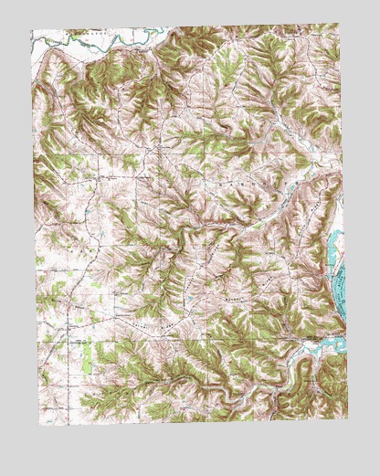
Aberdeen, IN USGS Topographic Map
Click on map above to begin viewing in our Map Viewer.

This topographic map contains these locations and features:
Feature Name Type Latitude Longitude GNIS ID View Map
AberdeenPopulated PlaceN38.9053°W84.9875°429985View Map
Arnold CreekStreamN38.9184°W84.8794°430276View Map
Bascom CornerPopulated PlaceN38.9089°W84.9686°430555View Map
Bovard CemeteryCemeteryN38.8878°W84.9880°431386View Map
Buckey RidgeRidgeN38.9134°W84.9166°431741View Map
Carmel RidgeRidgeN38.9028°W84.9550°432149View Map
Cass Union SchoolSchoolN38.9526°W84.9750°432219View Map
Cofield CornerPopulated PlaceN38.9528°W84.9586°432741View Map
Dutch RidgeRidgeN38.9348°W84.8916°433817View Map
Grant Brothers CemeteryCemeteryN38.8831°W84.9163°435316View Map
Grants Creek ChurchChurchN38.9001°W84.8949°435330View Map
HartfordPopulated PlaceN38.9931°W84.9569°435824View Map
Henschen BranchStreamN38.9687°W84.8997°436040View Map
Kinnet BranchStreamN38.9970°W84.9519°437342View Map
Marble BranchStreamN38.8981°W84.8919°438593View Map
Mount Carmel ChurchChurchN38.9023°W84.9494°439547View Map
Mount Pleasant ChurchChurchN38.9528°W84.9702°439674View Map
North Branch Arnold CreekStreamN38.9570°W84.8869°440217View Map
North CemeteryCemeteryN38.9009°W84.8758°440231View Map
Ohio CountyCivilN38.9501°W84.9650°450378View Map
Pleasant Ridge ChurchChurchN38.9620°W84.9491°441302View Map
Rising Sun AirportAirportN38.9265°W84.9076°2676910View Map
Salem ChurchChurchN38.9959°W84.8936°442906View Map
Salem RidgeRidgeN38.9953°W84.9166°442930View Map
Stewart RidgeRidgeN38.9164°W84.9388°444156View Map
Sycamore ChurchChurchN38.8870°W84.8883°444508View Map
Township of CassCivilN38.9292°W84.9926°453166View Map
Township of RandolphCivilN38.9610°W84.8947°453780View Map
Township of UnionCivilN38.9780°W84.9710°453927View Map
Wolfpen CreekStreamN38.9359°W84.9150°446263View Map
WSCH-FM (Aurora)TowerN38.9653°W84.9475°448951View Map

Note: Coordinates in the location and feature list above are referenced to NAD83 datum.


Copyright (C) 2008-2025 Ryan Niemi / Sunset Dynamics ... All Rights Reserved