TopoQuest Logo
Do you find TopoQuest useful?
Help keep TopoQuest running and adding new maps/features by donating!
Bitcoin:  19c7KJd3qBynnjoSw5npx9KScwjBe4ifkT
Litecoin:  LXs6TkuXGGXo1vDsWCkWVdjQX94eUKd6ui
Home View Maps Find Maps Find Places Resources & Links


Boyd Mountain, Montana Topographic Map

USGS Map Title: Boyd Mountain, MT
USGS Map MRC: 47115C2
DRG (GeoTIFF) Download: o47115c2.tif


Neighboring USGS Topographic Map Quads:


  De Borgia North, MT  
47115D3
 

  Penrose Peak, MT  
47115D2
 

  Sunset Peak, MT  
47115D1
 

  De Borgia South, MT  
47115C3
 

  Boyd Mountain, MT  
47115C2
 

  Saint Regis, MT  
47115C1
 

  Berge Peak, ID  
47115B3
 

  Torino Peak, MT  
47115B2
 

  Wilson Gulch, MT  
47115B1


Map MRC Location:

N48°
W116°
N48°
W115°
H8 H7 H6 H5 H4 H3 H2 H1
G8 G7 G6 G5 G4 G3 G2 G1
F8 F7 F6 F5 F4 F3 F2 F1
E8 E7 E6 E5 E4 E3 E2 E1
D8 D7 D6 D5 D4 D3 D2 D1
C8 C7 C6 C5 C4 C3 C2 C1
B8 B7 B6 B5 B4 B3 B2 B1
A8 A7 A6 A5 A4 A3 A2 A1
N47°
W116°
N47°
W115°

Boyd Mountain, MT USGS 1:24K Topographic Map Preview:
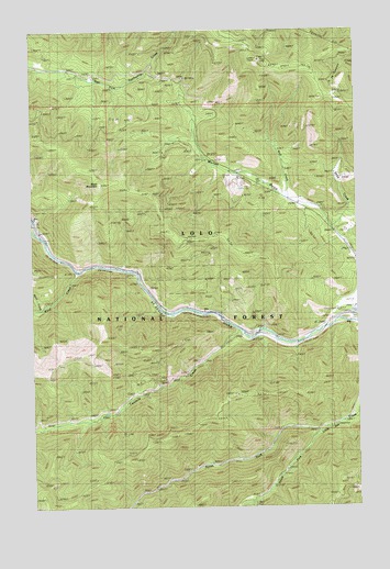
Boyd Mountain, MT USGS Topographic Map
Click on map above to begin viewing in our Map Viewer.

This topographic map contains these locations and features:
Feature Name Type Latitude Longitude GNIS ID View Map
Boyd MountainSummitN47.3349°W115.2246°780336View Map
Buford (historical)LocaleN47.2944°W115.1454°1781697View Map
Buford (historical)Populated PlaceN47.2944°W115.1454°1781698View Map
Buford School (historical)SchoolN47.2944°W115.1454°1781699View Map
Camels Hump Lookout StationLocaleN47.3669°W115.1621°780819View Map
ForakerPopulated PlaceN47.3005°W115.1971°802101View Map
Hendrickson GulchValleyN47.2510°W115.1668°784776View Map
Interchange 25CrossingN47.2888°W115.2482°1781728View Map
Interchange 26CrossingN47.3124°W115.2329°1781727View Map
Interchange 30CrossingN47.2952°W115.1649°1781726View Map
Keith CreekStreamN47.3224°W115.1354°785650View Map
Keith Creek MineMineN47.3388°W115.1329°804744View Map
Little Joe Lookout StationLocaleN47.2794°W115.1738°786314View Map
Little Saint Joe (historical)LocaleN47.2983°W115.1301°1781633View Map
Moon CreekStreamN47.3019°W115.2485°787605View Map
North Fork Little Joe CreekStreamN47.2697°W115.1407°788200View Map
South Fork Little Joe CreekStreamN47.2697°W115.1410°791001View Map
Twomile CreekStreamN47.2960°W115.1715°792569View Map
Twomile PondLakeN47.2966°W115.1613°792570View Map
Ward CreekStreamN47.3119°W115.2338°792812View Map
Wolf CreekStreamN47.3308°W115.1524°793447View Map
Wolf Creek MineMineN47.3388°W115.1496°804745View Map

Note: Coordinates in the location and feature list above are referenced to NAD83 datum.


Copyright (C) 2008-2024 Ryan Niemi / Sunset Dynamics ... All Rights Reserved