TopoQuest Logo
Do you find TopoQuest useful?
Help keep TopoQuest running and adding new maps/features by donating!
Bitcoin:  19c7KJd3qBynnjoSw5npx9KScwjBe4ifkT
Litecoin:  LXs6TkuXGGXo1vDsWCkWVdjQX94eUKd6ui
Home View Maps Find Maps Find Places Resources & Links


Wilson Gulch, Montana Topographic Map

USGS Map Title: Wilson Gulch, MT
USGS Map MRC: 47115B1
DRG (GeoTIFF) Download: o47115b1.tif


Neighboring USGS Topographic Map Quads:


  Boyd Mountain, MT  
47115C2
 

  Saint Regis, MT  
47115C1
 

  Keystone Peak, MT  
47114C8
 

  Torino Peak, MT  
47115B2
 

  Wilson Gulch, MT  
47115B1
 

  Superior, MT  
47114B8
 

  Sherlock Peak, ID  
47115A2
 

  Illinois Peak, MT  
47115A1
 

  Landowner Mountain, MT  
47114A8


Map MRC Location:

N48°
W116°
N48°
W115°
H8 H7 H6 H5 H4 H3 H2 H1
G8 G7 G6 G5 G4 G3 G2 G1
F8 F7 F6 F5 F4 F3 F2 F1
E8 E7 E6 E5 E4 E3 E2 E1
D8 D7 D6 D5 D4 D3 D2 D1
C8 C7 C6 C5 C4 C3 C2 C1
B8 B7 B6 B5 B4 B3 B2 B1
A8 A7 A6 A5 A4 A3 A2 A1
N47°
W116°
N47°
W115°

Wilson Gulch, MT USGS 1:24K Topographic Map Preview:
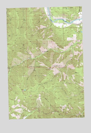
Wilson Gulch, MT USGS Topographic Map
Click on map above to begin viewing in our Map Viewer.

This topographic map contains these locations and features:
Feature Name Type Latitude Longitude GNIS ID View Map
Ann Arbor GulchValleyN47.1819°W115.1224°779051View Map
Bear CreekStreamN47.1927°W115.0885°779486View Map
Bear Creek MineMineN47.1944°W115.0885°804759View Map
Blacktail MountainSummitN47.1755°W115.0107°780074View Map
Bouchard LakeLakeN47.2205°W115.0005°780248View Map
Cayuse (historical)LocaleN47.1255°W115.0037°1781681View Map
Cayuse SaddleGapN47.1252°W115.0040°781086View Map
Cedar Creek Stock DrivewayTrailN47.1446°W115.0460°781105View Map
Cedar Junction (historical)Populated PlaceN47.1277°W115.0121°1781680View Map
Cedar Junction Post Office (historical)Post OfficeN47.1277°W115.0121°1781666View Map
Dry Creek Cabin SiteLocaleN47.1991°W115.0421°799850View Map
Dry Fork Dry CreekStreamN47.2063°W115.0187°782606View Map
Dry Fork MineMineN47.2013°W115.0149°804760View Map
Lime GulchValleyN47.1983°W115.0685°786134View Map
Lincoln City (historical)LocaleN47.1255°W115.0015°1781634View Map
Lost CreekStreamN47.1280°W115.0135°786587View Map
Lost MeadowsFlatN47.1263°W115.0999°793645View Map
Marble CreekStreamN47.2333°W115.0493°786827View Map
Marble PointRidgeN47.2141°W115.0590°794315View Map
Mount BaldySummitN47.1669°W115.0346°779307View Map
Pierson CreekStreamN47.1327°W115.0507°788850View Map
Reeves CreekStreamN47.2435°W115.0560°793648View Map
Sheep MountainSummitN47.1810°W115.0546°790362View Map
Sloway CampgroundLocaleN47.2341°W115.0262°790694View Map
Slowey GulchValleyN47.2394°W115.0024°799016View Map
Wilson GulchValleyN47.1927°W115.0796°793390View Map
Wilson LakeLakeN47.1575°W115.0986°793391View Map

Note: Coordinates in the location and feature list above are referenced to NAD83 datum.


Copyright (C) 2008-2024 Ryan Niemi / Sunset Dynamics ... All Rights Reserved