TopoQuest Logo
Do you find TopoQuest useful?
Help keep TopoQuest running and adding new maps/features by donating!
Bitcoin:  19c7KJd3qBynnjoSw5npx9KScwjBe4ifkT
Litecoin:  LXs6TkuXGGXo1vDsWCkWVdjQX94eUKd6ui
Home View Maps Find Maps Find Places Resources & Links


Branch, Arkansas Topographic Map

USGS Map Title: Branch, AR
USGS Map MRC: 35093C8
DRG (GeoTIFF) Download: o35093c8.tif


Neighboring USGS Topographic Map Quads:


  Mulberry, AR  
35094D1
 

  Cecil, AR  
35093D8
 

  Ozark, AR  
35093D7
 

  Charleston, AR  
35094C1
 

  Branch, AR  
35093C8
 

  Caulksville, AR  
35093C7
 

  Barber, AR  
35094B1
 

  Booneville, AR  
35093B8
 

  Magazine, AR  
35093B7


Map MRC Location:

N36°
W94°
N36°
W93°
H8 H7 H6 H5 H4 H3 H2 H1
G8 G7 G6 G5 G4 G3 G2 G1
F8 F7 F6 F5 F4 F3 F2 F1
E8 E7 E6 E5 E4 E3 E2 E1
D8 D7 D6 D5 D4 D3 D2 D1
C8 C7 C6 C5 C4 C3 C2 C1
B8 B7 B6 B5 B4 B3 B2 B1
A8 A7 A6 A5 A4 A3 A2 A1
N35°
W94°
N35°
W93°

Branch, AR USGS 1:24K Topographic Map Preview:
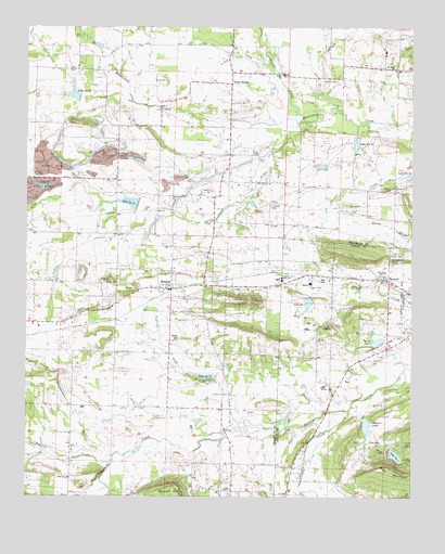
Branch, AR USGS Topographic Map
Click on map above to begin viewing in our Map Viewer.

This topographic map contains these locations and features:
Feature Name Type Latitude Longitude GNIS ID View Map
Assembly of God ChurchChurchN35.3068°W93.9552°79291View Map
Boydston CemeteryCemeteryN35.2806°W93.9449°46877View Map
BranchPopulated PlaceN35.3056°W93.9535°57428View Map
Branch Post OfficePost OfficeN35.3059°W93.9591°2781842View Map
Branch Volunteer Fire DepartmentBuildingN35.3062°W93.9555°2116189View Map
Brooklyn Freewill Baptist ChurchChurchN35.2918°W93.9060°79295View Map
Caney CreekStreamN35.2731°W93.8955°70999View Map
Cedar Grove ChurchChurchN35.2640°W93.8869°47609View Map
Church of ChristChurchN35.3059°W93.9549°79296View Map
City of BranchCivilN35.3079°W93.9545°2403912View Map
City of RatcliffCivilN35.3066°W93.8886°2404593View Map
Coles ChapelChurchN35.2520°W93.9341°47921View Map
Council CemeteryCemeteryN35.3609°W93.9005°48081View Map
County Line Elementary SchoolSchoolN35.3080°W93.9188°63003View Map
County Line High SchoolSchoolN35.3078°W93.9175°48092View Map
Crossno CemeteryCemeteryN35.3701°W93.8788°79297View Map
Dahoma (historical)Populated PlaceN35.3584°W93.9749°70296View Map
Donald (historical)Populated PlaceN35.3301°W93.9577°63045View Map
Dry ForkStreamN35.2743°W93.8946°71454View Map
Effa (historical)Populated PlaceN35.2681°W93.9558°63006View Map
Fealey (historical)Populated PlaceN35.3204°W93.9983°63008View Map
First Baptist ChurchChurchN35.3065°W93.9538°79293View Map
First United Methodist ChurchChurchN35.3076°W93.9549°79290View Map
Free Will Baptist ChurchChurchN35.3068°W93.9544°79292View Map
Full Gospel Bible ChurchChurchN35.3093°W93.8855°79294View Map
Grand Prairie ChurchChurchN35.3490°W93.9705°49544View Map
Hampton CemeteryCemeteryN35.3315°W93.9405°49810View Map
Henderson CemeteryCemeteryN35.2773°W93.9346°50006View Map
Hewitt LakeReservoirN35.2901°W93.8835°80596View Map
Hewitt Lake DamDamN35.2901°W93.8835°80595View Map
Hunter CemeteryCemeteryN35.2923°W93.9510°50414View Map
Kersey CemeteryCemeteryN35.3323°W93.8813°50824View Map
King CemeteryCemeteryN35.3609°W93.9555°50852View Map
Lake Number EightReservoirN35.3017°W93.9087°74817View Map
Lake Number ThirteenReservoirN35.2821°W93.9420°82566View Map
Lake Number ThreeReservoirN35.2611°W93.8806°80604View Map
Lake Number TwentyfiveReservoirN35.3446°W93.8929°82573View Map
Lake Number TwentyfourReservoirN35.3283°W93.9669°79967View Map
Lake Number TwentythreeReservoirN35.3570°W93.9854°79965View Map
Lowes CreekStreamN35.3506°W93.9133°51506View Map
Metcalf HillSummitN35.2506°W93.9508°58168View Map
Moffett CemeteryCemeteryN35.3279°W93.9210°52128View Map
Mount Hope ChurchChurchN35.3640°W93.8810°52303View Map
Perry CreekStreamN35.3498°W93.9130°53292View Map
Peter PenderPopulated PlaceN35.3601°W93.9344°77980View Map
Pony CreekStreamN35.2695°W93.9294°53684View Map
Prairie CreekStreamN35.2601°W93.9721°53769View Map
RatcliffPopulated PlaceN35.3084°W93.8835°58462View Map
Ratcliff Rural Fire DepartmentBuildingN35.3091°W93.8831°2117013View Map
Saint Anthonys ChurchChurchN35.3134°W93.8816°78233View Map
Six Mile Creek Watershed Site Eight DamDamN35.3018°W93.9085°80590View Map
Sixmile Creek Site 13 DamDamN35.2818°W93.9385°79968View Map
Sixmile Creek Site 13 ReservoirReservoirN35.2818°W93.9385°79969View Map
Sixmile Creek Site 23 DamDamN35.3568°W93.9835°79964View Map
Sixmile Creek Site 24 DamDamN35.3284°W93.9652°79966View Map
Sixmile Creek Site 25 DamDamN35.3468°W93.8919°79955View Map
Sixmile Creek Site 25 ReservoirReservoirN35.3468°W93.8919°79956View Map
Sixmile Creek Watershed Site Three DamDamN35.2618°W93.8819°80603View Map
Spirits CreekStreamN35.2876°W93.9346°78425View Map
Township of DonaldCivilN35.3090°W93.9429°66548View Map
Township of HurricaneCivilN35.3660°W93.9593°66551View Map
Township of Six MileCivilN35.2517°W93.9460°66563View Map
Watson LakeReservoirN35.2690°W93.8898°80598View Map
Watson Lake DamDamN35.2701°W93.8902°80597View Map
Wilcox CemeteryCemeteryN35.2787°W93.9005°56350View Map

Note: Coordinates in the location and feature list above are referenced to NAD83 datum.


Copyright (C) 2008-2024 Ryan Niemi / Sunset Dynamics ... All Rights Reserved