TopoQuest Logo
Do you find TopoQuest useful?
Help keep TopoQuest running and adding new maps/features by donating!
Bitcoin:  19c7KJd3qBynnjoSw5npx9KScwjBe4ifkT
Litecoin:  LXs6TkuXGGXo1vDsWCkWVdjQX94eUKd6ui
Home View Maps Find Maps Find Places Resources & Links


Brandenburg Mountain, Arizona Topographic Map

USGS Map Title: Brandenburg Mountain, AZ
USGS Map MRC: 32110H5
DRG (GeoTIFF) Download: o32110h5.tif


Neighboring USGS Topographic Map Quads:


  Christmas, AZ  
33110A6
 

  Jerusalem Mountain, AZ  
33110A5
 

  Rawhide Mountain, AZ  
33110A4
 

  Dudleyville, AZ  
32110H6
 

  Brandenburg Mountain, AZ  
32110H5
 

  Booger Canyon, AZ  
32110H4
 

  Lookout Mountain, AZ  
32110G6
 

  Holy Joe Peak, AZ  
32110G5
 

  Oak Grove Canyon, AZ  
32110G4


Map MRC Location:

N33°
W111°
N33°
W110°
H8 H7 H6 H5 H4 H3 H2 H1
G8 G7 G6 G5 G4 G3 G2 G1
F8 F7 F6 F5 F4 F3 F2 F1
E8 E7 E6 E5 E4 E3 E2 E1
D8 D7 D6 D5 D4 D3 D2 D1
C8 C7 C6 C5 C4 C3 C2 C1
B8 B7 B6 B5 B4 B3 B2 B1
A8 A7 A6 A5 A4 A3 A2 A1
N32°
W111°
N32°
W110°

Brandenburg Mountain, AZ USGS 1:24K Topographic Map Preview:
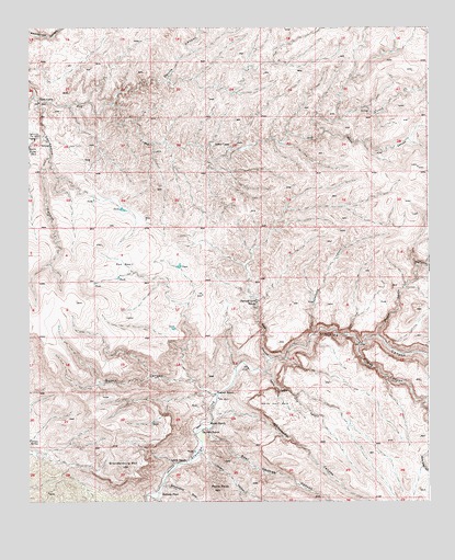
Brandenburg Mountain, AZ USGS Topographic Map
Click on map above to begin viewing in our Map Viewer.

This topographic map contains these locations and features:
Feature Name Type Latitude Longitude GNIS ID View Map
Apsey CampLocaleN32.9690°W110.5673°750View Map
Bates CanyonValleyN32.9728°W110.5329°1074View Map
Bear Springs CanyonValleyN32.8942°W110.5695°1146View Map
Brandenburg MountainSummitN32.8845°W110.5959°1943View Map
Brandenburg WashStreamN32.8795°W110.5832°1944View Map
Burro Water SpringSpringN32.9687°W110.6248°2281View Map
Buzan CanyonValleyN32.9045°W110.5701°2317View Map
Cave CanyonValleyN32.9128°W110.5498°2581View Map
Cedar CorralLocaleN32.9687°W110.6123°2618View Map
Depression CanyonValleyN32.9809°W110.6220°3852View Map
Devils CanyonValleyN32.9801°W110.5987°3897View Map
Eskiminzin Fort RockPillarN32.9712°W110.6248°4483View Map
Eskiminzin SpringSpringN32.9687°W110.6187°24251View Map
Hagen CanyonValleyN32.8878°W110.5709°5501View Map
Hells Half AcreAreaN32.9009°W110.5498°5711View Map
Hells Half Acre CanyonValleyN32.9090°W110.5509°5712View Map
Horse Camp CanyonValleyN32.9187°W110.5162°5948View Map
Hortons PlacePopulated PlaceN32.8778°W110.5837°24464View Map
Javalina CanyonValleyN32.9195°W110.5370°6367View Map
LaJolla RanchLocaleN32.8940°W110.5712°6820View Map
Lewis RanchLocaleN32.8856°W110.5762°6987View Map
Lion CampLocaleN32.9809°W110.6212°7049View Map
Periz PeakSummitN32.8784°W110.5657°9332View Map
Red BasinBasinN32.9370°W110.5951°10005View Map
Virgus CanyonValleyN32.9167°W110.5223°13237View Map
Wagner RanchLocaleN32.9037°W110.5670°13262View Map
Whitewash CanyonValleyN32.8978°W110.5668°13713View Map
Woods RanchLocaleN32.8962°W110.5693°14000View Map

Note: Coordinates in the location and feature list above are referenced to NAD83 datum.


Copyright (C) 2008-2025 Ryan Niemi / Sunset Dynamics ... All Rights Reserved