TopoQuest Logo
Do you find TopoQuest useful?
Help keep TopoQuest running and adding new maps/features by donating!
Bitcoin:  19c7KJd3qBynnjoSw5npx9KScwjBe4ifkT
Litecoin:  LXs6TkuXGGXo1vDsWCkWVdjQX94eUKd6ui
Home View Maps Find Maps Find Places Resources & Links


Booger Canyon, Arizona Topographic Map

USGS Map Title: Booger Canyon, AZ
USGS Map MRC: 32110H4
DRG (GeoTIFF) Download: o32110h4.tif


Neighboring USGS Topographic Map Quads:


  Jerusalem Mountain, AZ  
33110A5
 

  Rawhide Mountain, AZ  
33110A4
 

  Mount Turnbull, AZ  
33110A3
 

  Brandenburg Mountain, AZ  
32110H5
 

  Booger Canyon, AZ  
32110H4
 

  Cobre Grande Mountain, AZ  
32110H3
 

  Holy Joe Peak, AZ  
32110G5
 

  Oak Grove Canyon, AZ  
32110G4
 

  Klondyke, AZ  
32110G3


Map MRC Location:

N33°
W111°
N33°
W110°
H8 H7 H6 H5 H4 H3 H2 H1
G8 G7 G6 G5 G4 G3 G2 G1
F8 F7 F6 F5 F4 F3 F2 F1
E8 E7 E6 E5 E4 E3 E2 E1
D8 D7 D6 D5 D4 D3 D2 D1
C8 C7 C6 C5 C4 C3 C2 C1
B8 B7 B6 B5 B4 B3 B2 B1
A8 A7 A6 A5 A4 A3 A2 A1
N32°
W111°
N32°
W110°

Booger Canyon, AZ USGS 1:24K Topographic Map Preview:
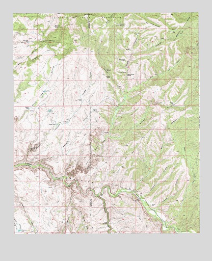
Booger Canyon, AZ USGS Topographic Map
Click on map above to begin viewing in our Map Viewer.

This topographic map contains these locations and features:
Feature Name Type Latitude Longitude GNIS ID View Map
Anderson SpringSpringN32.9934°W110.4286°642View Map
Aravaipa Canyon Primitive AreaParkN32.9112°W110.4840°42794View Map
Aravaipa Canyon Primitive Area East EntranceLocaleN32.8984°W110.4401°22391View Map
Aravaipa Canyon WildernessReserveN32.8968°W110.4916°2035038View Map
Aravaipa SchoolSchoolN32.8765°W110.3887°22392View Map
Arizona GulchValleyN32.9301°W110.4356°773View Map
Ash Creek DamDamN32.9834°W110.4901°841View Map
Bear CanyonValleyN32.8987°W110.4184°1113View Map
Big TankReservoirN32.9559°W110.4792°1385View Map
Black CanyonValleyN32.9559°W110.4240°1482View Map
Black Canyon SpringSpringN32.9653°W110.4237°1493View Map
Booger CanyonValleyN32.9159°W110.4929°1831View Map
Cement TankReservoirN32.9459°W110.4895°2673View Map
Chet TankReservoirN32.9448°W110.4762°2800View Map
Cottonwood SpringSpringN32.9729°W110.4248°3362View Map
Deer CreekStreamN32.9067°W110.4668°3799View Map
Dirt TankReservoirN32.9380°W110.4642°3962View Map
Double TankReservoirN32.9370°W110.4710°4059View Map
Hell HoleAreaN32.9145°W110.4518°23712View Map
Hell HoleArchN32.9119°W110.4575°2629408View Map
Hell Hole ValleyValleyN32.9117°W110.4534°5703View Map
Horse CanyonValleyN32.9551°W110.4270°5954View Map
Jacks TankReservoirN32.9449°W110.4466°6320View Map
John SpringSpringN32.9683°W110.4379°6460View Map
Juniper SpringSpringN32.9640°W110.4350°6547View Map
Lone Cedar MesaSummitN32.9912°W110.3970°7291View Map
Lookout MountainSummitN32.9965°W110.4534°7365View Map
Maroga CanyonValleyN32.8895°W110.4043°7718View Map
Martinez CanyonValleyN32.8962°W110.4129°7742View Map
McKinney SpringSpringN32.9923°W110.4723°7848View Map
Oak SpringSpringN32.9662°W110.4287°8874View Map
Oak SpringSpringN32.9662°W110.4287°8875View Map
Paisano CanyonValleyN32.9142°W110.4823°9119View Map
Parsons CanyonValleyN32.9028°W110.4623°9232View Map
Salazar CemeteryCemeteryN32.8912°W110.4079°10733View Map
Sand WashStreamN32.8806°W110.3981°10906View Map
Stone Cabin CanyonValleyN32.8917°W110.4959°11870View Map
Telegraph WashStreamN32.9765°W110.4195°12227View Map
The ChimneyPillarN32.8937°W110.4156°12300View Map
Turkey CreekStreamN32.8973°W110.4440°12864View Map
Wire Corral DrawValleyN32.8906°W110.4601°13940View Map
Woodrows TankReservoirN32.8771°W110.4964°13992View Map

Note: Coordinates in the location and feature list above are referenced to NAD83 datum.


Copyright (C) 2008-2025 Ryan Niemi / Sunset Dynamics ... All Rights Reserved