TopoQuest Logo
Do you find TopoQuest useful?
Help keep TopoQuest running and adding new maps/features by donating!
Bitcoin:  19c7KJd3qBynnjoSw5npx9KScwjBe4ifkT
Litecoin:  LXs6TkuXGGXo1vDsWCkWVdjQX94eUKd6ui
Home View Maps Find Maps Find Places Resources & Links


Rockbridge, Ohio Topographic Map

USGS Map Title: Rockbridge, OH
USGS Map MRC: 39082E5
DRG (GeoTIFF) Download: o39082e5.tif


Neighboring USGS Topographic Map Quads:


  Amanda, OH  
39082F6
 

  Lancaster, OH  
39082F5
 

  Bremen, OH  
39082F4
 

  Clearport, OH  
39082E6
 

  Rockbridge, OH  
39082E5
 

  Logan, OH  
39082E4
 

  Laurelville, OH  
39082D6
 

  South Bloomingville, OH  
39082D5
 

  New Plymouth, OH  
39082D4


Map MRC Location:

N40°
W83°
N40°
W82°
H8 H7 H6 H5 H4 H3 H2 H1
G8 G7 G6 G5 G4 G3 G2 G1
F8 F7 F6 F5 F4 F3 F2 F1
E8 E7 E6 E5 E4 E3 E2 E1
D8 D7 D6 D5 D4 D3 D2 D1
C8 C7 C6 C5 C4 C3 C2 C1
B8 B7 B6 B5 B4 B3 B2 B1
A8 A7 A6 A5 A4 A3 A2 A1
N39°
W83°
N39°
W82°

Rockbridge, OH USGS 1:24K Topographic Map Preview:
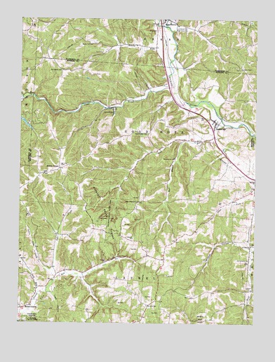
Rockbridge, OH USGS Topographic Map
Click on map above to begin viewing in our Map Viewer.

This topographic map contains these locations and features:
Feature Name Type Latitude Longitude GNIS ID View Map
Benua LakeReservoirN39.5819°W82.6221°1078798View Map
Benua Lake DamDamN39.5834°W82.6249°1078797View Map
Boling CemeteryCemeteryN39.5109°W82.5346°1940339View Map
Brown CemeteryCemeteryN39.5648°W82.6029°1963572View Map
Browns CornersLocaleN39.5637°W82.6043°1038388View Map
Brushy ForkStreamN39.6017°W82.5477°1038430View Map
Brushy Fork CemeteryCemeteryN39.6150°W82.5869°1038434View Map
Buck RunStreamN39.5817°W82.5171°1038464View Map
Camp WyandotLocaleN39.5867°W82.5757°1038770View Map
Cantwell CliffsCliffN39.5437°W82.5774°1038805View Map
Clear CreekStreamN39.5970°W82.5460°1065961View Map
Clear Creek Nature PreserveParkN39.5945°W82.5874°1806881View Map
Cola CreekStreamN39.5184°W82.6057°1065966View Map
Drinkle Post Office (historical)Post OfficeN39.5917°W82.6166°1985022View Map
East Branch Buck RunStreamN39.5748°W82.5382°1039969View Map
Fairview CemeteryCemeteryN39.5592°W82.5010°1963579View Map
Fairview ChurchChurchN39.5590°W82.5002°1040351View Map
Good Hope Township Volunteer Fire DepartmentBuildingN39.5839°W82.5228°2549592View Map
Hansen CemeteryCemeteryN39.5251°W82.5791°1041294View Map
Jack RunStreamN39.5134°W82.6152°1042016View Map
Little Cola CreekStreamN39.5203°W82.6077°1042651View Map
McBroom CemeteryCemeteryN39.5348°W82.5643°1043148View Map
Mound CrossingPopulated PlaceN39.5062°W82.6229°1062906View Map
Mount Olive CemeteryCemeteryN39.5073°W82.5565°1043587View Map
Nihizer CemeteryCemeteryN39.5145°W82.5040°1043874View Map
Old Catholic CemeteryCemeteryN39.6036°W82.6032°1044094View Map
Old Lutheran CemeteryCemeteryN39.5263°W82.5026°1044115View Map
Pine Grove (historical)Populated PlaceN39.5978°W82.5504°1067402View Map
Pisgah CemeteryCemeteryN39.5609°W82.6118°1963597View Map
RockbridgePopulated PlaceN39.5798°W82.5221°1061623View Map
RockbridgeArchN39.5761°W82.5019°1679034View Map
Rockbridge Census Designated PlaceCensusN39.5862°W82.5262°2628962View Map
Rockbridge Post OfficePost OfficeN39.5792°W82.5221°2009843View Map
Rocky ForkStreamN39.5670°W82.5413°1065873View Map
Rush CreekStreamN39.6223°W82.5488°1075239View Map
Saint John Lutheran CemeteryCemeteryN39.5314°W82.5030°1963601View Map
Saint Johns ChurchChurchN39.5312°W82.5027°1045524View Map
Saint Matthews Lutheran CemeteryCemeteryN39.6212°W82.5424°1806867View Map
Shade BridgeBridgeN39.6076°W82.5293°1056180View Map
Sharp CemeteryCemeteryN39.6203°W82.5535°1046144View Map
Sugar Grove CemeteryCemeteryN39.6203°W82.5435°1046809View Map
Toad HollowValleyN39.5120°W82.6074°1077060View Map
Township of Good HopeCivilN39.5763°W82.5590°1086318View Map
Township of LaurelCivilN39.5030°W82.5647°1086320View Map
Union CemeteryCemeteryN39.5776°W82.5607°1963606View Map
West Pleasant Hill CemeteryCemeteryN39.5501°W82.5613°1963608View Map
West Pleasant Hill ChurchChurchN39.5498°W82.5618°1047792View Map
Whippoorwill CemeteryCemeteryN39.5679°W82.5429°1047863View Map
Wildcat HollowValleyN39.5309°W82.5040°1047907View Map

Note: Coordinates in the location and feature list above are referenced to NAD83 datum.


Copyright (C) 2008-2024 Ryan Niemi / Sunset Dynamics ... All Rights Reserved