TopoQuest Logo
Do you find TopoQuest useful?
Help keep TopoQuest running and adding new maps/features by donating!
Bitcoin:  19c7KJd3qBynnjoSw5npx9KScwjBe4ifkT
Litecoin:  LXs6TkuXGGXo1vDsWCkWVdjQX94eUKd6ui
Home View Maps Find Maps Find Places Resources & Links


Bristol, Michigan Topographic Map

USGS Map Title: Bristol, MI
USGS Map MRC: 44085A5
DRG (GeoTIFF) Download: o44085a5.tif


Neighboring USGS Topographic Map Quads:


  Hoxeyville, MI  
44085B6
 

  Axin, MI  
44085B5


  Luther, MI  
44085A6
 

  Bristol, MI  
44085A5


  Chase, MI  
43085H6
 

  Reed City North, MI  
43085H5


Map MRC Location:

N45°
W86°
N45°
W85°
H8 H7 H6 H5 H4 H3 H2 H1
G8 G7 G6 G5 G4 G3 G2 G1
F8 F7 F6 F5 F4 F3 F2 F1
E8 E7 E6 E5 E4 E3 E2 E1
D8 D7 D6 D5 D4 D3 D2 D1
C8 C7 C6 C5 C4 C3 C2 C1
B8 B7 B6 B5 B4 B3 B2 B1
A8 A7 A6 A5 A4 A3 A2 A1
N44°
W86°
N44°
W85°

Bristol, MI USGS 1:24K Topographic Map Preview:
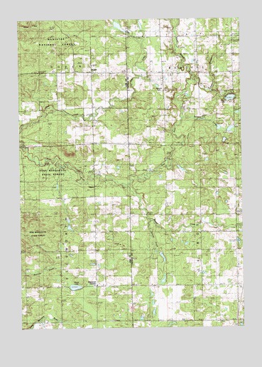
Bristol, MI USGS Topographic Map
Click on map above to begin viewing in our Map Viewer.

This topographic map contains these locations and features:
Feature Name Type Latitude Longitude GNIS ID View Map
Asplund LakeLakeN44.0979°W85.5471°1619046View Map
Beaver CreekStreamN44.0578°W85.5648°620909View Map
BristolPopulated PlaceN44.1039°W85.5837°1623726View Map
Bristol CemeteryCemeteryN44.1042°W85.5976°622007View Map
Bristol Post Office (historical)Post OfficeN44.1039°W85.5836°2513382View Map
Dewing's (historical)Populated PlaceN44.0028°W85.5017°2514680View Map
Dewing's Siding (historical)LocaleN44.0028°W85.5014°2514668View Map
Dewings Post Office (historical)Post OfficeN44.0028°W85.5017°2514681View Map
Dover Regular Baptist ChurchChurchN44.1036°W85.5828°2513269View Map
Dyer CreekStreamN44.1158°W85.5551°625056View Map
East Branch Pine RiverStreamN44.1000°W85.5276°1619806View Map
Edgett ChurchChurchN44.0386°W85.5828°625361View Map
EdgettsPopulated PlaceN44.0567°W85.5831°1622484View Map
Edgetts Post Office (historical)Post OfficeN44.0567°W85.5831°2513378View Map
Edgetts Station (historical)LocaleN44.0564°W85.5831°2513350View Map
Ellsworth CemeteryCemeteryN44.0319°W85.6056°1619845View Map
Harman SchoolLocaleN44.1183°W85.5051°627807View Map
Hewitt LakeLakeN44.0928°W85.5059°1620181View Map
Howe LakeLakeN44.0167°W85.5948°628711View Map
Interchange 162CrossingN44.0025°W85.5031°2514773View Map
Keenan Post Office (historical)Post OfficeN44.0539°W85.6222°2513374View Map
Keenan Station (historical)LocaleN44.0539°W85.6225°2513349View Map
LeRoy Township CemeteryCemeteryN44.0305°W85.5044°2514768View Map
Little Beaver CreekStreamN44.0439°W85.5523°1620536View Map
Marl Bed LakeLakeN44.0347°W85.5025°1965650View Map
North Branch Pine RiverStreamN44.1006°W85.5278°1621033View Map
Raymond CornersLocaleN44.0175°W85.5828°1621352View Map
Riverbank Post Office (historical)Post OfficeN44.0672°W85.5417°2514673View Map
Riverbank Station (historical)LocaleN44.0672°W85.5417°2514669View Map
Sprague CreekStreamN44.0850°W85.5331°1621729View Map
Township of BurdellCivilN44.1195°W85.5041°1626002View Map
Township of DoverCivilN44.1196°W85.6237°1626188View Map
Township of EllsworthCivilN44.0314°W85.6227°1626230View Map
Township of Le RoyCivilN44.0311°W85.5036°1626609View Map

Note: Coordinates in the location and feature list above are referenced to NAD83 datum.


Copyright (C) 2008-2025 Ryan Niemi / Sunset Dynamics ... All Rights Reserved