TopoQuest Logo
Do you find TopoQuest useful?
Help keep TopoQuest running and adding new maps/features by donating!
Bitcoin:  19c7KJd3qBynnjoSw5npx9KScwjBe4ifkT
Litecoin:  LXs6TkuXGGXo1vDsWCkWVdjQX94eUKd6ui
Home View Maps Find Maps Find Places Resources & Links


Bristow, Indiana Topographic Map

USGS Map Title: Bristow, IN
USGS Map MRC: 38086B6
DRG (GeoTIFF) Download: o38086b6.tif


Neighboring USGS Topographic Map Quads:


  Saint Anthony, IN  
38086C7
 

  Birdseye, IN  
38086C6
 

  Taswell, IN  
38086C5
 

  Saint Meinrad, IN  
38086B7
 

  Bristow, IN  
38086B6
 

  Branchville, IN  
38086B5
 

  Fulda, IN  
38086A7
 

  Gatchel, IN  
38086A6
 

  Derby, IN  
38086A5


Map MRC Location:

N39°
W87°
N39°
W86°
H8 H7 H6 H5 H4 H3 H2 H1
G8 G7 G6 G5 G4 G3 G2 G1
F8 F7 F6 F5 F4 F3 F2 F1
E8 E7 E6 E5 E4 E3 E2 E1
D8 D7 D6 D5 D4 D3 D2 D1
C8 C7 C6 C5 C4 C3 C2 C1
B8 B7 B6 B5 B4 B3 B2 B1
A8 A7 A6 A5 A4 A3 A2 A1
N38°
W87°
N38°
W86°

Bristow, IN USGS 1:24K Topographic Map Preview:
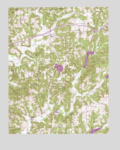
Bristow, IN USGS Topographic Map
Click on map above to begin viewing in our Map Viewer.

This topographic map contains these locations and features:
Feature Name Type Latitude Longitude GNIS ID View Map
Anderson Fire DepartmentBuildingN38.1397°W86.7203°2701344View Map
Anderson Township Fire Department Station 2BuildingN38.1397°W86.7203°2625761View Map
ApalonaPopulated PlaceN38.1545°W86.6322°450634View Map
Beard CemeteryCemeteryN38.1776°W86.6853°450663View Map
BristowPopulated PlaceN38.1401°W86.7217°450712View Map
Comstock CemeteryCemeteryN38.2064°W86.6678°450792View Map
Coon BranchStreamN38.1478°W86.7036°450799View Map
Dry BranchStreamN38.2373°W86.6867°450866View Map
Enlow CemeteryCemeteryN38.2339°W86.6508°450893View Map
Fosters RidgePopulated PlaceN38.2328°W86.6625°452122View Map
Fosters Ridge ChurchChurchN38.2273°W86.6614°450925View Map
Fox Ridge CemeteryCemeteryN38.2481°W86.6947°450927View Map
Hobbs CemeteryCemeteryN38.2242°W86.6911°451048View Map
Indian LakeReservoirN38.1991°W86.6513°451725View Map
Indian Lake Recreation AreaParkN38.1909°W86.6555°451834View Map
Kitterman CornersPopulated PlaceN38.2226°W86.6975°451118View Map
Lanman CemeteryCemeteryN38.1251°W86.6403°451133View Map
Lasher CemeteryCemeteryN38.1464°W86.7069°451135View Map
Maggity BranchStreamN38.1484°W86.7030°451191View Map
Massey CreekStreamN38.1364°W86.6253°451202View Map
Middle Fork Dam Number 5DamN38.1817°W86.6283°451756View Map
Middle Fork Number 6 DamDamN38.1901°W86.6567°451794View Map
Middle Fork Number 7 DamDamN38.1465°W86.6941°451755View Map
Miller CemeteryCemeteryN38.1695°W86.6455°451220View Map
Mount Pleasant CemeteryCemeteryN38.1684°W86.7347°451821View Map
Mount Sinai ChurchChurchN38.1895°W86.6919°451254View Map
Oak Ridge ChurchChurchN38.1392°W86.7483°451290View Map
Saint Johns ChurchChurchN38.1317°W86.6880°451419View Map
SassafrasPopulated PlaceN38.1884°W86.6903°451435View Map
SiberiaPopulated PlaceN38.2381°W86.7336°451460View Map
Sigler CreekStreamN38.2223°W86.7039°451463View Map
Snake BranchStreamN38.1253°W86.6472°451476View Map
Tige CreekStreamN38.2101°W86.6408°451565View Map
Tipsaw LakeReservoirN38.1273°W86.6432°451726View Map
Township of ClarkCivilN38.1859°W86.7198°453203View Map
Underhill CemeteryCemeteryN38.2306°W86.6261°451586View Map
UniontownPopulated PlaceN38.2253°W86.6608°451591View Map
Winding BranchStreamN38.1617°W86.6661°451637View Map

Note: Coordinates in the location and feature list above are referenced to NAD83 datum.


Copyright (C) 2008-2024 Ryan Niemi / Sunset Dynamics ... All Rights Reserved