TopoQuest Logo
Do you find TopoQuest useful?
Help keep TopoQuest running and adding new maps/features by donating!
Bitcoin:  19c7KJd3qBynnjoSw5npx9KScwjBe4ifkT
Litecoin:  LXs6TkuXGGXo1vDsWCkWVdjQX94eUKd6ui
Home View Maps Find Maps Find Places Resources & Links


Saint Anthony, Indiana Topographic Map

USGS Map Title: Saint Anthony, IN
USGS Map MRC: 38086C7
DRG (GeoTIFF) Download: o38086c7.tif


Neighboring USGS Topographic Map Quads:


  Jasper, IN  
38086D8
 

  Dubois, IN  
38086D7
 

  Cuzco, IN  
38086D6
 

  Huntingburg, IN  
38086C8
 

  Saint Anthony, IN  
38086C7
 

  Birdseye, IN  
38086C6
 

  Dale, IN  
38086B8
 

  Saint Meinrad, IN  
38086B7
 

  Bristow, IN  
38086B6


Map MRC Location:

N39°
W87°
N39°
W86°
H8 H7 H6 H5 H4 H3 H2 H1
G8 G7 G6 G5 G4 G3 G2 G1
F8 F7 F6 F5 F4 F3 F2 F1
E8 E7 E6 E5 E4 E3 E2 E1
D8 D7 D6 D5 D4 D3 D2 D1
C8 C7 C6 C5 C4 C3 C2 C1
B8 B7 B6 B5 B4 B3 B2 B1
A8 A7 A6 A5 A4 A3 A2 A1
N38°
W87°
N38°
W86°

Saint Anthony, IN USGS 1:24K Topographic Map Preview:
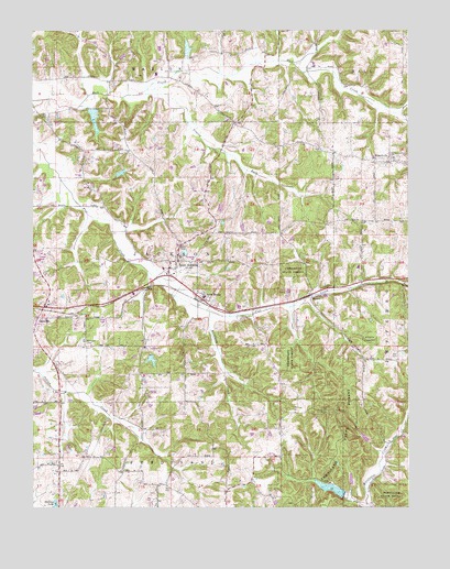
Saint Anthony, IN USGS Topographic Map
Click on map above to begin viewing in our Map Viewer.

This topographic map contains these locations and features:
Feature Name Type Latitude Longitude GNIS ID View Map
Birk LakeReservoirN38.3375°W86.8456°448507View Map
Birk Lake DamDamN38.3367°W86.8467°448506View Map
BretzvillePopulated PlaceN38.2995°W86.8731°431491View Map
Bretzville CemeteryCemeteryN38.2934°W86.8575°431492View Map
Camp Ground LakeLakeN38.2614°W86.7737°450331View Map
Cox CemeteryCemeteryN38.2906°W86.7544°433060View Map
Dungan CemeteryCemeteryN38.3078°W86.7783°433779View Map
Ferdinand Forest DamDamN38.2534°W86.7708°448583View Map
Ferdinand State Forest LakeReservoirN38.2550°W86.7761°448582View Map
Grassy ForkStreamN38.3578°W86.8400°435349View Map
Habig LakeReservoirN38.3701°W86.8234°448505View Map
Habig Lake DamDamN38.3684°W86.8233°448504View Map
Holiday LakeReservoirN38.2506°W86.8675°436319View Map
KyanaPopulated PlaceN38.3051°W86.7822°437481View Map
Larry Hopf LakeReservoirN38.3289°W86.8124°448868View Map
Larry Hopf Lake DamDamN38.3284°W86.8117°448867View Map
Olinger LakeReservoirN38.3567°W86.8583°447828View Map
Olinger Lake DamDamN38.3567°W86.8583°447827View Map
Richland CreekStreamN38.3009°W86.8161°441967View Map
Sacred Heart SchoolSchoolN38.3414°W86.7553°443058View Map
Saint AnthonyPopulated PlaceN38.3145°W86.8267°442481View Map
Saint Anthony Conservation Club DamDamN38.2892°W86.8350°448587View Map
Saint Anthony Conservation Club LakeReservoirN38.2887°W86.8355°448588View Map
Saint Anthony Fire DepartmentBuildingN38.3144°W86.8287°2625973View Map
Saint Anthony SchoolSchoolN38.3153°W86.8258°446613View Map
Saint Anthony School LakeReservoirN38.3168°W86.8247°448657View Map
Saint Anthony School Lake DamDamN38.3167°W86.8250°448656View Map
Saint MarksPopulated PlaceN38.3056°W86.8180°442675View Map
SchnellvillePopulated PlaceN38.3412°W86.7561°443084View Map
Schnellville Volunteer Fire DepartmentBuildingN38.3401°W86.7542°2625954View Map
Township of JacksonCivilN38.3134°W86.8380°453441View Map

Note: Coordinates in the location and feature list above are referenced to NAD83 datum.


Copyright (C) 2008-2024 Ryan Niemi / Sunset Dynamics ... All Rights Reserved