TopoQuest Logo
Do you find TopoQuest useful?
Help keep TopoQuest running and adding new maps/features by donating!
Bitcoin:  19c7KJd3qBynnjoSw5npx9KScwjBe4ifkT
Litecoin:  LXs6TkuXGGXo1vDsWCkWVdjQX94eUKd6ui
Home View Maps Find Maps Find Places Resources & Links


Taswell, Indiana Topographic Map

USGS Map Title: Taswell, IN
USGS Map MRC: 38086C5
DRG (GeoTIFF) Download: o38086c5.tif


Neighboring USGS Topographic Map Quads:


  Cuzco, IN  
38086D6
 

  Greenbrier, IN  
38086D5
 

  Valeene, IN  
38086D4
 

  Birdseye, IN  
38086C6
 

  Taswell, IN  
38086C5
 

  English, IN  
38086C4
 

  Bristow, IN  
38086B6
 

  Branchville, IN  
38086B5
 

  Beechwood, IN  
38086B4


Map MRC Location:

N39°
W87°
N39°
W86°
H8 H7 H6 H5 H4 H3 H2 H1
G8 G7 G6 G5 G4 G3 G2 G1
F8 F7 F6 F5 F4 F3 F2 F1
E8 E7 E6 E5 E4 E3 E2 E1
D8 D7 D6 D5 D4 D3 D2 D1
C8 C7 C6 C5 C4 C3 C2 C1
B8 B7 B6 B5 B4 B3 B2 B1
A8 A7 A6 A5 A4 A3 A2 A1
N38°
W87°
N38°
W86°

Taswell, IN USGS 1:24K Topographic Map Preview:
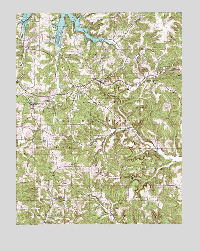
Taswell, IN USGS Topographic Map
Click on map above to begin viewing in our Map Viewer.

This topographic map contains these locations and features:
Feature Name Type Latitude Longitude GNIS ID View Map
Allen CreekStreamN38.3739°W86.5867°450623View Map
Allstott SchoolSchoolN38.3612°W86.5605°451849View Map
Allstott SchoolSchoolN38.3603°W86.5600°450626View Map
Arrowhead ArchArchN38.2828°W86.5253°2701937View Map
Bethany ChurchChurchN38.2853°W86.5819°450675View Map
Bethel ChurchChurchN38.2520°W86.6042°450676View Map
Brown CemeteryCemeteryN38.3531°W86.5289°450715View Map
Clarksville PlazaLocaleN38.3162°W86.5833°449460View Map
Dexter Well (historical)OilfieldN38.2551°W86.5564°451774View Map
Doolittle MillsPopulated PlaceN38.2509°W86.6030°450861View Map
EckertyPopulated PlaceN38.3203°W86.6119°450882View Map
Eckerty CemeteryCemeteryN38.3256°W86.6110°450883View Map
Eckerty QuarryMineN38.3581°W86.6161°2649421View Map
English Volunteer Fire Department Patoka StationBuildingN38.3410°W86.5681°2626044View Map
Gilmore CemeteryCemeteryN38.2999°W86.6051°450959View Map
Golden HollowValleyN38.3230°W86.5962°450965View Map
Hemlock CliffsCliffN38.2778°W86.5375°451727View Map
Hemlock Cliffs Recreation AreaLocaleN38.2776°W86.5386°451845View Map
Highfill ChapelChurchN38.3662°W86.5489°451038View Map
Highfill CreekStreamN38.3551°W86.5508°451772View Map
Johnson Township SchoolSchoolN38.2987°W86.6214°451848View Map
MifflinPopulated PlaceN38.3062°W86.5403°451215View Map
Mount Eden CemeteryCemeteryN38.3662°W86.5941°451850View Map
Padora Post Office (historical)Post OfficeN38.3687°W86.5367°452993View Map
Patoka SchoolSchoolN38.3306°W86.5805°451654View Map
Pedora SchoolSchoolN38.3698°W86.6064°451322View Map
Pedora SchoolSchoolN38.3703°W86.5939°451851View Map
Pleasant Ridge ChurchChurchN38.2795°W86.5630°451344View Map
Potter CemeteryCemeteryN38.3076°W86.6247°451363View Map
Ravine ArchArchN38.3317°W86.5453°2701936View Map
Russell BranchStreamN38.2559°W86.5542°451411View Map
Salinda Lake DamDamN38.3167°W86.5142°447433View Map
Sycamore CreekStreamN38.3551°W86.5503°451534View Map
TaswellPopulated PlaceN38.3342°W86.5611°451541View Map
Tick RidgeRidgeN38.2795°W86.5630°451563View Map
Township of PatokaCivilN38.3593°W86.5972°453707View Map
Township of UnionCivilN38.2591°W86.5188°453911View Map
Township SchoolSchoolN38.3320°W86.5811°451844View Map
Tunnel HillSummitN38.3406°W86.5055°451583View Map
Union Tar Spring (historical)SpringN38.2565°W86.5036°451773View Map
Williams CemeteryCemeteryN38.3545°W86.6089°451631View Map

Note: Coordinates in the location and feature list above are referenced to NAD83 datum.


Copyright (C) 2008-2025 Ryan Niemi / Sunset Dynamics ... All Rights Reserved