TopoQuest Logo
Do you find TopoQuest useful?
Help keep TopoQuest running and adding new maps/features by donating!
Bitcoin:  19c7KJd3qBynnjoSw5npx9KScwjBe4ifkT
Litecoin:  LXs6TkuXGGXo1vDsWCkWVdjQX94eUKd6ui
Home View Maps Find Maps Find Places Resources & Links


Bronson NE, Florida Topographic Map

USGS Map Title: Bronson NE, FL
USGS Map MRC: 29082D5
DRG (GeoTIFF) Download: o29082d5.tif


Neighboring USGS Topographic Map Quads:


  Newberry SW, FL  
29082E6
 

  Archer, FL  
29082E5
 

  Arredondo, FL  
29082E4
 

  Bronson, FL  
29082D6
 

  Bronson NE, FL  
29082D5
 

  Williston, FL  
29082D4
 

  Bronson SW, FL  
29082C6
 

  Bronson SE, FL  
29082C5
 

  Morriston, FL  
29082C4


Map MRC Location:

N30°
W83°
N30°
W82°
H8 H7 H6 H5 H4 H3 H2 H1
G8 G7 G6 G5 G4 G3 G2 G1
F8 F7 F6 F5 F4 F3 F2 F1
E8 E7 E6 E5 E4 E3 E2 E1
D8 D7 D6 D5 D4 D3 D2 D1
C8 C7 C6 C5 C4 C3 C2 C1
B8 B7 B6 B5 B4 B3 B2 B1
A8 A7 A6 A5 A4 A3 A2 A1
N29°
W83°
N29°
W82°

Bronson NE, FL USGS 1:24K Topographic Map Preview:
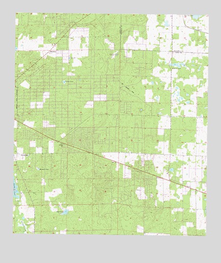
Bronson NE, FL USGS Topographic Map
Click on map above to begin viewing in our Map Viewer.

This topographic map contains these locations and features:
Feature Name Type Latitude Longitude GNIS ID View Map
AdamPopulated PlaceN29.4914°W82.5062°300331View Map
Bailey MineMineN29.4772°W82.5593°278041View Map
Bronson Church of GodChurchN29.4372°W82.6172°2119775View Map
Cherry SinkBasinN29.4197°W82.6151°280367View Map
East Bronson Census Designated PlaceCensusN29.4593°W82.5905°2402423View Map
German PondLakeN29.4613°W82.5928°283040View Map
Iglesia Evagelica el TaborChurchN29.4164°W82.5394°2119355View Map
Iglesia Pentecostal Redimidos por CristoChurchN29.4239°W82.5825°2119356View Map
Iglesia Pentecostal Templo de la AlabanzaChurchN29.4300°W82.6011°2119357View Map
Marshall PondLakeN29.4118°W82.6088°286462View Map
MeredithsPopulated PlaceN29.4786°W82.6029°294853View Map
Mount Olive African Methodist Elpiscopal ChurchChurchN29.4094°W82.5158°2119358View Map
Sand PondLakeN29.3877°W82.5909°290560View Map
Sawgrass LakeLakeN29.4719°W82.5210°290719View Map
Sinclair MineMineN29.4750°W82.5896°294441View Map
Smith CemeteryCemeteryN29.3802°W82.6129°291245View Map
Spring HillSummitN29.4252°W82.5923°291535View Map
WFEZ-FM (Williston)TowerN29.4180°W82.5493°310275View Map
Williston-Bronson DivisionCivilN29.3919°W82.5524°1935975View Map

Note: Coordinates in the location and feature list above are referenced to NAD83 datum.


Copyright (C) 2008-2024 Ryan Niemi / Sunset Dynamics ... All Rights Reserved