TopoQuest Logo
Do you find TopoQuest useful?
Help keep TopoQuest running and adding new maps/features by donating!
Bitcoin:  19c7KJd3qBynnjoSw5npx9KScwjBe4ifkT
Litecoin:  LXs6TkuXGGXo1vDsWCkWVdjQX94eUKd6ui
Home View Maps Find Maps Find Places Resources & Links


Newberry SW, Florida Topographic Map

USGS Map Title: Newberry SW, FL
USGS Map MRC: 29082E6
DRG (GeoTIFF) Download: o29082e6.tif


Neighboring USGS Topographic Map Quads:


  Fourmile Lake, FL  
29082F7
 

  Waters Lake, FL  
29082F6
 

  Newberry, FL  
29082F5
 

  Trenton, FL  
29082E7
 

  Newberry SW, FL  
29082E6
 

  Archer, FL  
29082E5
 

  Chiefland, FL  
29082D7
 

  Bronson, FL  
29082D6
 

  Bronson NE, FL  
29082D5


Map MRC Location:

N30°
W83°
N30°
W82°
H8 H7 H6 H5 H4 H3 H2 H1
G8 G7 G6 G5 G4 G3 G2 G1
F8 F7 F6 F5 F4 F3 F2 F1
E8 E7 E6 E5 E4 E3 E2 E1
D8 D7 D6 D5 D4 D3 D2 D1
C8 C7 C6 C5 C4 C3 C2 C1
B8 B7 B6 B5 B4 B3 B2 B1
A8 A7 A6 A5 A4 A3 A2 A1
N29°
W83°
N29°
W82°

Newberry SW, FL USGS 1:24K Topographic Map Preview:
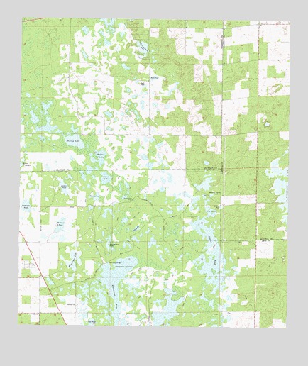
Newberry SW, FL USGS Topographic Map
Click on map above to begin viewing in our Map Viewer.

This topographic map contains these locations and features:
Feature Name Type Latitude Longitude GNIS ID View Map
Asbell Creek BridgeBridgeN29.5261°W82.7084°277964View Map
Billups PondLakeN29.5400°W82.6953°278774View Map
Boat PondLakeN29.6014°W82.6880°279104View Map
Bowen LakeLakeN29.5604°W82.7099°279286View Map
Crabgrass PondLakeN29.5488°W82.7468°280978View Map
Doorshutter LakeLakeN29.5329°W82.7086°281679View Map
Duck PondLakeN29.5980°W82.6927°281821View Map
Ebenezer ChurchChurchN29.5091°W82.7234°282062View Map
Fort Waccasassa SiteLocaleN29.5441°W82.6693°282709View Map
Fox LakeReservoirN29.5404°W82.6631°282769View Map
Jones PondLakeN29.5565°W82.7293°284920View Map
McCain LakeLakeN29.5691°W82.7118°286565View Map
McGowen PondLakeN29.5410°W82.7312°286616View Map
Meeting PondReservoirN29.5495°W82.6562°286679View Map
Mineral Feeder PondReservoirN29.5539°W82.6604°286953View Map
NewtonLocaleN29.5050°W82.7396°303691View Map
Porter Smith BridgeBridgeN29.5519°W82.6968°289249View Map
Sawgrass SpringsSwampN29.5236°W82.7004°290725View Map
Shirley LakeLakeN29.5753°W82.7247°291067View Map
Station PondLakeN29.5243°W82.6592°291654View Map
Tom PondLakeN29.5006°W82.7158°292337View Map
Union ChurchChurchN29.5047°W82.7401°292658View Map
Waccasassa LakeLakeN29.6140°W82.6935°292806View Map
Waccasassa RiverSwampN29.5111°W82.7046°292808View Map
Watermelon PondLakeN29.5502°W82.6263°292934View Map
Waters PondLakeN29.5529°W82.7140°292937View Map
Winquipin LakeReservoirN29.5267°W82.7242°293418View Map

Note: Coordinates in the location and feature list above are referenced to NAD83 datum.


Copyright (C) 2008-2025 Ryan Niemi / Sunset Dynamics ... All Rights Reserved