TopoQuest Logo
Do you find TopoQuest useful?
Help keep TopoQuest running and adding new maps/features by donating!
Bitcoin:  19c7KJd3qBynnjoSw5npx9KScwjBe4ifkT
Litecoin:  LXs6TkuXGGXo1vDsWCkWVdjQX94eUKd6ui
Home View Maps Find Maps Find Places Resources & Links


Crimson Dawn, Wyoming Topographic Map

USGS Map Title: Crimson Dawn, WY
USGS Map MRC: 42106F3
DRG (GeoTIFF) Download: o42106f3.tif


Neighboring USGS Topographic Map Quads:


  Goose Egg, WY  
42106G4
 

  Casper, WY  
42106G3
 

  Brookhurst, WY  
42106G2
 

  Freeland, WY  
42106F4
 

  Crimson Dawn, WY  
42106F3
 

  Otter Creek, WY  
42106F2
 

  Twin Buttes, WY  
42106E4
 

  Sheep Creek, WY  
42106E3
 

  Ice Cave Mountain, WY  
42106E2


Map MRC Location:

N43°
W107°
N43°
W106°
H8 H7 H6 H5 H4 H3 H2 H1
G8 G7 G6 G5 G4 G3 G2 G1
F8 F7 F6 F5 F4 F3 F2 F1
E8 E7 E6 E5 E4 E3 E2 E1
D8 D7 D6 D5 D4 D3 D2 D1
C8 C7 C6 C5 C4 C3 C2 C1
B8 B7 B6 B5 B4 B3 B2 B1
A8 A7 A6 A5 A4 A3 A2 A1
N42°
W107°
N42°
W106°

Crimson Dawn, WY USGS 1:24K Topographic Map Preview:
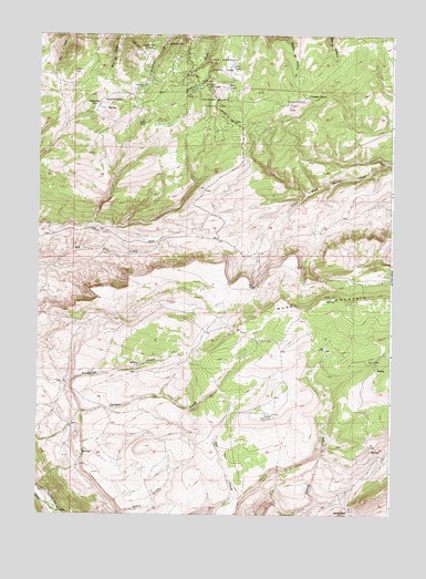
Crimson Dawn, WY USGS Topographic Map
Click on map above to begin viewing in our Map Viewer.

This topographic map contains these locations and features:
Feature Name Type Latitude Longitude GNIS ID View Map
Asbestos SpringSpringN42.7476°W106.3248°1584963View Map
Beartrap Meadow County ParkParkN42.7325°W106.3139°1585291View Map
Big Red Creek MineMineN42.6844°W106.3531°1726287View Map
Camp SacajaweaLocaleN42.7330°W106.3456°1586313View Map
Camp WyobaLocaleN42.7352°W106.3209°1586314View Map
Casper Lions CampLocaleN42.7364°W106.3172°1586428View Map
Casper MountainPopulated PlaceN42.7330°W106.3267°1853199View Map
Casper Mountain Census Designated PlaceCensusN42.7448°W106.3206°2407984View Map
Casper Mountain County ParkFlatN42.7422°W106.3114°1586430View Map
Casper Mountain Fire DepartmentBuildingN42.7377°W106.3231°2673480View Map
Casper Mountain MineMineN42.7361°W106.3239°1726286View Map
Cheney Cow CampLocaleN42.6508°W106.2917°1586598View Map
Crimson DawnPopulated PlaceN42.7336°W106.2795°1597271View Map
Crimson Dawn CemeteryCemeteryN42.7312°W106.2868°2774487View Map
Eadsville (historical)Populated PlaceN42.7319°W106.3539°1597301View Map
Eadsville CemeteryCemeteryN42.7294°W106.3611°2774488View Map
Hogadon Basin Ski AreaLocaleN42.7455°W106.3386°1589610View Map
KCSP-FM (Casper)TowerN42.7400°W106.3070°1608909View Map
KFNB-TV (Casper)TowerN42.7436°W106.3078°1608948View Map
KGWC-TV (Casper)TowerN42.7405°W106.3600°1608947View Map
KMGW-FM (Casper)TowerN42.7341°W106.3339°1608905View Map
Koch Deposit Number ThreeMineN42.7367°W106.3408°1726285View Map
KQLT-FM (Casper)TowerN42.7436°W106.3078°1608908View Map
KTRS-FM (Casper)TowerN42.7436°W106.3078°1608907View Map
KTWO-TV (Casper)TowerN42.7341°W106.3339°1608949View Map
Muddy Creek MineMineN42.7144°W106.2539°1726288View Map
Rocky GapGapN42.6261°W106.2650°1593603View Map

Note: Coordinates in the location and feature list above are referenced to NAD83 datum.


Copyright (C) 2008-2025 Ryan Niemi / Sunset Dynamics ... All Rights Reserved