TopoQuest Logo
Do you find TopoQuest useful?
Help keep TopoQuest running and adding new maps/features by donating!
Bitcoin:  19c7KJd3qBynnjoSw5npx9KScwjBe4ifkT
Litecoin:  LXs6TkuXGGXo1vDsWCkWVdjQX94eUKd6ui
Home View Maps Find Maps Find Places Resources & Links


Brookshire, Texas Topographic Map

USGS Map Title: Brookshire, TX
USGS Map MRC: 29095G8
DRG (GeoTIFF) Download: o29095g8.tif


Neighboring USGS Topographic Map Quads:


  Sunny Side, TX  
29096H1
 

  Hockley Mound, TX  
29095H8
 

  Warren Lake, TX  
29095H7
 

  San Felipe, TX  
29096G1
 

  Brookshire, TX  
29095G8
 

  Katy, TX  
29095G7
 

  Wallis, TX  
29096F1
 

  Fulshear, TX  
29095F8
 

  Richmond NE, TX  
29095F7


Map MRC Location:

N30°
W96°
N30°
W95°
H8 H7 H6 H5 H4 H3 H2 H1
G8 G7 G6 G5 G4 G3 G2 G1
F8 F7 F6 F5 F4 F3 F2 F1
E8 E7 E6 E5 E4 E3 E2 E1
D8 D7 D6 D5 D4 D3 D2 D1
C8 C7 C6 C5 C4 C3 C2 C1
B8 B7 B6 B5 B4 B3 B2 B1
A8 A7 A6 A5 A4 A3 A2 A1
N29°
W96°
N29°
W95°

Brookshire, TX USGS 1:24K Topographic Map Preview:
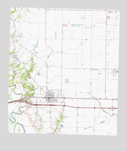
Brookshire, TX USGS Topographic Map
Click on map above to begin viewing in our Map Viewer.

This topographic map contains these locations and features:
Feature Name Type Latitude Longitude GNIS ID View Map
Apostolic ChurchChurchN29.8136°W95.9811°1329630View Map
Bell Bottom CreekStreamN29.7988°W95.9936°1330360View Map
BrookshirePopulated PlaceN29.7861°W95.9511°1331324View Map
Brookshire - Pattison Area Emergency Medical ServiceBuildingN29.7860°W95.9456°2656209View Map
Brookshire Auxiliary Fire DepartmentBuildingN29.7863°W95.9519°2334385View Map
Brookshire CemeteryCemeteryN29.7636°W95.9411°1331325View Map
Brookshire City HallBuildingN29.7850°W95.9532°2753496View Map
Brookshire Community ChurchChurchN29.7763°W95.9616°2024303View Map
Brookshire DivisionCivilN29.8407°W95.9731°1938568View Map
Brookshire Memorial Oaks CemeteryCemeteryN29.7980°W95.9713°1331326View Map
Brookshire Police DepartmentBuildingN29.7856°W95.9670°2375942View Map
Brookshire Post OfficePost OfficeN29.7848°W95.9545°2731577View Map
Brookshire Volunteer Fire DepartmentBuildingN29.7860°W95.9451°2334650View Map
CardiffPopulated PlaceN29.7861°W95.9061°1378092View Map
City of BrookshireCivilN29.7826°W95.9545°2409917View Map
City of PattisonCivilN29.8189°W95.9760°2411384View Map
Curry Chapel Baptist ChurchChurchN29.7819°W95.9575°2024300View Map
Currys ChapelChurchN29.7827°W95.9619°1333830View Map
First Baptist ChurchChurchN29.8205°W95.9586°2024301View Map
Houston Executive AirportAirportN29.8029°W95.9028°1386985View Map
Jo Na Acres AirportAirportN29.7568°W95.9168°1386297View Map
JohnsuePopulated PlaceN29.7861°W95.8766°1378498View Map
Kellner CreekStreamN29.7822°W95.9808°1339000View Map
Mount Zion Baptist ChurchChurchN29.7772°W95.9677°2024302View Map
PattisonPopulated PlaceN29.8252°W95.9950°1343685View Map
Pattison Area Volunteer Fire DepartmentBuildingN29.8213°W95.9845°2552463View Map
Pattison City OfficesBuildingN29.8245°W95.9912°2753314View Map
Pattison Post OfficePost OfficeN29.8242°W95.9935°2731358View Map
Royal High SchoolSchoolN29.8094°W95.9660°1345727View Map
Royal Middle SchoolSchoolN29.8068°W95.9687°2009589View Map
Royal SchoolSchoolN29.7883°W95.9530°1345729View Map
Sport Flyers AirportAirportN29.8380°W95.9494°1386296View Map
Waller County Constable's Office Precinct 4BuildingN29.8245°W95.9912°2739450View Map
Waller County Emergency ServicesBuildingN29.8213°W95.9845°2655783View Map
Waller County Historical MuseumBuildingN29.7883°W95.9536°2014367View Map
Wilpitz CemeteryCemeteryN29.8225°W95.9752°1350249View Map
Woods AirportAirportN29.7846°W95.9147°1386295View Map
Woods Number 2 AirportAirportN29.7936°W95.9252°1386298View Map

Note: Coordinates in the location and feature list above are referenced to NAD83 datum.


Copyright (C) 2008-2024 Ryan Niemi / Sunset Dynamics ... All Rights Reserved