TopoQuest Logo
Do you find TopoQuest useful?
Help keep TopoQuest running and adding new maps/features by donating!
Bitcoin:  19c7KJd3qBynnjoSw5npx9KScwjBe4ifkT
Litecoin:  LXs6TkuXGGXo1vDsWCkWVdjQX94eUKd6ui
Home View Maps Find Maps Find Places Resources & Links


Brookside, Alabama Topographic Map

USGS Map Title: Brookside, AL
USGS Map MRC: 33086F8
DRG (GeoTIFF) Download: o33086f8.tif


Neighboring USGS Topographic Map Quads:


  Sipsey, AL  
33087G1
 

  Creel, AL  
33086G8
 

  Warrior, AL  
33086G7
 

  Dora, AL  
33087F1
 

  Brookside, AL  
33086F8
 

  Gardendale, AL  
33086F7
 

  Sylvan Springs, AL  
33087E1
 

  Adamsville, AL  
33086E8
 

  Birmingham North, AL  
33086E7


Map MRC Location:

N34°
W87°
N34°
W86°
H8 H7 H6 H5 H4 H3 H2 H1
G8 G7 G6 G5 G4 G3 G2 G1
F8 F7 F6 F5 F4 F3 F2 F1
E8 E7 E6 E5 E4 E3 E2 E1
D8 D7 D6 D5 D4 D3 D2 D1
C8 C7 C6 C5 C4 C3 C2 C1
B8 B7 B6 B5 B4 B3 B2 B1
A8 A7 A6 A5 A4 A3 A2 A1
N33°
W87°
N33°
W86°

Brookside, AL USGS 1:24K Topographic Map Preview:
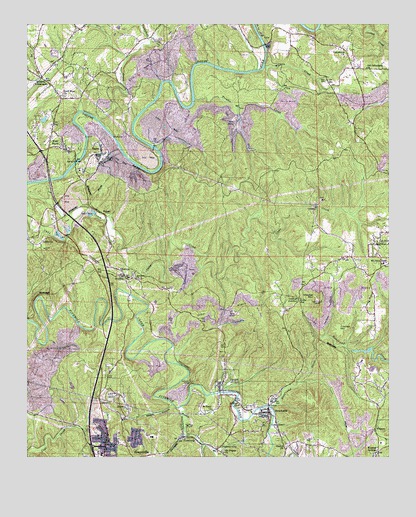
Brookside, AL USGS Topographic Map
Click on map above to begin viewing in our Map Viewer.

This topographic map contains these locations and features:
Feature Name Type Latitude Longitude GNIS ID View Map
AldenPopulated PlaceN33.6390°W86.9653°112973View Map
Alden Elementary SchoolSchoolN33.6420°W86.9661°143961View Map
Antioch Baptist ChurchChurchN33.6768°W86.9625°151661View Map
Bagley Volunteer Fire and RescueBuildingN33.7184°W86.9911°2682944View Map
Baileys Quarters (historical)LocaleN33.6562°W86.8908°143982View Map
Banner MinesMineN33.6782°W86.9953°143985View Map
Banner New MineMineN33.6682°W86.8986°146195View Map
Banner Shaft MineMineN33.6598°W86.8819°146194View Map
Bibb CemeteryCemeteryN33.7359°W86.8767°144006View Map
BlossburgPopulated PlaceN33.6307°W86.9467°114503View Map
Blossburg MineMineN33.6404°W86.9639°146122View Map
Brazil MineMineN33.6501°W86.9347°146121View Map
Brents Cross RoadsPopulated PlaceN33.7112°W86.9931°144027View Map
BrooksidePopulated PlaceN33.6379°W86.9167°114968View Map
Brookside DivisionCivilN33.6829°W86.9199°165813View Map
Brookside Elementary SchoolSchoolN33.6332°W86.9250°144032View Map
Brookside Fire and RescueBuildingN33.6387°W86.9172°2682722View Map
Brookside High SchoolSchoolN33.6398°W86.9267°144033View Map
Brookside MineMineN33.6418°W86.9333°146120View Map
Brookside Police DepartmentBuildingN33.6283°W86.9074°2751770View Map
Brookville SchoolSchoolN33.6334°W86.9603°144034View Map
Calcedonia Baptist ChurchChurchN33.7407°W86.8903°115385View Map
Campbell CreekStreamN33.7226°W86.9758°115497View Map
CardiffPopulated PlaceN33.6457°W86.9336°115614View Map
Cardiff CemeteryCemeteryN33.6557°W86.9319°144064View Map
Cardiff Drift MineMineN33.6390°W86.9347°146119View Map
ChetopaPopulated PlaceN33.6790°W86.9681°116028View Map
Chetopa MineMineN33.6751°W86.9472°146124View Map
Chetopa Mine - Impoundment Number 2DamN33.6801°W86.9500°131679View Map
Chetopa Mine - Impoundment Number 2ReservoirN33.6793°W86.9503°131680View Map
City of GraysvilleCivilN33.6583°W86.9673°2403734View Map
Coal Creek MineMineN33.6376°W86.9861°146126View Map
Cougar HollowValleyN33.6279°W86.9394°151378View Map
Cow BranchStreamN33.6518°W86.9481°144117View Map
Crocker ChurchChurchN33.6818°W86.8950°144120View Map
Crocker Drift MineMineN33.6682°W86.8917°146196View Map
Crocker HillSummitN33.6601°W86.8928°116875View Map
Crocker JunctionPopulated PlaceN33.6676°W86.9106°156227View Map
Crocker MountainSummitN33.6701°W86.9000°116876View Map
Divide StationLocaleN33.6701°W86.9058°117305View Map
Durant MinesMineN33.6648°W86.9031°144142View Map
Erskine MineMineN33.6668°W86.9458°146123View Map
Flat Top MineMineN33.6501°W86.9958°146127View Map
Good Hope ChurchChurchN33.7298°W86.9878°119123View Map
Goode MinesMineN33.6384°W86.8911°144233View Map
Graysville Fire and Rescue Station 1BuildingN33.6274°W86.9738°2682691View Map
Graysville Fire and Rescue Station 2BuildingN33.6261°W86.9571°2682967View Map
Graysville First United Methodist ChurchChurchN33.6273°W86.9717°151310View Map
Graysville Junior High SchoolSchoolN33.6257°W86.9744°144244View Map
Graysville Police DepartmentBuildingN33.6274°W86.9736°2752071View Map
Graysville Post OfficePost OfficeN33.6278°W86.9755°2789026View Map
Hewitt BridgeBridgeN33.7443°W86.9183°120011View Map
Island FordCrossingN33.7145°W86.9556°144302View Map
Jefferson TunnelTunnelN33.6470°W86.9439°120835View Map
JetPopulated PlaceN33.6679°W86.9319°156532View Map
John Bensko ParkParkN33.6370°W86.9242°151307View Map
Knob MineMineN33.7418°W86.9458°146129View Map
Kosmo MinesMineN33.6420°W86.8805°144327View Map
Lees ChapelChurchN33.6337°W86.9147°121479View Map
Linn CemeteryCemeteryN33.6482°W86.9728°121676View Map
Linn CrossingPopulated PlaceN33.6773°W86.9664°152076View Map
Linns Crossing CemeteryCemeteryN33.6773°W86.9633°154246View Map
LittletonPopulated PlaceN33.6887°W86.9981°121922View Map
Littleton MineMineN33.6834°W86.8819°146197View Map
Loller Ferry (historical)CrossingN33.7245°W86.9819°154247View Map
MacDonald HollowValleyN33.6282°W86.9378°122137View Map
Meadows Chapel ChurchChurchN33.6268°W86.9342°144375View Map
Mineral SpringsPopulated PlaceN33.6262°W86.8786°122865View Map
Mount Olive Elementary SchoolSchoolN33.6815°W86.8758°165485View Map
Mount Olive Fire and Rescue District Station 2BuildingN33.7395°W86.8874°2683339View Map
Mount Pisgah ChurchChurchN33.6265°W86.9322°123344View Map
Narl CemeteryCemeteryN33.7337°W86.8967°123640View Map
Nebo (historical)LocaleN33.6726°W86.9483°144426View Map
New Found Creek Lake DamDamN33.6551°W86.8883°131660View Map
New Found MinesMineN33.6376°W86.9069°144427View Map
Newfound CreekStreamN33.6395°W86.9156°123926View Map
Newfound Creek LakeReservoirN33.6551°W86.8883°131661View Map
Old Calcedonia ChurchChurchN33.7376°W86.8828°152772View Map
Orono (historical)LocaleN33.6301°W86.8892°144440View Map
Orono MineMineN33.6390°W86.8875°146193View Map
Pinkney CityPopulated PlaceN33.6273°W86.9347°124900View Map
Pinkney City Elementary SchoolSchoolN33.6262°W86.9344°144459View Map
Pinkney Number 3 MineMineN33.6254°W86.9333°146118View Map
Prudes CreekStreamN33.6395°W86.9469°153087View Map
Rilma (historical)LocaleN33.6462°W86.8922°144501View Map
Robbins CrossroadsPopulated PlaceN33.7345°W86.9956°153166View Map
Robbins Crossroads DivisionCivilN33.7316°W86.9945°165825View Map
Saint Michaels CemeteryCemeteryN33.6343°W86.9189°151305View Map
Saint Nicholas Russian Orthodox ChurchChurchN33.6368°W86.9186°151306View Map
Saint Pauls ChurchChurchN33.6390°W86.9364°126190View Map
Sardis ChurchChurchN33.7101°W86.9753°140269View Map
Sardis ChurchChurchN33.7084°W86.9806°140270View Map
SayrePopulated PlaceN33.7123°W86.9744°126454View Map
Sayre ChurchChurchN33.7162°W86.9969°140273View Map
Sayre Impoundment Number 1ReservoirN33.7071°W86.9619°131691View Map
Sayre Impoundment Number 1 DamDamN33.7068°W86.9633°131692View Map
Sayre Junior High SchoolSchoolN33.7079°W86.9819°140274View Map
Sayre MineMineN33.7112°W86.9708°151309View Map
Sayre MineMineN33.6737°W86.9583°146125View Map
Sayre MineMineN33.7265°W86.8806°146128View Map
Sayre United Methodist ChurchChurchN33.7129°W86.9742°151308View Map
Sharon ChurchChurchN33.6279°W86.9108°126631View Map
Short Ferry (historical)CrossingN33.7445°W86.9183°140296View Map
Sleepy HollowValleyN33.6401°W86.9500°126968View Map
Sleepy Hollow BranchStreamN33.6404°W86.9500°151423View Map
Stumptown (historical)LocaleN33.6454°W86.9542°140316View Map
Town of BrooksideCivilN33.6380°W86.9013°2405331View Map
Town of CardiffCivilN33.6472°W86.9306°2405377View Map
Trouble CreekStreamN33.7284°W86.9422°128085View Map
United States Reservation - Flat Top Experimental ForestForestN33.6423°W86.9906°163335View Map
Victor School (historical)SchoolN33.7393°W86.9903°1987083View Map
VulcanPopulated PlaceN33.6957°W86.9736°157205View Map
WatsonPopulated PlaceN33.6337°W86.8794°157222View Map
Watson Post OfficePost OfficeN33.6272°W86.8789°2788968View Map
West Blossburg (historical)LocaleN33.6376°W86.9589°140388View Map
West SayrePopulated PlaceN33.7140°W86.9875°128796View Map
Whites CreekStreamN33.7382°W86.9181°128914View Map

Note: Coordinates in the location and feature list above are referenced to NAD83 datum.


Copyright (C) 2008-2025 Ryan Niemi / Sunset Dynamics ... All Rights Reserved