TopoQuest Logo
Do you find TopoQuest useful?
Help keep TopoQuest running and adding new maps/features by donating!
Bitcoin:  19c7KJd3qBynnjoSw5npx9KScwjBe4ifkT
Litecoin:  LXs6TkuXGGXo1vDsWCkWVdjQX94eUKd6ui
Home View Maps Find Maps Find Places Resources & Links


Brookville, Iowa Topographic Map

USGS Map Title: Brookville, IA
USGS Map MRC: 41092A1
DRG (GeoTIFF) Download: o41092a1.tif


Neighboring USGS Topographic Map Quads:


  Pekin, IA  
41092B2
 

  Ollie, IA  
41092B1
 

  Richland, IA  
41091B8
 

  Abingdon, IA  
41092A2
 

  Brookville, IA  
41092A1
 

  Fairfield North, IA  
41091A8
 

  Eldon, IA  
40092H2
 

  Libertyville, IA  
40092H1
 

  Fairfield South, IA  
40091H8


Map MRC Location:

N42°
W93°
N42°
W92°
H8 H7 H6 H5 H4 H3 H2 H1
G8 G7 G6 G5 G4 G3 G2 G1
F8 F7 F6 F5 F4 F3 F2 F1
E8 E7 E6 E5 E4 E3 E2 E1
D8 D7 D6 D5 D4 D3 D2 D1
C8 C7 C6 C5 C4 C3 C2 C1
B8 B7 B6 B5 B4 B3 B2 B1
A8 A7 A6 A5 A4 A3 A2 A1
N41°
W93°
N41°
W92°

Brookville, IA USGS 1:24K Topographic Map Preview:
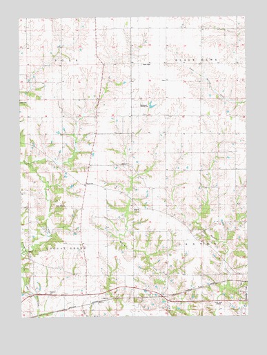
Brookville, IA USGS Topographic Map
Click on map above to begin viewing in our Map Viewer.

This topographic map contains these locations and features:
Feature Name Type Latitude Longitude GNIS ID View Map
BernhartPopulated PlaceN41.0125°W92.0680°464310View Map
Bernhart (historical)LocaleN41.0086°W92.0841°1976358View Map
Bernhart Post Office (historical)Post OfficeN41.0086°W92.0841°1976359View Map
Brooks CemeteryCemeteryN41.0636°W92.0696°454846View Map
BrookvillePopulated PlaceN41.0556°W92.0891°464472View Map
Brookville (historical)LocaleN41.0556°W92.0891°1976354View Map
Brookville Post Office (historical)Post OfficeN41.0556°W92.0891°1976355View Map
Cedar Hill CemeteryCemeteryN41.0084°W92.0335°1976511View Map
City of Maharishi Vedic CityCivilN41.0543°W92.0139°2395815View Map
Competine CreekStreamN41.0167°W92.1241°455556View Map
Coon CemeteryCemeteryN41.0267°W92.1246°455596View Map
Gantz CemeteryCemeteryN41.0464°W92.1018°456819View Map
Gregg CemeteryCemeteryN41.0079°W92.0809°457144View Map
KBCT-FM (Fairfield)TowerN41.0070°W92.0141°463687View Map
KMCD-AM (Fairfield)TowerN41.0070°W92.0141°467026View Map
Long CemeteryCemeteryN41.0250°W92.0918°1976369View Map
Middlekoop AirportAirportN41.0848°W92.0578°466913View Map
Moorman CemeteryCemeteryN41.0453°W92.0624°459219View Map
Myers CemeteryCemeteryN41.0892°W92.1221°459423View Map
Suburban Heights Baptist ChurchChurchN41.0042°W92.0013°1976440View Map
Suburban Heights Baptist Church SchoolSchoolN41.0042°W92.0013°1976439View Map
Township of Black HawkCivilN41.1199°W92.0050°467457View Map
Township of CenterCivilN41.0251°W92.0061°467578View Map
Township of Locust GroveCivilN41.0323°W92.1214°468293View Map
Township of PolkCivilN41.1196°W92.1216°468556View Map
Witham WoodsParkN41.0111°W92.0099°1976327View Map

Note: Coordinates in the location and feature list above are referenced to NAD83 datum.


Copyright (C) 2008-2025 Ryan Niemi / Sunset Dynamics ... All Rights Reserved