TopoQuest Logo
Do you find TopoQuest useful?
Help keep TopoQuest running and adding new maps/features by donating!
Bitcoin:  19c7KJd3qBynnjoSw5npx9KScwjBe4ifkT
Litecoin:  LXs6TkuXGGXo1vDsWCkWVdjQX94eUKd6ui
Home View Maps Find Maps Find Places Resources & Links


Libertyville, Iowa Topographic Map

USGS Map Title: Libertyville, IA
USGS Map MRC: 40092H1
DRG (GeoTIFF) Download: o40092h1.tif


Neighboring USGS Topographic Map Quads:


  Abingdon, IA  
41092A2
 

  Brookville, IA  
41092A1
 

  Fairfield North, IA  
41091A8
 

  Eldon, IA  
40092H2
 

  Libertyville, IA  
40092H1
 

  Fairfield South, IA  
40091H8
 

  Selma, IA  
40092G2
 

  Douds, IA  
40092G1
 

  Mount Zion, IA  
40091G8


Map MRC Location:

N41°
W93°
N41°
W92°
H8 H7 H6 H5 H4 H3 H2 H1
G8 G7 G6 G5 G4 G3 G2 G1
F8 F7 F6 F5 F4 F3 F2 F1
E8 E7 E6 E5 E4 E3 E2 E1
D8 D7 D6 D5 D4 D3 D2 D1
C8 C7 C6 C5 C4 C3 C2 C1
B8 B7 B6 B5 B4 B3 B2 B1
A8 A7 A6 A5 A4 A3 A2 A1
N40°
W93°
N40°
W92°

Libertyville, IA USGS 1:24K Topographic Map Preview:
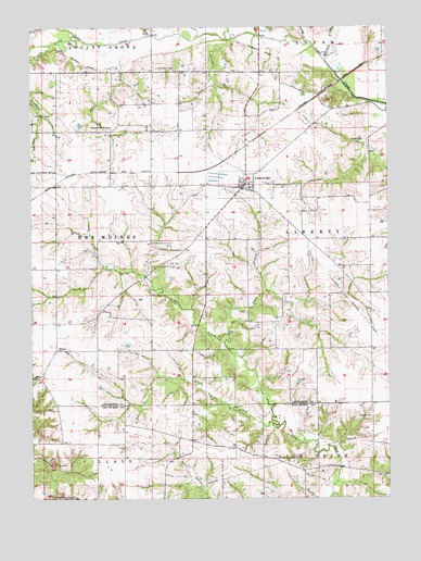
Libertyville, IA USGS Topographic Map
Click on map above to begin viewing in our Map Viewer.

This topographic map contains these locations and features:
Feature Name Type Latitude Longitude GNIS ID View Map
Bethel CemeteryCemeteryN40.8967°W92.0062°454546View Map
Bonell CreekStreamN40.9967°W92.0899°454746View Map
Brethren CemeteryCemeteryN40.9768°W92.1240°1976503View Map
Cedar Creek Timber Recreation AreaParkN40.9875°W92.0210°1976337View Map
Church CreekStreamN40.9961°W92.0288°455411View Map
City of LibertyvilleCivilN40.9582°W92.0502°2395702View Map
Dragoon Trail Historical MarkerParkN40.9575°W92.0513°1976370View Map
East Branch Lick CreekStreamN40.9186°W92.0563°456125View Map
EllmakerPopulated PlaceN40.9728°W92.0827°464309View Map
Faith United Methodist ChurchChurchN40.9570°W92.0493°1976477View Map
Fell CemeteryCemeteryN40.9375°W92.0774°456566View Map
Grubb RunStreamN40.9964°W92.0560°457171View Map
Hupp CreekStreamN40.9978°W92.0832°457731View Map
KIIK-FM (Fairfield)TowerN40.9797°W92.0960°467323View Map
Krum Post Office (historical)Post OfficeN40.9911°W92.0474°1976341View Map
LibertyvillePopulated PlaceN40.9575°W92.0513°458333View Map
Libertyville (historical)LocaleN40.9578°W92.0521°1976482View Map
Libertyville City HallBuildingN40.9586°W92.0502°1976480View Map
Libertyville Elementary SchoolSchoolN40.9582°W92.0489°1976481View Map
Libertyville Fire DepartmentBuildingN40.9578°W92.0512°1976479View Map
Libertyville Post OfficePost OfficeN40.9586°W92.0502°1976478View Map
Little Lick CreekStreamN40.8945°W92.0396°458479View Map
McCleary CemeteryCemeteryN40.9892°W92.0807°458888View Map
Mitchell CreekStreamN40.9909°W92.0218°459153View Map
Mount Zion ChurchChurchN40.9147°W92.1160°459360View Map
Rock CreekStreamN40.9975°W92.1093°460723View Map
Smith CemeteryCemeteryN40.9972°W92.0363°1976502View Map
Sunnybrook Assisted Living CenterHospitalN40.9834°W92.0030°1976380View Map
Township of Des MoinesCivilN40.9441°W92.1215°467708View Map
Township of LibertyCivilN40.9381°W92.0139°468219View Map
Whitefield (historical)Populated PlaceN40.9950°W92.0438°465469View Map
Whitfield Post Office (historical)Post OfficeN40.9911°W92.0474°1976342View Map
Winsell CemeteryCemeteryN40.9068°W92.1246°463135View Map

Note: Coordinates in the location and feature list above are referenced to NAD83 datum.


Copyright (C) 2008-2025 Ryan Niemi / Sunset Dynamics ... All Rights Reserved