TopoQuest Logo
Do you find TopoQuest useful?
Help keep TopoQuest running and adding new maps/features by donating!
Bitcoin:  19c7KJd3qBynnjoSw5npx9KScwjBe4ifkT
Litecoin:  LXs6TkuXGGXo1vDsWCkWVdjQX94eUKd6ui
Home View Maps Find Maps Find Places Resources & Links


Fairfield South, Iowa Topographic Map

USGS Map Title: Fairfield South, IA
USGS Map MRC: 40091H8
DRG (GeoTIFF) Download: o40091h8.tif


Neighboring USGS Topographic Map Quads:


  Brookville, IA  
41092A1
 

  Fairfield North, IA  
41091A8
 

  Salina, IA  
41091A7
 

  Libertyville, IA  
40092H1
 

  Fairfield South, IA  
40091H8
 

  Lockridge West, IA  
40091H7
 

  Douds, IA  
40092G1
 

  Mount Zion, IA  
40091G8
 

  Stockport, IA  
40091G7


Map MRC Location:

N41°
W92°
N41°
W91°
H8 H7 H6 H5 H4 H3 H2 H1
G8 G7 G6 G5 G4 G3 G2 G1
F8 F7 F6 F5 F4 F3 F2 F1
E8 E7 E6 E5 E4 E3 E2 E1
D8 D7 D6 D5 D4 D3 D2 D1
C8 C7 C6 C5 C4 C3 C2 C1
B8 B7 B6 B5 B4 B3 B2 B1
A8 A7 A6 A5 A4 A3 A2 A1
N40°
W92°
N40°
W91°

Fairfield South, IA USGS 1:24K Topographic Map Preview:
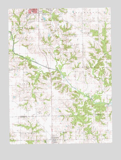
Fairfield South, IA USGS Topographic Map
Click on map above to begin viewing in our Map Viewer.

This topographic map contains these locations and features:
Feature Name Type Latitude Longitude GNIS ID View Map
BirminghamPopulated PlaceN40.8789°W91.9471°454645View Map
Birmingham (historical)LocaleN40.8789°W91.9471°1980981View Map
Birmingham Early Childhood CenterSchoolN40.8787°W91.9432°2719691View Map
Birmingham Fire StationBuildingN40.8789°W91.9471°1980985View Map
Birmingham First Presbyterian ChurchChurchN40.8789°W91.9471°1980982View Map
Birmingham Free Methodist ChurchChurchN40.8781°W91.9563°1980984View Map
Birmingham LibraryBuildingN40.8778°W91.9454°1980980View Map
Birmingham Post OfficePost OfficeN40.8789°W91.9471°1980977View Map
Birmingham Town HallBuildingN40.8778°W91.9454°1980979View Map
Birmington Medical ClinicHospitalN40.8789°W91.9471°1980978View Map
Bradshaw CemeteryCemeteryN40.9767°W91.9035°454801View Map
Calvary Baptist ChurchChurchN40.9881°W91.9696°455061View Map
City of BirminghamCivilN40.8777°W91.9473°2394174View Map
Clinkenbeard Family CemeteryCemeteryN40.9084°W91.9585°1976505View Map
CollettPopulated PlaceN40.9061°W91.9777°464504View Map
Collett (historical)LocaleN40.9061°W91.9777°1976352View Map
Collett Post Office (historical)Post OfficeN40.9061°W91.9777°1976353View Map
County Poor Farm CemeteryCemeteryN40.9417°W91.9996°1976506View Map
Crow CreekStreamN40.9439°W91.9410°455739View Map
Fairfield Christian SchoolSchoolN40.9861°W91.9627°1976442View Map
Fairfield Golf and Country ClubLocaleN40.9978°W91.9502°1976451View Map
Fairfield Middle SchoolSchoolN40.9943°W91.9696°463786View Map
Fairfield Wastewater Treatment PlantLocaleN40.9789°W91.9450°2728311View Map
Faith Baptist ChurchChurchN40.9953°W91.9752°1976427View Map
Foursquare Gospel ChurchChurchN40.9900°W91.9635°1976430View Map
Free Methodist Camp GroundLocaleN40.8778°W91.9571°1980986View Map
Friends ChurchChurchN40.9956°W91.9699°1976422View Map
Galliher Family CemeteryCemeteryN40.9667°W91.8835°1981386View Map
Harmony Post Office (historical)Post OfficeN40.9861°W91.8891°1976347View Map
Immanuel Lutheran ChurchChurchN40.9903°W91.9627°1976429View Map
Jefferson County Health CenterHospitalN40.9862°W91.9654°1976382View Map
Jefferson County HomeBuildingN40.9436°W91.9996°463304View Map
Jefferson County ParkParkN40.9889°W91.9868°1976373View Map
Jefferson County Park TrailTrailN40.9889°W91.9868°1976372View Map
Lamson Woods State PreserveParkN40.9931°W91.9424°1976463View Map
Lewis Bonnett Historical MarkerParkN40.8809°W91.8966°1980990View Map
Maple Hill CemeteryCemeteryN40.8776°W91.9349°1824992View Map
Methodist Episcopal CemeteryCemeteryN40.8787°W91.9427°1981024View Map
O B Nelson ParkParkN40.9945°W91.9655°1976458View Map
Patterson CemeteryCemeteryN40.9445°W91.9052°460041View Map
Pence Elementary SchoolSchoolN40.9971°W91.9711°1976447View Map
Roth CemeteryCemeteryN40.9588°W91.9577°460819View Map
Smith CemeteryCemeteryN40.8804°W91.8968°461682View Map
Southwood ParkParkN40.9931°W91.9724°1976462View Map
Steele CemeteryCemeteryN40.9222°W91.9974°1976504View Map
The Church of Jesus Christ of Latter Day SaintsChurchN40.9800°W91.9968°1976441View Map
Thompson CemeteryCemeteryN40.9157°W91.9777°462217View Map
Township of CedarCivilN40.9445°W91.8910°467554View Map
Troy CreekStreamN40.9145°W91.8966°462342View Map
Turkey Run Wildlife AreaParkN40.9084°W91.9002°1976324View Map
United Methodist ChurchChurchN40.8789°W91.9471°1980983View Map
United Presbyterian CemeteryCemeteryN40.8790°W91.9420°1981025View Map
Wilson ParkParkN40.9964°W91.9593°1976461View Map
Zillman's Hickory Hills Recreation AreaParkN40.9778°W91.8988°1976325View Map

Note: Coordinates in the location and feature list above are referenced to NAD83 datum.


Copyright (C) 2008-2025 Ryan Niemi / Sunset Dynamics ... All Rights Reserved