TopoQuest Logo
Do you find TopoQuest useful?
Help keep TopoQuest running and adding new maps/features by donating!
Bitcoin:  19c7KJd3qBynnjoSw5npx9KScwjBe4ifkT
Litecoin:  LXs6TkuXGGXo1vDsWCkWVdjQX94eUKd6ui
Home View Maps Find Maps Find Places Resources & Links


Broughton, Illinois Topographic Map

USGS Map Title: Broughton, IL
USGS Map MRC: 37088H4
DRG (GeoTIFF) Download: o37088h4.tif


Neighboring USGS Topographic Map Quads:


  McLeansboro, IL  
38088A5
 

  Thackeray, IL  
38088A4
 

  Enfield, IL  
38088A3
 

  Walpole, IL  
37088H5
 

  Broughton, IL  
37088H4
 

  Norris City, IL  
37088H3
 

  Galatia, IL  
37088G5
 

  Eldorado, IL  
37088G4
 

  Ridgway, IL  
37088G3


Map MRC Location:

N38°
W89°
N38°
W88°
H8 H7 H6 H5 H4 H3 H2 H1
G8 G7 G6 G5 G4 G3 G2 G1
F8 F7 F6 F5 F4 F3 F2 F1
E8 E7 E6 E5 E4 E3 E2 E1
D8 D7 D6 D5 D4 D3 D2 D1
C8 C7 C6 C5 C4 C3 C2 C1
B8 B7 B6 B5 B4 B3 B2 B1
A8 A7 A6 A5 A4 A3 A2 A1
N37°
W89°
N37°
W88°

Broughton, IL USGS 1:24K Topographic Map Preview:
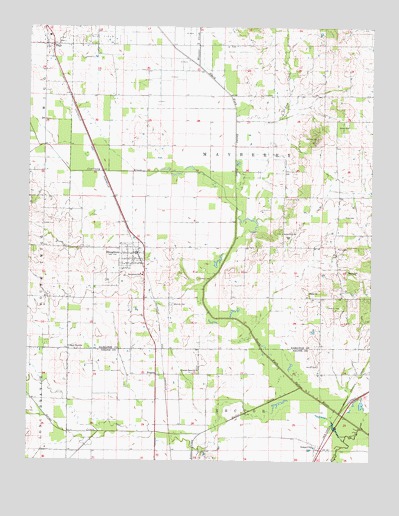
Broughton, IL USGS Topographic Map
Click on map above to begin viewing in our Map Viewer.

This topographic map contains these locations and features:
Feature Name Type Latitude Longitude GNIS ID View Map
Barker CemeteryCemeteryN37.9431°W88.4948°403819View Map
Big Hill CemeteryCemeteryN37.9684°W88.3950°404412View Map
BroughtonPopulated PlaceN37.9348°W88.4620°404929View Map
Broughton Post OfficePost OfficeN37.9346°W88.4610°2788254View Map
Broughton SchoolSchoolN37.9284°W88.4584°404932View Map
Brush CreekStreamN37.8864°W88.3778°405025View Map
Contrary CreekStreamN37.9481°W88.4245°406488View Map
Cook CemeteryCemeteryN37.9456°W88.3850°406495View Map
DalePopulated PlaceN37.9950°W88.4917°406928View Map
Dale Elementary SchoolSchoolN37.9975°W88.4928°1812452View Map
Dale Post OfficePost OfficeN37.9950°W88.4931°1812453View Map
FrancisPopulated PlaceN37.8998°W88.4531°422710View Map
Gaines Family CemeteryCemeteryN37.9025°W88.3942°408838View Map
Gholson CemeteryCemeteryN37.9203°W88.4473°408979View Map
Gholson Grove ChurchChurchN37.9073°W88.4850°408980View Map
Indian CreekStreamN37.8825°W88.4367°410840View Map
Keasler CemeteryCemeteryN37.9195°W88.3906°411335View Map
Lantham CemeteryCemeteryN37.9275°W88.4384°411822View Map
Lost CreekStreamN37.9748°W88.4250°412645View Map
Morris CemeteryCemeteryN37.9370°W88.3873°413837View Map
North Fork ChurchChurchN37.9409°W88.4075°414591View Map
Pleasant Grove ChurchChurchN37.9012°W88.4381°415783View Map
Rector CreekStreamN37.8964°W88.4006°416445View Map
Rector TownhallBuildingN37.8778°W88.4348°1821000View Map
Rectorville (historical)Populated PlaceN37.9217°W88.4578°1812489View Map
Salem ChurchChurchN37.9237°W88.3978°417865View Map
Shiloh ChurchChurchN37.9717°W88.3839°418409View Map
Texas CityPopulated PlaceN37.8784°W88.3934°419613View Map
Township of MayberryCivilN37.9730°W88.4297°429344View Map
Township of RectorCivilN37.8855°W88.4298°429624View Map
Village of BroughtonCivilN37.9346°W88.4615°2397470View Map
Wheeler CreekStreamN37.9892°W88.4389°420993View Map
Wolfe CemeteryCemeteryN37.9298°W88.3837°421401View Map

Note: Coordinates in the location and feature list above are referenced to NAD83 datum.


Copyright (C) 2008-2025 Ryan Niemi / Sunset Dynamics ... All Rights Reserved