TopoQuest Logo
Do you find TopoQuest useful?
Help keep TopoQuest running and adding new maps/features by donating!
Bitcoin:  19c7KJd3qBynnjoSw5npx9KScwjBe4ifkT
Litecoin:  LXs6TkuXGGXo1vDsWCkWVdjQX94eUKd6ui
Home View Maps Find Maps Find Places Resources & Links


Enfield, Illinois Topographic Map

USGS Map Title: Enfield, IL
USGS Map MRC: 38088A3
DRG (GeoTIFF) Download: o38088a3.tif


Neighboring USGS Topographic Map Quads:


  Bungay, IL  
38088B4
 

  Springerton, IL  
38088B3
 

  Centerville, IL  
38088B2
 

  Thackeray, IL  
38088A4
 

  Enfield, IL  
38088A3
 

  Carmi, IL  
38088A2
 

  Broughton, IL  
37088H4
 

  Norris City, IL  
37088H3
 

  New Haven, IL  
37088H2


Map MRC Location:

N39°
W89°
N39°
W88°
H8 H7 H6 H5 H4 H3 H2 H1
G8 G7 G6 G5 G4 G3 G2 G1
F8 F7 F6 F5 F4 F3 F2 F1
E8 E7 E6 E5 E4 E3 E2 E1
D8 D7 D6 D5 D4 D3 D2 D1
C8 C7 C6 C5 C4 C3 C2 C1
B8 B7 B6 B5 B4 B3 B2 B1
A8 A7 A6 A5 A4 A3 A2 A1
N38°
W89°
N38°
W88°

Enfield, IL USGS 1:24K Topographic Map Preview:
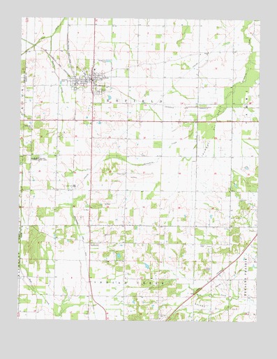
Enfield, IL USGS Topographic Map
Click on map above to begin viewing in our Map Viewer.

This topographic map contains these locations and features:
Feature Name Type Latitude Longitude GNIS ID View Map
Bethel ChurchChurchN38.1112°W88.2767°404290View Map
Booth Elementary SchoolSchoolN38.1012°W88.3387°1823943View Map
Brockett School (historical)SchoolN38.0539°W88.2789°1705604View Map
EnfieldPopulated PlaceN38.0995°W88.3375°408024View Map
Enfield Fire DepartmentBuildingN38.0994°W88.3391°2681807View Map
Enfield Post OfficePost OfficeN38.0997°W88.3371°2788820View Map
Enfield Village CemeteryCemeteryN38.0942°W88.3339°408025View Map
Gowdy CreekStreamN38.1170°W88.3592°409222View Map
Hickory Valley School (historical)SchoolN38.0503°W88.3562°1705608View Map
Jamestown (historical)Populated PlaceN38.0389°W88.3742°1812459View Map
Johnson CemeteryCemeteryN38.0028°W88.3006°411149View Map
Modoc School (historical)SchoolN38.1114°W88.3142°1705613View Map
Murdach School (historical)SchoolN38.0825°W88.2825°1705614View Map
Rice CemeteryCemeteryN38.0217°W88.2767°416581View Map
Roland Oil FieldOilfieldN38.0267°W88.2545°425409View Map
SacramentoPopulated PlaceN38.0317°W88.3375°423145View Map
Saint Patricks ChurchChurchN38.0789°W88.3692°417682View Map
Sharon ChurchChurchN38.0353°W88.3292°418289View Map
Smith School (historical)SchoolN38.1117°W88.2817°1705618View Map
Stephens School (historical)SchoolN38.1114°W88.3592°1705620View Map
StokesPopulated PlaceN38.0175°W88.2739°1705621View Map
Storey Real Estate AirportAirportN38.0446°W88.3009°2679047View Map
Township of EnfieldCivilN38.0824°W88.3185°428971View Map
Trousdale School (historical)SchoolN38.0800°W88.3187°1705622View Map
Trumbull Oil FieldOilfieldN38.0714°W88.2795°425570View Map
Upponblock School (historical)SchoolN38.0542°W88.3198°1705624View Map
Veatch School (historical)SchoolN38.0253°W88.3195°1705625View Map
Village of EnfieldCivilN38.1019°W88.3381°2398835View Map
Wesley ChapelChurchN38.0609°W88.3195°420765View Map
West Point School (historical)SchoolN38.0245°W88.3559°1705626View Map
West Union ChurchChurchN38.0503°W88.2595°420932View Map

Note: Coordinates in the location and feature list above are referenced to NAD83 datum.


Copyright (C) 2008-2025 Ryan Niemi / Sunset Dynamics ... All Rights Reserved