TopoQuest Logo
Do you find TopoQuest useful?
Help keep TopoQuest running and adding new maps/features by donating!
Bitcoin:  19c7KJd3qBynnjoSw5npx9KScwjBe4ifkT
Litecoin:  LXs6TkuXGGXo1vDsWCkWVdjQX94eUKd6ui
Home View Maps Find Maps Find Places Resources & Links


Thackeray, Illinois Topographic Map

USGS Map Title: Thackeray, IL
USGS Map MRC: 38088A4
DRG (GeoTIFF) Download: o38088a4.tif


Neighboring USGS Topographic Map Quads:


  Belle Prairie City, IL  
38088B5
 

  Bungay, IL  
38088B4
 

  Springerton, IL  
38088B3
 

  McLeansboro, IL  
38088A5
 

  Thackeray, IL  
38088A4
 

  Enfield, IL  
38088A3
 

  Walpole, IL  
37088H5
 

  Broughton, IL  
37088H4
 

  Norris City, IL  
37088H3


Map MRC Location:

N39°
W89°
N39°
W88°
H8 H7 H6 H5 H4 H3 H2 H1
G8 G7 G6 G5 G4 G3 G2 G1
F8 F7 F6 F5 F4 F3 F2 F1
E8 E7 E6 E5 E4 E3 E2 E1
D8 D7 D6 D5 D4 D3 D2 D1
C8 C7 C6 C5 C4 C3 C2 C1
B8 B7 B6 B5 B4 B3 B2 B1
A8 A7 A6 A5 A4 A3 A2 A1
N38°
W89°
N38°
W88°

Thackeray, IL USGS 1:24K Topographic Map Preview:
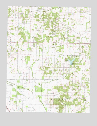
Thackeray, IL USGS Topographic Map
Click on map above to begin viewing in our Map Viewer.

This topographic map contains these locations and features:
Feature Name Type Latitude Longitude GNIS ID View Map
Albion ChurchChurchN38.0153°W88.3831°403381View Map
Arterberry CemeteryCemeteryN38.1098°W88.4278°403643View Map
Ash Grove Picnic AreaLocaleN38.0617°W88.4081°1812448View Map
Brush Harbor ChurchChurchN38.0920°W88.4281°405040View Map
Catfish Corner Picnic AreaLocaleN38.0564°W88.4031°1812450View Map
Clark CemeteryCemeteryN38.0042°W88.4781°406148View Map
Concord ChurchChurchN38.0889°W88.4600°406444View Map
Concord School (historical)SchoolN38.0945°W88.4581°1705516View Map
Digby CemeteryCemeteryN38.0034°W88.4900°407215View Map
Dolan Lake DamDamN38.0570°W88.4042°1691622View Map
Farris School (historical)SchoolN38.0603°W88.3870°1705521View Map
Four CornersLocaleN38.0167°W88.4753°1705522View Map
Green Acre Picnic AreaLocaleN38.0656°W88.3928°1812455View Map
Hamilton County State Conservation AreaParkN38.0570°W88.3959°409692View Map
Hickory Hill Picnic AreaLocaleN38.0664°W88.3989°1812457View Map
Hopewell ChurchChurchN38.0748°W88.4864°410517View Map
Hopkins CemeteryCemeteryN38.1195°W88.3817°410530View Map
Jackies Giant Oak Picnic AreaLocaleN38.0664°W88.4056°1812458View Map
Kiwanis Point Picnic AreaLocaleN38.0614°W88.3998°1812461View Map
L P Dolan LakeReservoirN38.0609°W88.4031°411633View Map
Lakeside View Picnic AreaLocaleN38.0592°W88.4056°1812462View Map
Lick CreekStreamN38.0314°W88.4475°412047View Map
Lick Creek ChurchChurchN38.0392°W88.4262°412060View Map
Lick Creek DrainCanalN38.0350°W88.4367°412061View Map
Logansport (historical)Populated PlaceN38.1059°W88.4234°1812463View Map
Logansport School (historical)SchoolN38.1037°W88.4148°1705526View Map
Main LakeReservoirN38.0734°W88.3917°1692139View Map
Main Lake DamDamN38.0734°W88.3917°1692138View Map
Martins Store (historical)LocaleN38.0592°W88.4378°1812465View Map
Mayberry BranchStreamN38.0239°W88.4475°413156View Map
Mayberry School (historical)SchoolN38.0164°W88.4231°1705532View Map
Metcalf School (historical)SchoolN38.1075°W88.3914°1705533View Map
Munsell CemeteryCemeteryN38.0881°W88.3931°414238View Map
New Hope CemeteryCemeteryN38.1150°W88.4784°414410View Map
New Prospect ChurchChurchN38.0139°W88.4200°414453View Map
Nipper CornerPopulated PlaceN38.0387°W88.4703°423024View Map
Old Brush Harbor CemeteryCemeteryN38.0895°W88.4345°414994View Map
Oliver ChurchChurchN38.0453°W88.4784°415099View Map
Oliver School (historical)SchoolN38.0459°W88.4784°1705537View Map
Persimmon Ridge Picnic AreaLocaleN38.0589°W88.4017°1812470View Map
Pig Ridge School (historical)SchoolN38.0064°W88.3925°1705540View Map
Piney Wood Camping AreaLocaleN38.0634°W88.4039°1812488View Map
Prince CemeteryCemeteryN38.1006°W88.4075°416224View Map
Riley CreekStreamN38.0520°W88.4631°416673View Map
Rocky Point Picnic AreaLocaleN38.0612°W88.4042°1812490View Map
Runoff Collection DamDamN38.0650°W88.4767°1692142View Map
Runoff Collection PondReservoirN38.0650°W88.4767°1692143View Map
Shady Rest Picnic AreaLocaleN38.0584°W88.3989°1812491View Map
Sneed ChurchChurchN38.0589°W88.4239°418674View Map
Sneed School (historical)SchoolN38.0598°W88.4198°1705548View Map
Sunrise Point Picnic AreaLocaleN38.0609°W88.4064°1812492View Map
Tenmile CreekStreamN38.0178°W88.4614°419591View Map
ThackerayPopulated PlaceN38.1200°W88.4531°419619View Map
Thackeray Church (historical)ChurchN38.1145°W88.4798°1705553View Map
Thackeray Oil FieldOilfieldN38.0992°W88.4217°425553View Map
ThurberPopulated PlaceN38.0825°W88.4275°423239View Map
Township of CrookCivilN38.0820°W88.4285°428857View Map
Twin Oaks Picnic AreaLocaleN38.0612°W88.3942°1812493View Map
Walters School (historical)SchoolN38.0275°W88.3925°1705557View Map
Webb CemeteryCemeteryN38.0453°W88.4164°420681View Map
Wheeler Creek DrainCanalN38.0156°W88.4475°420994View Map
Williams School (historical)SchoolN38.0675°W88.4562°1705560View Map
Zinnia Knoll Picnic AreaLocaleN38.0575°W88.4059°1812494View Map

Note: Coordinates in the location and feature list above are referenced to NAD83 datum.


Copyright (C) 2008-2024 Ryan Niemi / Sunset Dynamics ... All Rights Reserved