TopoQuest Logo
Do you find TopoQuest useful?
Help keep TopoQuest running and adding new maps/features by donating!
Bitcoin:  19c7KJd3qBynnjoSw5npx9KScwjBe4ifkT
Litecoin:  LXs6TkuXGGXo1vDsWCkWVdjQX94eUKd6ui
Home View Maps Find Maps Find Places Resources & Links


Brown City, Michigan Topographic Map

USGS Map Title: Brown City, MI
USGS Map MRC: 43082B8
DRG (GeoTIFF) Download: o43082b8.tif


Neighboring USGS Topographic Map Quads:


  Marlette, MI  
43083C1
 

  Juhl, MI  
43082C8
 

  Peck, MI  
43082C7
 

  Burnside, MI  
43083B1
 

  Brown City, MI  
43082B8
 

  Yale, MI  
43082B7
 

  Imlay City, MI  
43083A1
 

  Capac, MI  
43082A8
 

  Brockway, MI  
43082A7


Map MRC Location:

N44°
W83°
N44°
W82°
H8 H7 H6 H5 H4 H3 H2 H1
G8 G7 G6 G5 G4 G3 G2 G1
F8 F7 F6 F5 F4 F3 F2 F1
E8 E7 E6 E5 E4 E3 E2 E1
D8 D7 D6 D5 D4 D3 D2 D1
C8 C7 C6 C5 C4 C3 C2 C1
B8 B7 B6 B5 B4 B3 B2 B1
A8 A7 A6 A5 A4 A3 A2 A1
N43°
W83°
N43°
W82°

Brown City, MI USGS 1:24K Topographic Map Preview:
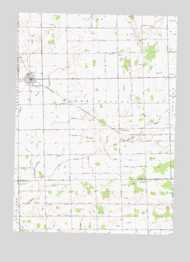
Brown City, MI USGS Topographic Map
Click on map above to begin viewing in our Map Viewer.

This topographic map contains these locations and features:
Feature Name Type Latitude Longitude GNIS ID View Map
Brown CityPopulated PlaceN43.2122°W82.9897°622071View Map
Brown City Banner Historical MarkerParkN43.2125°W82.9889°2554494View Map
Brown City Community SchoolSchoolN43.2147°W82.9908°2554421View Map
Brown City Community Schools Historical MarkerParkN43.2139°W82.9914°2554493View Map
Brown City Family Health CareHospitalN43.2119°W82.9967°2554416View Map
Brown City Fire DepartmentBuildingN43.2130°W82.9834°2554417View Map
Brown City HallBuildingN43.2122°W82.9889°2554418View Map
Brown City Health CenterHospitalN43.2014°W82.9983°2554415View Map
Brown City Police DepartmentBuildingN43.2119°W82.9878°2737432View Map
Brown City Post OfficePost OfficeN43.2286°W82.9872°2554414View Map
Brown City Public LibraryBuildingN43.2122°W82.9889°2554170View Map
Brown City StationLocaleN43.2117°W82.9864°2554164View Map
Brown City United Methodist ChurchChurchN43.2108°W82.9908°2554169View Map
City of Brown CityCivilN43.2114°W82.9879°1625992View Map
Drennan SchoolSchoolN43.1347°W82.9547°1624496View Map
Evergreen CemeteryCemeteryN43.2220°W82.9997°625704View Map
Faith Baptist ChurchChurchN43.2078°W82.9983°2554167View Map
Hill SchoolSchoolN43.2220°W82.9019°628289View Map
Hydorn DrainCanalN43.2136°W82.9155°628908View Map
Immanuel Revival ChurchChurchN43.2133°W82.9928°2554420View Map
Kenney DrainCanalN43.1309°W82.9460°1624640View Map
Lapeer and Sanilac DrainCanalN43.2125°W82.9747°630147View Map
Macklem DrainCanalN43.2170°W82.8766°631288View Map
Mapleview Estates Mobile Home ParkPopulated PlaceN43.2092°W82.9831°2554419View Map
Mennonite ChurchChurchN43.1414°W82.9544°1624731View Map
Missionary ChurchChurchN43.2150°W82.9883°2554168View Map
Odelville SchoolSchoolN43.1689°W82.9672°633939View Map
Sacred Heart Catholic ChurchChurchN43.2039°W82.9983°2554165View Map
Sacred Heart CemeteryCemeteryN43.2228°W82.9985°636887View Map
Scott DrainCanalN43.1664°W82.9577°637465View Map
Sharpsville Post Office (historical)Post OfficeN43.1547°W82.9981°2575321View Map
Sharpsville SchoolSchoolN43.1522°W82.9958°1624925View Map
Toman DrainCanalN43.1678°W82.9872°1614940View Map
Township of Maple ValleyCivilN43.1984°W82.9377°1626681View Map
Trinity Lutheran ChurchChurchN43.2050°W82.9983°2554166View Map
Valley CenterPopulated PlaceN43.1850°W82.9185°1617909View Map
Valley Center CemeteryCemeteryN43.1786°W82.9002°1615447View Map
Valley Center DrainCanalN43.2056°W82.9199°1615448View Map
Valley Center Post Office (historical)Post OfficeN43.1850°W82.9186°2554186View Map
Valley Center SchoolSchoolN43.1781°W82.9160°1615449View Map
Valley Center StationLocaleN43.1842°W82.9172°2554180View Map
Varney DrainCanalN43.1800°W82.9469°1615519View Map
Wait DrainCanalN43.1314°W82.9138°1624998View Map
Willoughby BranchStreamN43.1511°W82.9805°1625021View Map
Willoughby DrainCanalN43.1439°W82.9833°1625022View Map
Winters DrainCanalN43.1997°W82.9547°1616649View Map
Witmer DrainCanalN43.1922°W82.9452°1616669View Map
York DrainCanalN43.1670°W82.9160°1616892View Map

Note: Coordinates in the location and feature list above are referenced to NAD83 datum.


Copyright (C) 2008-2025 Ryan Niemi / Sunset Dynamics ... All Rights Reserved