TopoQuest Logo
Do you find TopoQuest useful?
Help keep TopoQuest running and adding new maps/features by donating!
Bitcoin:  19c7KJd3qBynnjoSw5npx9KScwjBe4ifkT
Litecoin:  LXs6TkuXGGXo1vDsWCkWVdjQX94eUKd6ui
Home View Maps Find Maps Find Places Resources & Links


Browns Lake, Mississippi Topographic Map

USGS Map Title: Browns Lake, MS
USGS Map MRC: 30089G3
DRG (GeoTIFF) Download: o30089g3.tif


Neighboring USGS Topographic Map Quads:


  Hillsdale, MS  
30089H4
 

  Carnes, MS  
30089H3
 

  Bond, MS  
30089H2
 

  Big Swamp, MS  
30089G4
 

  Browns Lake, MS  
30089G3
 

  Wiggins, MS  
30089G2
 

  Savannah, MS  
30089F4
 

  Silver Run, MS  
30089F3
 

  McHenry, MS  
30089F2


Map MRC Location:

N31°
W90°
N31°
W89°
H8 H7 H6 H5 H4 H3 H2 H1
G8 G7 G6 G5 G4 G3 G2 G1
F8 F7 F6 F5 F4 F3 F2 F1
E8 E7 E6 E5 E4 E3 E2 E1
D8 D7 D6 D5 D4 D3 D2 D1
C8 C7 C6 C5 C4 C3 C2 C1
B8 B7 B6 B5 B4 B3 B2 B1
A8 A7 A6 A5 A4 A3 A2 A1
N30°
W90°
N30°
W89°

Browns Lake, MS USGS 1:24K Topographic Map Preview:
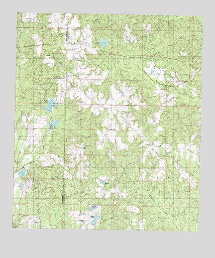
Browns Lake, MS USGS Topographic Map
Click on map above to begin viewing in our Map Viewer.

This topographic map contains these locations and features:
Feature Name Type Latitude Longitude GNIS ID View Map
Batson Lake DamDamN30.8669°W89.3301°680528View Map
Bill Cloud Lake DamDamN30.8119°W89.3451°680511View Map
Browns LakeReservoirN30.7784°W89.3163°667649View Map
Browns Lake DamDamN30.7785°W89.3167°680498View Map
Carrol LakeReservoirN30.7622°W89.3226°683271View Map
Cowpen CreekStreamN30.7638°W89.2781°668904View Map
Crystal LakeReservoirN30.7557°W89.3198°683273View Map
Daugdrill CemeteryCemeteryN30.8635°W89.3451°669120View Map
Davis CemeteryCemeteryN30.8118°W89.2778°669131View Map
Davis CemeteryCemeteryN30.8707°W89.3670°669132View Map
Donald Durks Lake DamDamN30.7746°W89.3709°680499View Map
Donald Durks Lake DamDamN30.7785°W89.3701°680500View Map
Holiday LakeReservoirN30.8217°W89.3517°690881View Map
Horsehead LakeReservoirN30.7539°W89.3271°683276View Map
Juniper CreekStreamN30.7821°W89.3737°672060View Map
Lake Toc-O-LeenReservoirN30.8584°W89.3165°683289View Map
Lake Toc-O-Leen DamDamN30.8602°W89.3134°680524View Map
Lee CemeteryCemeteryN30.8157°W89.3687°672366View Map
Lee CemeteryCemeteryN30.8496°W89.3562°672367View Map
Lee CemeteryCemeteryN30.7974°W89.3287°683277View Map
Lee CemeteryCemeteryN30.8591°W89.3348°683278View Map
Lee Lookout TowerTowerN30.8588°W89.3381°711263View Map
Magnolia SchoolSchoolN30.8027°W89.2864°673082View Map
Magnolia Volunteer Fire DepartmentBuildingN30.8179°W89.3031°2332814View Map
Plainview ChurchChurchN30.7538°W89.3573°690893View Map
Red Creek ChurchChurchN30.8363°W89.2614°676526View Map
Red Hill ChurchChurchN30.8374°W89.3478°676534View Map
Rogers Lake DamDamN30.7519°W89.3284°680486View Map
Rogers Lake DamDamN30.7535°W89.3201°680487View Map
Rogers Lake DamDamN30.7535°W89.3267°680488View Map
Rogers Lake DamDamN30.7585°W89.3267°680489View Map
Rogers Lake DamDamN30.7619°W89.3234°680491View Map
Seals CemeteryCemeteryN30.8527°W89.3351°677485View Map
Smith CemeteryCemeteryN30.8138°W89.3087°677898View Map
Smith Lake DamDamN30.7869°W89.3267°680503View Map
Smith TownPopulated PlaceN30.8080°W89.3126°683284View Map
Supervisor District 3CivilN30.7553°W89.2560°712077View Map
Toc - O - Leen CampgroundLocaleN30.8601°W89.3216°2596579View Map
Turkey CreekStreamN30.8152°W89.3737°678947View Map
W W Cloud Lake DamDamN30.8085°W89.3434°680510View Map
Wesson Lake DamDamN30.7885°W89.2801°680507View Map

Note: Coordinates in the location and feature list above are referenced to NAD83 datum.


Copyright (C) 2008-2025 Ryan Niemi / Sunset Dynamics ... All Rights Reserved