TopoQuest Logo
Do you find TopoQuest useful?
Help keep TopoQuest running and adding new maps/features by donating!
Bitcoin:  19c7KJd3qBynnjoSw5npx9KScwjBe4ifkT
Litecoin:  LXs6TkuXGGXo1vDsWCkWVdjQX94eUKd6ui
Home View Maps Find Maps Find Places Resources & Links


Carnes, Mississippi Topographic Map

USGS Map Title: Carnes, MS
USGS Map MRC: 30089H3
DRG (GeoTIFF) Download: o30089h3.tif


Neighboring USGS Topographic Map Quads:


  Lumberton, MS  
31089A4
 

  Rock Hill, MS  
31089A3
 

  Brooklyn, MS  
31089A2
 

  Hillsdale, MS  
30089H4
 

  Carnes, MS  
30089H3
 

  Bond, MS  
30089H2
 

  Big Swamp, MS  
30089G4
 

  Browns Lake, MS  
30089G3
 

  Wiggins, MS  
30089G2


Map MRC Location:

N31°
W90°
N31°
W89°
H8 H7 H6 H5 H4 H3 H2 H1
G8 G7 G6 G5 G4 G3 G2 G1
F8 F7 F6 F5 F4 F3 F2 F1
E8 E7 E6 E5 E4 E3 E2 E1
D8 D7 D6 D5 D4 D3 D2 D1
C8 C7 C6 C5 C4 C3 C2 C1
B8 B7 B6 B5 B4 B3 B2 B1
A8 A7 A6 A5 A4 A3 A2 A1
N30°
W90°
N30°
W89°

Carnes, MS USGS 1:24K Topographic Map Preview:
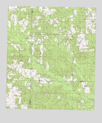
Carnes, MS USGS Topographic Map
Click on map above to begin viewing in our Map Viewer.

This topographic map contains these locations and features:
Feature Name Type Latitude Longitude GNIS ID View Map
Billy BranchStreamN30.9541°W89.3489°692616View Map
Bounds CemeteryCemeteryN30.9082°W89.3156°705621View Map
CarnesPopulated PlaceN30.9935°W89.2598°692841View Map
Carnes Volunteer Fire Department Station 1 HeadquartersBuildingN30.9934°W89.2617°2332853View Map
Dana CreekStreamN30.9639°W89.3619°2778525View Map
Davis CemeteryCemeteryN30.9607°W89.2864°693057View Map
Dry CreekStreamN30.9596°W89.3590°669409View Map
Entrekin CemeteryCemeteryN30.9855°W89.3109°693180View Map
Eureka CemeteryCemeteryN30.9182°W89.2812°704766View Map
Fairley CemeteryCemeteryN30.8838°W89.2689°704556View Map
Hickory CreekStreamN30.9419°W89.3448°693463View Map
Hickory Creek ChurchChurchN30.9330°W89.3570°705349View Map
Hurricane CreekStreamN30.9107°W89.3045°693569View Map
Indian CreekStreamN30.9038°W89.2534°693584View Map
J E Bounds Memorial CemeteryCemeteryN30.9835°W89.2528°704774View Map
Lancaster CemeteryCemeteryN30.9152°W89.2948°704776View Map
Landrum CemeteryCemeteryN30.9677°W89.3562°693685View Map
Lee Town ChurchChurchN30.9866°W89.3703°693705View Map
Lott Smith CemeteryCemeteryN30.9046°W89.2651°694820View Map
Maxie Oil and Gas FieldOilfieldN30.9782°W89.2739°693892View Map
Mill CreekStreamN30.9071°W89.3306°693977View Map
Mill CreekStreamN30.9321°W89.2831°693979View Map
Mill CreekStreamN30.9421°W89.3614°693991View Map
Mill CreekStreamN30.9446°W89.2509°693992View Map
Mill Creek ChurchChurchN30.9602°W89.2914°694001View Map
Near Prong Rester CreekStreamN30.8810°W89.2514°694149View Map
Old Sandhill ChurchChurchN30.9285°W89.3256°694269View Map
Pistol Ridge Oil and Gas FieldOilfieldN30.9780°W89.3567°694412View Map
Poison Head BranchStreamN30.9549°W89.3051°694445View Map
Sand Ridge School (historical)SchoolN30.8863°W89.3573°705356View Map
Sandhill ChurchChurchN30.9624°W89.2695°694702View Map
Seal CemeteryCemeteryN30.9593°W89.2651°694736View Map
TexasPopulated PlaceN30.8860°W89.2720°694958View Map
Thomas SchoolLocaleN30.9344°W89.3606°694965View Map
Wash CreekStreamN30.9557°W89.3520°695098View Map
White Oak BranchStreamN30.9502°W89.3039°695150View Map
YoungPopulated PlaceN30.9980°W89.3692°695232View Map

Note: Coordinates in the location and feature list above are referenced to NAD83 datum.


Copyright (C) 2008-2025 Ryan Niemi / Sunset Dynamics ... All Rights Reserved