TopoQuest Logo
Do you find TopoQuest useful?
Help keep TopoQuest running and adding new maps/features by donating!
Bitcoin:  19c7KJd3qBynnjoSw5npx9KScwjBe4ifkT
Litecoin:  LXs6TkuXGGXo1vDsWCkWVdjQX94eUKd6ui
Home View Maps Find Maps Find Places Resources & Links


Broxton South, Georgia Topographic Map

USGS Map Title: Broxton South, GA
USGS Map MRC: 31082E8
DRG (GeoTIFF) Download: o31082e8.tif


Neighboring USGS Topographic Map Quads:


  Osierfield, GA  
31083F1
 

  Broxton North, GA  
31082F8
 

  Broxton NE, GA  
31082F7
 

  Ambrose, GA  
31083E1
 

  Broxton South, GA  
31082E8
 

  Douglas North, GA  
31082E7
 

  Lax, GA  
31083D1
 

  Mora, GA  
31082D8
 

  Douglas South, GA  
31082D7


Map MRC Location:

N32°
W83°
N32°
W82°
H8 H7 H6 H5 H4 H3 H2 H1
G8 G7 G6 G5 G4 G3 G2 G1
F8 F7 F6 F5 F4 F3 F2 F1
E8 E7 E6 E5 E4 E3 E2 E1
D8 D7 D6 D5 D4 D3 D2 D1
C8 C7 C6 C5 C4 C3 C2 C1
B8 B7 B6 B5 B4 B3 B2 B1
A8 A7 A6 A5 A4 A3 A2 A1
N31°
W83°
N31°
W82°

Broxton South, GA USGS 1:24K Topographic Map Preview:
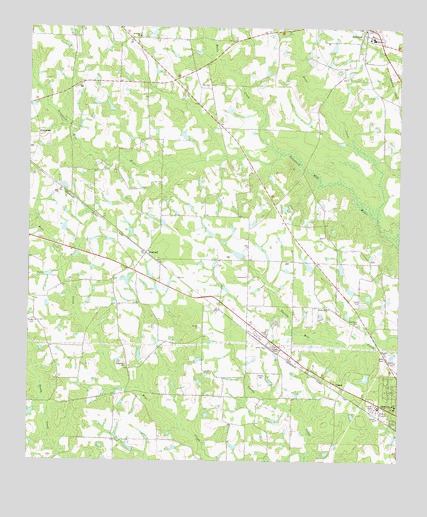
Broxton South, GA USGS Topographic Map
Click on map above to begin viewing in our Map Viewer.

This topographic map contains these locations and features:
Feature Name Type Latitude Longitude GNIS ID View Map
Bethany CemeteryCemeteryN31.6224°W82.9621°344845View Map
Bethany ChurchChurchN31.6224°W82.9632°311132View Map
Broxton Baptist ChurchChurchN31.6233°W82.8848°2740739View Map
Broxton LibraryBuildingN31.6246°W82.8868°344849View Map
Broxton Police DepartmentBuildingN31.6250°W82.8863°2733572View Map
BushnellPopulated PlaceN31.5602°W82.9599°326203View Map
Bushnell ChurchChurchN31.5571°W82.9554°352249View Map
Chaney CemeteryCemeteryN31.5255°W82.9213°355113View Map
City of BroxtonCivilN31.6248°W82.8877°2403942View Map
Coffee County Fire and Rescue Department Station 10BuildingN31.6246°W82.8869°2603560View Map
Coffee County Fire and Rescue Department Station 14BuildingN31.5179°W82.9751°2604686View Map
Day CemeteryCemeteryN31.6080°W82.9401°313369View Map
Grantham CemeteryCemeteryN31.5402°W82.8882°314776View Map
Griffin CemeteryCemeteryN31.5407°W82.9976°314903View Map
Halls CreekStreamN31.5888°W82.9151°315044View Map
Harper LakeReservoirN31.5525°W82.9669°341731View Map
Harper Lake DamDamN31.5519°W82.9665°341730View Map
Perimeter West Industrial ParkLocaleN31.5030°W82.8776°345109View Map
Peterson CemeteryCemeteryN31.5046°W82.9179°345110View Map
Rocky Pond CemeteryCemeteryN31.5441°W82.8979°345115View Map
Rocky Pond ChurchChurchN31.5446°W82.8985°321859View Map
Roses CreekStreamN31.5705°W82.8824°321935View Map
Salem CemeteryCemeteryN31.5327°W82.9196°345128View Map
Salem Holiness Baptist ChurchChurchN31.5330°W82.9196°322345View Map
Sunnyside ChurchChurchN31.5285°W82.9668°323765View Map
UptonPopulated PlaceN31.5216°W82.8932°333313View Map
Young CemeteryCemeteryN31.6007°W82.8807°345157View Map

Note: Coordinates in the location and feature list above are referenced to NAD83 datum.


Copyright (C) 2008-2025 Ryan Niemi / Sunset Dynamics ... All Rights Reserved