TopoQuest Logo
Do you find TopoQuest useful?
Help keep TopoQuest running and adding new maps/features by donating!
Bitcoin:  19c7KJd3qBynnjoSw5npx9KScwjBe4ifkT
Litecoin:  LXs6TkuXGGXo1vDsWCkWVdjQX94eUKd6ui
Home View Maps Find Maps Find Places Resources & Links


Osierfield, Georgia Topographic Map

USGS Map Title: Osierfield, GA
USGS Map MRC: 31083F1
DRG (GeoTIFF) Download: o31083f1.tif


Neighboring USGS Topographic Map Quads:


  Queensland, GA  
31083G2
 

  China Hill, GA  
31083G1
 

  Jacksonville, GA  
31082G8
 

  Fitzgerald East, GA  
31083F2
 

  Osierfield, GA  
31083F1
 

  Broxton North, GA  
31082F8
 

  Ocilla East, GA  
31083E2
 

  Ambrose, GA  
31083E1
 

  Broxton South, GA  
31082E8


Map MRC Location:

N32°
W84°
N32°
W83°
H8 H7 H6 H5 H4 H3 H2 H1
G8 G7 G6 G5 G4 G3 G2 G1
F8 F7 F6 F5 F4 F3 F2 F1
E8 E7 E6 E5 E4 E3 E2 E1
D8 D7 D6 D5 D4 D3 D2 D1
C8 C7 C6 C5 C4 C3 C2 C1
B8 B7 B6 B5 B4 B3 B2 B1
A8 A7 A6 A5 A4 A3 A2 A1
N31°
W84°
N31°
W83°

Osierfield, GA USGS 1:24K Topographic Map Preview:
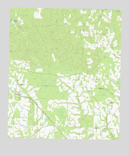
Osierfield, GA USGS Topographic Map
Click on map above to begin viewing in our Map Viewer.

This topographic map contains these locations and features:
Feature Name Type Latitude Longitude GNIS ID View Map
Ben Hill County Volunteer Fire Department Station 4BuildingN31.7156°W83.0261°2604328View Map
Dickson Mill (historical)LocaleN31.7380°W83.1215°335366View Map
Dicksons CemeteryCemeteryN31.7250°W83.1243°355498View Map
Dicksons Mill CreekStreamN31.7341°W83.1168°313474View Map
Dicksons MillpondReservoirN31.7360°W83.1216°355499View Map
Dicksons Millpond DamDamN31.7380°W83.1215°341925View Map
Evergreen Church (historical)ChurchN31.7494°W83.0124°335371View Map
Faulkner Lake NorthReservoirN31.6452°W83.0915°337288View Map
Faulkner Lake North DamDamN31.6452°W83.0915°337287View Map
Faulkner Lake SouthReservoirN31.6416°W83.0831°340869View Map
Faulkner Lake South DamDamN31.6402°W83.0849°340868View Map
Friendship ChurchChurchN31.6627°W83.1107°314400View Map
Fusselle CemeteryCemeteryN31.7485°W83.0021°314466View Map
Jowers Lake NorthReservoirN31.6317°W83.0517°340871View Map
Jowers Lake North DamDamN31.6319°W83.0499°340870View Map
Macedonia ChurchChurchN31.6832°W83.0274°317530View Map
McMillan CemeteryCemeteryN31.6849°W83.0684°317959View Map
McMillan CemeteryCemeteryN31.7071°W83.1243°317960View Map
Metz LakeReservoirN31.7069°W83.0865°341679View Map
Metz Lake DamDamN31.7069°W83.0865°341678View Map
New Bethel CemeteryCemeteryN31.7285°W83.0426°335397View Map
New Bethel ChurchChurchN31.7288°W83.0418°319272View Map
New Corinth ChurchChurchN31.6835°W83.0326°1704659View Map
Old Union CemeteryCemeteryN31.7132°W83.0107°320032View Map
OsierfieldPopulated PlaceN31.6671°W83.1160°320108View Map
Osierfield CemeteryCemeteryN31.6649°W83.1054°344983View Map
Poplar Spring ChurchChurchN31.6632°W83.1110°321032View Map
Saint Pauls CemeteryCemeteryN31.7255°W83.0190°322239View Map
Tucker CemeteryCemeteryN31.6941°W83.1029°324347View Map
Union School (historical)SchoolN31.7138°W83.0115°335414View Map
Virgle Smith DamDamN31.7169°W83.0415°335957View Map
Wray ChurchChurchN31.6257°W83.0601°345002View Map

Note: Coordinates in the location and feature list above are referenced to NAD83 datum.


Copyright (C) 2008-2025 Ryan Niemi / Sunset Dynamics ... All Rights Reserved