TopoQuest Logo
Do you find TopoQuest useful?
Help keep TopoQuest running and adding new maps/features by donating!
Bitcoin:  19c7KJd3qBynnjoSw5npx9KScwjBe4ifkT
Litecoin:  LXs6TkuXGGXo1vDsWCkWVdjQX94eUKd6ui
Home View Maps Find Maps Find Places Resources & Links


Douglas South, Georgia Topographic Map

USGS Map Title: Douglas South, GA
USGS Map MRC: 31082D7
DRG (GeoTIFF) Download: o31082d7.tif


Neighboring USGS Topographic Map Quads:


  Broxton South, GA  
31082E8
 

  Douglas North, GA  
31082E7
 

  Nicholls, GA  
31082E6
 

  Mora, GA  
31082D8
 

  Douglas South, GA  
31082D7
 

  Wilsonville, GA  
31082D6
 

  Kirkland, GA  
31082C8
 

  Pearson, GA  
31082C7
 

  Axson, GA  
31082C6


Map MRC Location:

N32°
W83°
N32°
W82°
H8 H7 H6 H5 H4 H3 H2 H1
G8 G7 G6 G5 G4 G3 G2 G1
F8 F7 F6 F5 F4 F3 F2 F1
E8 E7 E6 E5 E4 E3 E2 E1
D8 D7 D6 D5 D4 D3 D2 D1
C8 C7 C6 C5 C4 C3 C2 C1
B8 B7 B6 B5 B4 B3 B2 B1
A8 A7 A6 A5 A4 A3 A2 A1
N31°
W83°
N31°
W82°

Douglas South, GA USGS 1:24K Topographic Map Preview:
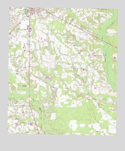
Douglas South, GA USGS Topographic Map
Click on map above to begin viewing in our Map Viewer.

This topographic map contains these locations and features:
Feature Name Type Latitude Longitude GNIS ID View Map
Ashley Yoemans CemeteryCemeteryN31.4627°W82.8701°344841View Map
Bell Lake ParkParkN31.4910°W82.8207°344844View Map
Carver CemeteryCemeteryN31.4374°W82.8657°344852View Map
Carver ChurchChurchN31.4369°W82.8657°355019View Map
Church of God (historical)ChurchN31.4974°W82.8471°347455View Map
Coffee County Fire and Rescue Department Station 20BuildingN31.4874°W82.8550°2603570View Map
Coffee County Fire and Rescue Department Station 9BuildingN31.4039°W82.8304°2604298View Map
Coffee County High SchoolSchoolN31.4913°W82.8526°345050View Map
Coffee Junior High SchoolSchoolN31.4966°W82.8451°345051View Map
Douglas DivisionCivilN31.4612°W82.8328°1936231View Map
Douglas Municipal AirportAirportN31.4761°W82.8578°351749View Map
Everette Chapel Christian Methodist Episcopal ChurchChurchN31.4971°W82.8454°352290View Map
First Assembly of God ChurchChurchN31.4999°W82.8549°345060View Map
Franklin CemeteryCemeteryN31.4632°W82.8518°345068View Map
Franklin ChurchChurchN31.4633°W82.8515°355907View Map
George Washington Carver High School (historical)SchoolN31.4966°W82.8451°345072View Map
Georgia State Patrol Troop H Post 36 DouglasBuildingN31.4725°W82.8569°2734045View Map
Harmony Grove ChurchChurchN31.3899°W82.8646°315152View Map
Harrel Grove ChurchChurchN31.4555°W82.7924°356202View Map
Harrell Grove CemeteryCemeteryN31.4560°W82.7924°345074View Map
Haskin LakeReservoirN31.4588°W82.8443°341739View Map
Haskin Lake DamDamN31.4569°W82.8449°341738View Map
Hills ChapelChurchN31.3788°W82.7696°356304View Map
Johnson LakeReservoirN31.4651°W82.7954°341741View Map
Johnson Lake DamDamN31.4652°W82.7949°341740View Map
Johnson Lake Dam NorthDamN31.4735°W82.7849°341742View Map
Johnson Lake NorthReservoirN31.4756°W82.7868°341743View Map
Jowers ChapelChurchN31.3774°W82.7599°316288View Map
Macedonia Baptist Church (historical)ChurchN31.4996°W82.8488°345090View Map
McClelland CemeteryCemeteryN31.4524°W82.8718°317860View Map
Morman CemeteryCemeteryN31.4616°W82.8288°318469View Map
Pine Forests Memorial GardensCemeteryN31.4224°W82.8513°320557View Map
Pine Street Church of GodChurchN31.4938°W82.8429°345111View Map
Pine Street ParkParkN31.4944°W82.8451°345112View Map
Roundtree Center ParkParkN31.4994°W82.8463°345117View Map
Saints Temple Church of God in ChristChurchN31.4996°W82.8471°345127View Map
Satilla SchoolSchoolN31.4396°W82.7882°322578View Map
Shiloh Missionary Baptist ChurchChurchN31.4988°W82.8438°345133View Map
South Georgia CollegeSchoolN31.4958°W82.8551°356545View Map
South Georgia College Department of Public SafetyBuildingN31.4976°W82.8552°2734079View Map
Southwest Industrial ParkLocaleN31.4869°W82.8679°345136View Map
Tanner CemeteryCemeteryN31.4107°W82.7754°345138View Map
Tanner ChurchChurchN31.4105°W82.7760°323906View Map
Tison CemeteryCemeteryN31.3766°W82.8324°324198View Map
Wayfare CemeteryCemeteryN31.4785°W82.8251°345146View Map
Wayfarer ChurchChurchN31.4783°W82.8249°324937View Map
William S Smith LibraryBuildingN31.4977°W82.8546°345154View Map

Note: Coordinates in the location and feature list above are referenced to NAD83 datum.


Copyright (C) 2008-2024 Ryan Niemi / Sunset Dynamics ... All Rights Reserved