TopoQuest Logo
Do you find TopoQuest useful?
Help keep TopoQuest running and adding new maps/features by donating!
Bitcoin:  19c7KJd3qBynnjoSw5npx9KScwjBe4ifkT
Litecoin:  LXs6TkuXGGXo1vDsWCkWVdjQX94eUKd6ui
Home View Maps Find Maps Find Places Resources & Links


Brule, Wisconsin Topographic Map

USGS Map Title: Brule, WI
USGS Map MRC: 46091E5
DRG (GeoTIFF) Download: o46091e5.tif


Neighboring USGS Topographic Map Quads:


  Cloverland, WI  
46091F6
 

  Oulu, WI  
46091F5
 

  Blaine Creek, WI  
46091F4
 

  Lake Nebagamon, WI  
46091E6
 

  Brule, WI  
46091E5
 

  Iron Lake, WI  
46091E4
 

  Lake Minnesuing, WI  
46091D6
 

  Island Lake, WI  
46091D5
 

  Drummond NW, WI  
46091D4


Map MRC Location:

N47°
W92°
N47°
W91°
H8 H7 H6 H5 H4 H3 H2 H1
G8 G7 G6 G5 G4 G3 G2 G1
F8 F7 F6 F5 F4 F3 F2 F1
E8 E7 E6 E5 E4 E3 E2 E1
D8 D7 D6 D5 D4 D3 D2 D1
C8 C7 C6 C5 C4 C3 C2 C1
B8 B7 B6 B5 B4 B3 B2 B1
A8 A7 A6 A5 A4 A3 A2 A1
N46°
W92°
N46°
W91°

Brule, WI USGS 1:24K Topographic Map Preview:
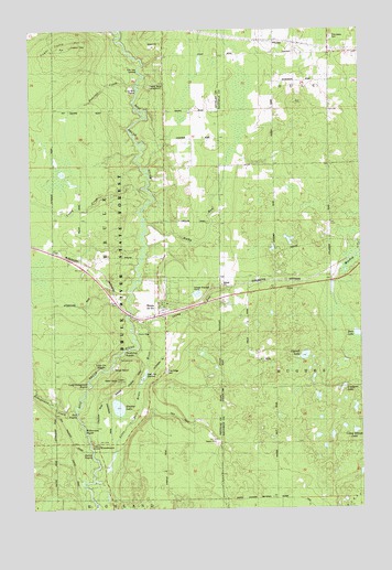
Brule, WI USGS Topographic Map
Click on map above to begin viewing in our Map Viewer.

This topographic map contains these locations and features:
Feature Name Type Latitude Longitude GNIS ID View Map
Bass LakeLakeN46.5455°W91.5017°1561278View Map
BrulePopulated PlaceN46.5530°W91.5766°1562290View Map
Brule Census Designated PlaceCensusN46.5589°W91.5708°2586460View Map
Brule Post OfficePost OfficeN46.5504°W91.5758°2768069View Map
Brule Volunteer Fire DepartmentBuildingN46.5554°W91.5762°2696878View Map
Camp Eleven LakeLakeN46.5201°W91.5027°1577908View Map
Carroll LakeLakeN46.5399°W91.5217°1562744View Map
Casey CreekStreamN46.5808°W91.5805°1562769View Map
Co-op Park RapidsRapidsN46.6099°W91.5841°1577907View Map
Copper Range CampgroundLocaleN46.6088°W91.5816°1577906View Map
Doodlebug RapidsRapidsN46.5413°W91.5899°1577911View Map
Hall RapidsRapidsN46.5244°W91.6077°1578173View Map
Hoodoo LakeLakeN46.5265°W91.5926°1566662View Map
Lindgren LakeLakeN46.5315°W91.5070°1568138View Map
Little Bois Brule RiverStreamN46.5511°W91.5894°1568204View Map
Little Joe RapidsRapidsN46.5366°W91.5994°1577912View Map
Long Nebagamon RapidsRapidsN46.5311°W91.6049°1577913View Map
Nebagamon CreekStreamN46.5277°W91.6094°1570126View Map
Oulu TownhallBuildingN46.6188°W91.5255°1834258View Map
Percival CreekStreamN46.6119°W91.5863°1571219View Map
Pine Glade CemeteryCemeteryN46.6228°W91.5101°1571445View Map
Pine Ridge CemeteryCemeteryN46.5360°W91.5740°1571515View Map
Pine Tree LandingLocaleN46.6155°W91.5819°1577909View Map
Rocky RunStreamN46.5747°W91.5827°1572511View Map
Sandy RunStreamN46.5483°W91.5827°1573723View Map
Station RapidsRapidsN46.5133°W91.6019°1578171View Map
Sugar Camp HillSummitN46.6208°W91.6116°1575017View Map
Town of BruleCivilN46.5816°W91.6067°1582879View Map
Williamson RapidsRapidsN46.5208°W91.6055°1578085View Map
WillsPopulated PlaceN46.5391°W91.5394°1577887View Map
WinneboujouPopulated PlaceN46.5174°W91.6010°1577890View Map
Wisconsin State Fish HatcheryLocaleN46.5352°W91.5821°1577910View Map

Note: Coordinates in the location and feature list above are referenced to NAD83 datum.


Copyright (C) 2008-2025 Ryan Niemi / Sunset Dynamics ... All Rights Reserved