TopoQuest Logo
Do you find TopoQuest useful?
Help keep TopoQuest running and adding new maps/features by donating!
Bitcoin:  19c7KJd3qBynnjoSw5npx9KScwjBe4ifkT
Litecoin:  LXs6TkuXGGXo1vDsWCkWVdjQX94eUKd6ui
Home View Maps Find Maps Find Places Resources & Links


Bruning, Nebraska Topographic Map

USGS Map Title: Bruning, NE
USGS Map MRC: 40097C5
DRG (GeoTIFF) Download: o40097c5.tif


Neighboring USGS Topographic Map Quads:


  Shickley, NE  
40097D6
 

  Strang, NE  
40097D5
 

  Ohiowa, NE  
40097D4
 

  Carleton, NE  
40097C6
 

  Bruning, NE  
40097C5
 

  Tobias SW, NE  
40097C4
 

  Deshler, NE  
40097B6
 

  Hebron, NE  
40097B5
 

  Alexandria, NE  
40097B4


Map MRC Location:

N41°
W98°
N41°
W97°
H8 H7 H6 H5 H4 H3 H2 H1
G8 G7 G6 G5 G4 G3 G2 G1
F8 F7 F6 F5 F4 F3 F2 F1
E8 E7 E6 E5 E4 E3 E2 E1
D8 D7 D6 D5 D4 D3 D2 D1
C8 C7 C6 C5 C4 C3 C2 C1
B8 B7 B6 B5 B4 B3 B2 B1
A8 A7 A6 A5 A4 A3 A2 A1
N40°
W98°
N40°
W97°

Bruning, NE USGS 1:24K Topographic Map Preview:
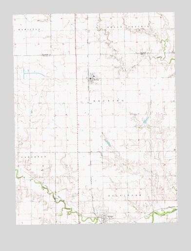
Bruning, NE USGS Topographic Map
Click on map above to begin viewing in our Map Viewer.

This topographic map contains these locations and features:
Feature Name Type Latitude Longitude GNIS ID View Map
BelvidereLocaleN40.2522°W97.5573°1883078View Map
BelviderePopulated PlaceN40.2519°W97.5578°827316View Map
Belvidere Election Precinct (historical)CivilN40.2539°W97.5325°1928722View Map
Belvidere Post OfficePost OfficeN40.2519°W97.5578°1883077View Map
Belvidere Public School (historical)SchoolN40.2553°W97.5584°1882909View Map
Belvidere Rural Fire DepartmentBuildingN40.2522°W97.5582°2553458View Map
BruningPopulated PlaceN40.3361°W97.5659°827706View Map
BruningLocaleN40.3361°W97.5675°1883074View Map
Bruning Dam CampgroundLocaleN40.3486°W97.5100°1882971View Map
Bruning Election PrecinctCivilN40.2925°W97.5717°1928758View Map
Bruning Grain and Feed Company ElevatorLocaleN40.3361°W97.5659°1883073View Map
Bruning Grain and Feed Company ElevatorLocaleN40.2519°W97.5578°1883075View Map
Bruning Medical ClinicHospitalN40.3361°W97.5659°1883072View Map
Bruning Post OfficePost OfficeN40.3364°W97.5658°1883071View Map
Bruning Public LibraryBuildingN40.3361°W97.5659°1883068View Map
Bruning Public SchoolsSchoolN40.3378°W97.5634°1882961View Map
Bruning Volunteer Fire and RescueBuildingN40.3353°W97.5659°2553442View Map
East Ward School (historical)SchoolN40.3356°W97.5170°1882895View Map
Forty-Niner Trail Historical MarkerParkN40.2519°W97.5578°1883086View Map
Hinrichs DamDamN40.2967°W97.5520°1769390View Map
Hinrichs ReservoirReservoirN40.2973°W97.5528°1769391View Map
Keim CemeteryCemeteryN40.3222°W97.6036°830451View Map
Lahners School (historical)SchoolN40.2922°W97.5575°1882897View Map
Nedza School (historical)SchoolN40.2772°W97.5017°1882898View Map
Pickett School (historical)SchoolN40.3083°W97.5212°1882896View Map
Prairie Marsh State Wildlife Management AreaParkN40.3417°W97.6170°1882974View Map
Prairie Star School (historical)SchoolN40.3364°W97.5475°1882894View Map
Thayer County MuseumBuildingN40.2519°W97.5578°1883076View Map
Town Four School (historical)SchoolN40.2772°W97.5387°1882893View Map
Township of BelvidereCivilN40.2583°W97.5337°1883047View Map
Township of BruningCivilN40.3000°W97.5337°1882946View Map
Trinity Lutheran ChurchChurchN40.3361°W97.5659°1883070View Map
Trinity Lutheran Parochial School (historical)SchoolN40.3333°W97.5642°1882953View Map
United Methodist ChurchChurchN40.3361°W97.5659°1883069View Map
Village of BelvidereCivilN40.2546°W97.5577°2398091View Map
Village of BruningCivilN40.3357°W97.5647°2397476View Map
West Ward School (historical)SchoolN40.3222°W97.6128°1882891View Map
Wilkening School (historical)SchoolN40.2847°W97.5937°1882892View Map

Note: Coordinates in the location and feature list above are referenced to NAD83 datum.


Copyright (C) 2008-2024 Ryan Niemi / Sunset Dynamics ... All Rights Reserved