TopoQuest Logo
Do you find TopoQuest useful?
Help keep TopoQuest running and adding new maps/features by donating!
Bitcoin:  19c7KJd3qBynnjoSw5npx9KScwjBe4ifkT
Litecoin:  LXs6TkuXGGXo1vDsWCkWVdjQX94eUKd6ui
Home View Maps Find Maps Find Places Resources & Links


Tobias SW, Nebraska Topographic Map

USGS Map Title: Tobias SW, NE
USGS Map MRC: 40097C4
DRG (GeoTIFF) Download: o40097c4.tif


Neighboring USGS Topographic Map Quads:


  Strang, NE  
40097D5
 

  Ohiowa, NE  
40097D4
 

  Tobias, NE  
40097D3
 

  Bruning, NE  
40097C5
 

  Tobias SW, NE  
40097C4
 

  Daykin, NE  
40097C3
 

  Hebron, NE  
40097B5
 

  Alexandria, NE  
40097B4
 

  Gladstone, NE  
40097B3


Map MRC Location:

N41°
W98°
N41°
W97°
H8 H7 H6 H5 H4 H3 H2 H1
G8 G7 G6 G5 G4 G3 G2 G1
F8 F7 F6 F5 F4 F3 F2 F1
E8 E7 E6 E5 E4 E3 E2 E1
D8 D7 D6 D5 D4 D3 D2 D1
C8 C7 C6 C5 C4 C3 C2 C1
B8 B7 B6 B5 B4 B3 B2 B1
A8 A7 A6 A5 A4 A3 A2 A1
N40°
W98°
N40°
W97°

Tobias SW, NE USGS 1:24K Topographic Map Preview:
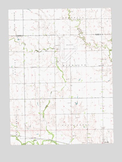
Tobias SW, NE USGS Topographic Map
Click on map above to begin viewing in our Map Viewer.

This topographic map contains these locations and features:
Feature Name Type Latitude Longitude GNIS ID View Map
Antioch CemeteryCemeteryN40.3511°W97.4450°827025View Map
Bruning Army Air Base (historical)MilitaryN40.3403°W97.4283°2090303View Map
Bruning Army Air Field Historical MarkerParkN40.3217°W97.4350°1882882View Map
Dry Sandy CreekStreamN40.2522°W97.4498°828848View Map
Excelsior School (historical)SchoolN40.3278°W97.4253°1882902View Map
Franklin CemeteryCemeteryN40.3653°W97.4428°829388View Map
Hawks Field (historical)AirportN40.3178°W97.4942°837507View Map
Highland-Alexandria Election Precinct (historical)CivilN40.2781°W97.4250°1928963View Map
Kerwood DamDamN40.3161°W97.3819°1770174View Map
Kerwood ReservoirReservoirN40.3150°W97.3827°1770175View Map
Medlar School (historical)SchoolN40.3506°W97.4725°1882899View Map
Mid - America Feed YardLocaleN40.3328°W97.4269°2581910View Map
Olive Branch School (historical)SchoolN40.2856°W97.4262°1882903View Map
Pleasant Plain CemeteryCemeteryN40.3217°W97.4742°832206View Map
Pleasant Plain School (historical)SchoolN40.3217°W97.4809°1882900View Map
School Number 21SchoolN40.3217°W97.3875°836385View Map
Sieber DamDamN40.3735°W97.4728°1766815View Map
Sieber ReservoirLakeN40.3748°W97.4761°1766816View Map
Square Top School (historical)SchoolN40.2889°W97.4637°1882901View Map
Township of HighlandCivilN40.3167°W97.4170°1882937View Map
Walnut CreekStreamN40.3353°W97.3767°834446View Map
Yoachim School (historical)SchoolN40.2556°W97.4587°1882913View Map

Note: Coordinates in the location and feature list above are referenced to NAD83 datum.


Copyright (C) 2008-2024 Ryan Niemi / Sunset Dynamics ... All Rights Reserved