TopoQuest Logo
Do you find TopoQuest useful?
Help keep TopoQuest running and adding new maps/features by donating!
Bitcoin:  19c7KJd3qBynnjoSw5npx9KScwjBe4ifkT
Litecoin:  LXs6TkuXGGXo1vDsWCkWVdjQX94eUKd6ui
Home View Maps Find Maps Find Places Resources & Links


Bruno, Oklahoma Topographic Map

USGS Map Title: Bruno, OK
USGS Map MRC: 34096C1
DRG (GeoTIFF) Download: o34096c1.tif


Neighboring USGS Topographic Map Quads:


  Lehigh, OK  
34096D2
 

  Stringtown, OK  
34096D1
 

  Lane NW, OK  
34095D8
 

  Tushka, OK  
34096C2
 

  Bruno, OK  
34096C1
 

  Lane, OK  
34095C8
 

  Caney, OK  
34096B2
 

  Bentley, OK  
34096B1
 

  Boswell NW, OK  
34095B8


Map MRC Location:

N35°
W97°
N35°
W96°
H8 H7 H6 H5 H4 H3 H2 H1
G8 G7 G6 G5 G4 G3 G2 G1
F8 F7 F6 F5 F4 F3 F2 F1
E8 E7 E6 E5 E4 E3 E2 E1
D8 D7 D6 D5 D4 D3 D2 D1
C8 C7 C6 C5 C4 C3 C2 C1
B8 B7 B6 B5 B4 B3 B2 B1
A8 A7 A6 A5 A4 A3 A2 A1
N34°
W97°
N34°
W96°

Bruno, OK USGS 1:24K Topographic Map Preview:
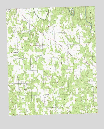
Bruno, OK USGS Topographic Map
Click on map above to begin viewing in our Map Viewer.

This topographic map contains these locations and features:
Feature Name Type Latitude Longitude GNIS ID View Map
Atoka CountyCivilN34.3737°W96.0378°1101790View Map
Bera CemeteryCemeteryN34.3147°W96.0753°2701784View Map
Bethany CemeteryCemeteryN34.2873°W96.1164°1090024View Map
Bethany SchoolSchoolN34.2879°W96.1200°1090031View Map
Blackjack SchoolSchoolN34.2734°W96.0733°1090234View Map
BrunoPopulated PlaceN34.3443°W96.0753°1100240View Map
Buffalo ChurchChurchN34.3315°W96.0558°1090635View Map
Buffalo Creek CemeteryCemeteryN34.3314°W96.0561°2704465View Map
East Branch Caney CreekStreamN34.2637°W96.0597°1092364View Map
Faith TabernacleChurchN34.3731°W96.1092°1092746View Map
Farris Volunteer Fire DepartmentBuildingN34.3671°W96.1029°2657247View Map
Forest Hill SchoolSchoolN34.3237°W96.1105°1092940View Map
General Assembly ChurchChurchN34.2879°W96.1100°1093158View Map
Half Bank CrossingPopulated PlaceN34.3531°W96.0055°1100471View Map
Harmony CemeteryCemeteryN34.3311°W96.0814°2704469View Map
Harmony Elementary SchoolSchoolN34.3171°W96.0744°1093553View Map
Harmony Fire DepartmentBuildingN34.3170°W96.0759°2657246View Map
Lane Fire DistrictBuildingN34.3057°W96.0060°2657325View Map
Little Rock CreekStreamN34.3312°W96.0128°1094816View Map
New Zion CemeteryCemeteryN34.3164°W96.1136°2701790View Map
New Zion ChurchChurchN34.3162°W96.1136°1095847View Map
Rock CreekStreamN34.3440°W96.0030°1097280View Map
Sand CreekStreamN34.3626°W96.0767°1097731View Map
Scratch HillSummitN34.3693°W96.1150°1097890View Map
Tumbler CreekStreamN34.3473°W96.0919°1098879View Map
Vera ChurchChurchN34.3143°W96.0750°1099240View Map
West Sand CreekStreamN34.3493°W96.0880°1099602View Map

Note: Coordinates in the location and feature list above are referenced to NAD83 datum.


Copyright (C) 2008-2025 Ryan Niemi / Sunset Dynamics ... All Rights Reserved