TopoQuest Logo
Do you find TopoQuest useful?
Help keep TopoQuest running and adding new maps/features by donating!
Bitcoin:  19c7KJd3qBynnjoSw5npx9KScwjBe4ifkT
Litecoin:  LXs6TkuXGGXo1vDsWCkWVdjQX94eUKd6ui
Home View Maps Find Maps Find Places Resources & Links


Boswell NW, Oklahoma Topographic Map

USGS Map Title: Boswell NW, OK
USGS Map MRC: 34095B8
DRG (GeoTIFF) Download: o34095b8.tif


Neighboring USGS Topographic Map Quads:


  Bruno, OK  
34096C1
 

  Lane, OK  
34095C8
 

  Farris, OK  
34095C7
 

  Bentley, OK  
34096B1
 

  Boswell NW, OK  
34095B8
 

  Darwin, OK  
34095B7
 

  Bennington North, OK  
34096A1
 

  Boswell SW, OK  
34095A8
 

  Boswell, OK  
34095A7


Map MRC Location:

N35°
W96°
N35°
W95°
H8 H7 H6 H5 H4 H3 H2 H1
G8 G7 G6 G5 G4 G3 G2 G1
F8 F7 F6 F5 F4 F3 F2 F1
E8 E7 E6 E5 E4 E3 E2 E1
D8 D7 D6 D5 D4 D3 D2 D1
C8 C7 C6 C5 C4 C3 C2 C1
B8 B7 B6 B5 B4 B3 B2 B1
A8 A7 A6 A5 A4 A3 A2 A1
N34°
W96°
N34°
W95°

Boswell NW, OK USGS 1:24K Topographic Map Preview:
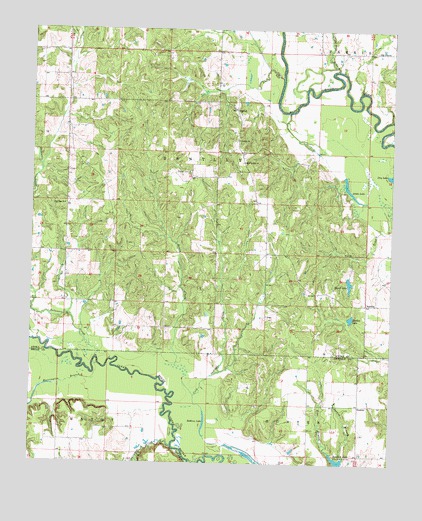
Boswell NW, OK USGS Topographic Map
Click on map above to begin viewing in our Map Viewer.

This topographic map contains these locations and features:
Feature Name Type Latitude Longitude GNIS ID View Map
Atoka LakeLakeN34.2018°W95.8880°1089747View Map
BoehlerPopulated PlaceN34.1709°W95.8836°1100219View Map
Boehler LakeLakeN34.1671°W95.8891°1090327View Map
Crab Tree BranchStreamN34.2387°W95.8947°1091798View Map
CrystalPopulated PlaceN34.2268°W95.9303°1100337View Map
Crystal CemeteryCemeteryN34.2087°W95.9461°1091875View Map
Crystal ChurchChurchN34.2182°W95.9291°1091876View Map
Crystal Volunteer Fire DepartmentBuildingN34.2288°W95.9292°2657248View Map
Delaware CreekStreamN34.1548°W95.9769°1092031View Map
Dobbins LakeLakeN34.1370°W95.9391°1092109View Map
Farris CemeteryCemeteryN34.2441°W95.8817°2701786View Map
Harrington BranchStreamN34.1507°W95.9780°1093565View Map
Hasell LakeLakeN34.1771°W95.8897°1093590View Map
Myrtle Day ChurchChurchN34.2118°W95.9272°1095735View Map
Newkirk LakeReservoirN34.1253°W95.8926°1095860View Map
Oknoname 023002 DamDamN34.2068°W95.9003°1751760View Map
Oknoname 023002 ReservoirReservoirN34.2068°W95.9003°1751761View Map
Old FarrisPopulated PlaceN34.2440°W95.8753°1100694View Map
Pine Pole ChurchChurchN34.1993°W95.9892°1096670View Map
Sandy CreekStreamN34.1532°W95.9494°1097799View Map
Shawnee CreekStreamN34.1298°W95.9508°1097969View Map
Spring BranchStreamN34.1268°W95.8908°1098368View Map
SunkistPopulated PlaceN34.1420°W95.8861°1100864View Map

Note: Coordinates in the location and feature list above are referenced to NAD83 datum.


Copyright (C) 2008-2025 Ryan Niemi / Sunset Dynamics ... All Rights Reserved