TopoQuest Logo
Do you find TopoQuest useful?
Help keep TopoQuest running and adding new maps/features by donating!
Bitcoin:  19c7KJd3qBynnjoSw5npx9KScwjBe4ifkT
Litecoin:  LXs6TkuXGGXo1vDsWCkWVdjQX94eUKd6ui
Home View Maps Find Maps Find Places Resources & Links


Buckeye Valley, Nebraska Topographic Map

USGS Map Title: Buckeye Valley, NE
USGS Map MRC: 40098G8
DRG (GeoTIFF) Download: o40098g8.tif


Neighboring USGS Topographic Map Quads:


  Pleasanton, NE  
40099H1
 

  Poole, NE  
40098H8
 

  Poole NE, NE  
40098H7
 

  Pleasanton SE, NE  
40099G1
 

  Buckeye Valley, NE  
40098G8
 

  Gibbon North, NE  
40098G7
 

  Kearney, NE  
40099F1
 

  Newark, NE  
40098F8
 

  Gibbon South, NE  
40098F7


Map MRC Location:

N41°
W99°
N41°
W98°
H8 H7 H6 H5 H4 H3 H2 H1
G8 G7 G6 G5 G4 G3 G2 G1
F8 F7 F6 F5 F4 F3 F2 F1
E8 E7 E6 E5 E4 E3 E2 E1
D8 D7 D6 D5 D4 D3 D2 D1
C8 C7 C6 C5 C4 C3 C2 C1
B8 B7 B6 B5 B4 B3 B2 B1
A8 A7 A6 A5 A4 A3 A2 A1
N40°
W99°
N40°
W98°

Buckeye Valley, NE USGS 1:24K Topographic Map Preview:
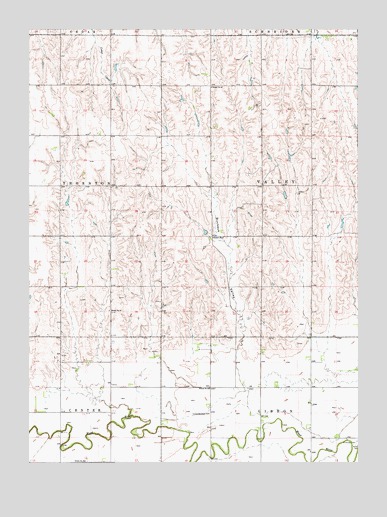
Buckeye Valley, NE USGS Topographic Map
Click on map above to begin viewing in our Map Viewer.

This topographic map contains these locations and features:
Feature Name Type Latitude Longitude GNIS ID View Map
Buckeye ValleyValleyN40.7839°W98.9190°827734View Map
Center Public SchoolSchoolN40.7503°W98.9787°836504View Map
Dry CreekStreamN40.7589°W98.9998°828808View Map
Election Precinct 21CivilN40.7779°W98.8825°2784116View Map
Lewis FeedlotLocaleN40.7597°W98.9542°2581906View Map
Nebraska Center Post Office (historical)Post OfficeN40.7639°W98.9698°1875106View Map
Randall DamDamN40.7867°W98.9387°1767318View Map
Randall Dam-1 DamDamN40.8167°W98.9337°1767656View Map
Randall ReservoirReservoirN40.7866°W98.9383°1767319View Map
Randall ReservoirReservoirN40.8162°W98.9332°1767657View Map
Riverside CemeteryCemeteryN40.7558°W98.8759°832576View Map
Rogers DamDamN40.8267°W98.9020°1767902View Map
Rogers ReservoirReservoirN40.8278°W98.9034°1767903View Map
School Number 25 (historical)SchoolN40.7714°W98.9315°836457View Map
School Number 34 (historical)SchoolN40.7936°W98.9698°836606View Map
School Number 49SchoolN40.8581°W98.9312°836791View Map
School Number 97SchoolN40.8147°W98.9306°837211View Map
Township of Valley (historical)CivilN40.8296°W98.8930°838301View Map
United Brethren ChurchChurchN40.7639°W98.9317°834289View Map

Note: Coordinates in the location and feature list above are referenced to NAD83 datum.


Copyright (C) 2008-2025 Ryan Niemi / Sunset Dynamics ... All Rights Reserved