TopoQuest Logo
Do you find TopoQuest useful?
Help keep TopoQuest running and adding new maps/features by donating!
Bitcoin:  19c7KJd3qBynnjoSw5npx9KScwjBe4ifkT
Litecoin:  LXs6TkuXGGXo1vDsWCkWVdjQX94eUKd6ui
Home View Maps Find Maps Find Places Resources & Links


Buckhorn Mountain, Colorado Topographic Map

USGS Map Title: Buckhorn Mountain, CO
USGS Map MRC: 40105E3
DRG (GeoTIFF) Download: o40105e3.tif


Neighboring USGS Topographic Map Quads:


  Big Narrows, CO  
40105F4
 

  Poudre Park, CO  
40105F3
 

  Laporte, CO  
40105F2
 

  Crystal Mountain, CO  
40105E4
 

  Buckhorn Mountain, CO  
40105E3
 

  Horsetooth Reservoir, CO  
40105E2
 

  Glen Haven, CO  
40105D4
 

  Drake, CO  
40105D3
 

  Masonville, CO  
40105D2


Map MRC Location:

N41°
W106°
N41°
W105°
H8 H7 H6 H5 H4 H3 H2 H1
G8 G7 G6 G5 G4 G3 G2 G1
F8 F7 F6 F5 F4 F3 F2 F1
E8 E7 E6 E5 E4 E3 E2 E1
D8 D7 D6 D5 D4 D3 D2 D1
C8 C7 C6 C5 C4 C3 C2 C1
B8 B7 B6 B5 B4 B3 B2 B1
A8 A7 A6 A5 A4 A3 A2 A1
N40°
W106°
N40°
W105°

Buckhorn Mountain, CO USGS 1:24K Topographic Map Preview:
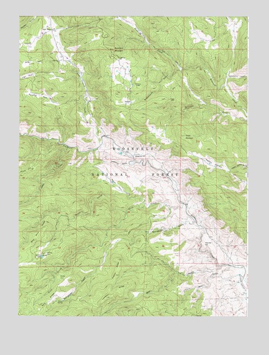
Buckhorn Mountain, CO USGS Topographic Map
Click on map above to begin viewing in our Map Viewer.

This topographic map contains these locations and features:
Feature Name Type Latitude Longitude GNIS ID View Map
Bear GulchValleyN40.5214°W105.2649°177352View Map
Blackhurst GulchValleyN40.6028°W105.2873°177368View Map
Buckhorn Canyon CampgroundLocaleN40.5728°W105.3430°197721View Map
Buckhorn LodgeLocaleN40.5966°W105.3114°177358View Map
Buckhorn Mica MineMineN40.5419°W105.3717°1683502View Map
Buckhorn MountainSummitN40.6111°W105.3242°177357View Map
Charles C Green GraveCemeteryN40.6010°W105.3657°2036953View Map
Christ MountainSummitN40.5755°W105.2850°177369View Map
Deadman GulchValleyN40.5670°W105.3128°177362View Map
Deadman HillSummitN40.5661°W105.3069°177361View Map
Fiddler RidgeRidgeN40.5175°W105.3250°177364View Map
Fish CreekStreamN40.5444°W105.2855°177354View Map
Fletcher HillSummitN40.5294°W105.2742°177363View Map
Happy HollowValleyN40.5611°W105.2593°177360View Map
Hyatt HillSummitN40.5161°W105.3528°177347View Map
Kirchner DitchCanalN40.5161°W105.2520°2723092View Map
Lampton RidgeRidgeN40.5080°W105.3269°177365View Map
Lass Family CemeteryCemeteryN40.6060°W105.3208°2036962View Map
Little Bear GulchValleyN40.5211°W105.2596°177351View Map
Martin Family CemeteryCemeteryN40.5539°W105.3091°2036969View Map
Mica Mine RidgeRidgeN40.5316°W105.3664°177367View Map
Moody HillSummitN40.5614°W105.3686°202455View Map
Moody ParkFlatN40.5572°W105.3214°177359View Map
North Fork Fish CreekStreamN40.5466°W105.3055°177343View Map
Paradise ParkFlatN40.5916°W105.3644°177346View Map
Parks HillSummitN40.5264°W105.3603°177366View Map
Pittington Family CemeteryCemeteryN40.5904°W105.2758°2036940View Map
Ralph Darby GraveCemeteryN40.5597°W105.2936°2036949View Map
Raspberry GulchValleyN40.6001°W105.2614°177374View Map
Rist Canyon Volunteer Fire Department Station 3 Stove PrairieBuildingN40.6198°W105.3481°2667236View Map
Rist Canyon Volunteer Fire Department Station 5 BuckhornBuildingN40.5759°W105.3294°2667238View Map
Sheep CreekStreamN40.5708°W105.3483°177344View Map
Stove Prairie CreekStreamN40.5711°W105.3303°177356View Map
Stove Prairie SchoolSchoolN40.6197°W105.3576°177349View Map
Stringtown GulchValleyN40.5390°W105.2787°177353View Map
Thomson CemeteryCemeteryN40.5950°W105.3266°2036915View Map
Vannorsdel Family CemeteryCemeteryN40.6153°W105.3561°2036918View Map

Note: Coordinates in the location and feature list above are referenced to NAD83 datum.


Copyright (C) 2008-2024 Ryan Niemi / Sunset Dynamics ... All Rights Reserved