TopoQuest Logo
Do you find TopoQuest useful?
Help keep TopoQuest running and adding new maps/features by donating!
Bitcoin:  19c7KJd3qBynnjoSw5npx9KScwjBe4ifkT
Litecoin:  LXs6TkuXGGXo1vDsWCkWVdjQX94eUKd6ui
Home View Maps Find Maps Find Places Resources & Links


Drake, Colorado Topographic Map

USGS Map Title: Drake, CO
USGS Map MRC: 40105D3
DRG (GeoTIFF) Download: o40105d3.tif


Neighboring USGS Topographic Map Quads:


  Crystal Mountain, CO  
40105E4
 

  Buckhorn Mountain, CO  
40105E3
 

  Horsetooth Reservoir, CO  
40105E2
 

  Glen Haven, CO  
40105D4
 

  Drake, CO  
40105D3
 

  Masonville, CO  
40105D2
 

  Panorama Peak, CO  
40105C4
 

  Pinewood Lake, CO  
40105C3
 

  Carter Lake Reservoir, CO  
40105C2


Map MRC Location:

N41°
W106°
N41°
W105°
H8 H7 H6 H5 H4 H3 H2 H1
G8 G7 G6 G5 G4 G3 G2 G1
F8 F7 F6 F5 F4 F3 F2 F1
E8 E7 E6 E5 E4 E3 E2 E1
D8 D7 D6 D5 D4 D3 D2 D1
C8 C7 C6 C5 C4 C3 C2 C1
B8 B7 B6 B5 B4 B3 B2 B1
A8 A7 A6 A5 A4 A3 A2 A1
N40°
W106°
N40°
W105°

Drake, CO USGS 1:24K Topographic Map Preview:
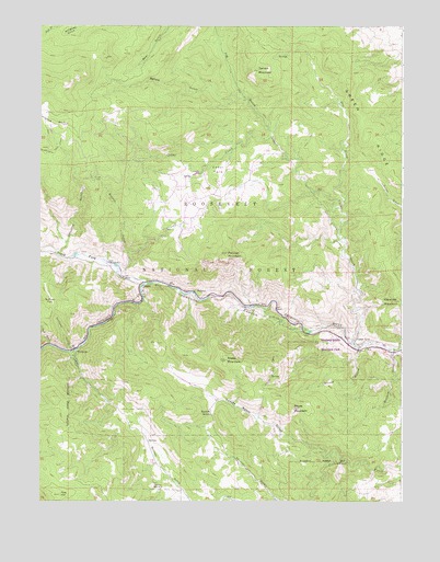
Drake, CO USGS Topographic Map
Click on map above to begin viewing in our Map Viewer.

This topographic map contains these locations and features:
Feature Name Type Latitude Longitude GNIS ID View Map
Alexander MountainSummitN40.4275°W105.2514°202488View Map
Bald RidgeRidgeN40.4994°W105.3678°202459View Map
Big Thompson Canyon Volunteer Fire DepartmentBuildingN40.4290°W105.3183°2667280View Map
Bobcat GulchValleyN40.4352°W105.3466°177658View Map
Cedar CovePopulated PlaceN40.4158°W105.2655°177665View Map
Cedar CreekStreamN40.4158°W105.2667°177659View Map
Cedar ParkFlatN40.4625°W105.3144°177653View Map
Cedar Springs DamDamN40.4616°W105.3205°200838View Map
Cedar Springs ReservoirReservoirN40.4614°W105.3212°200839View Map
Colorado State Fish HatcheryLocaleN40.4372°W105.3497°197757View Map
Dickson GulchValleyN40.4144°W105.2533°177672View Map
DrakePopulated PlaceN40.4319°W105.3403°177661View Map
Drake Fire Department Cedar Cove StationBuildingN40.4147°W105.2647°2666987View Map
Drake Post OfficePost OfficeN40.4327°W105.3396°2759189View Map
Dry CreekStreamN40.4519°W105.2714°177656View Map
Fire Station 9BuildingN40.4503°W105.3303°2667022View Map
Galuchie GulchValleyN40.4401°W105.3684°177655View Map
Galuchie ParkFlatN40.4750°W105.3728°202486View Map
Green RidgeRidgeN40.4722°W105.2628°202457View Map
Grouse HollowValleyN40.4150°W105.2654°177671View Map
Hide-a-way ClaimMineN40.4839°W105.3717°1683558View Map
Hilltop Number Three ClaimsMineN40.4841°W105.3667°1683559View Map
Hyatt MineMineN40.4600°W105.3567°177651View Map
Idylwilde DamDamN40.4300°W105.3122°200844View Map
Idylwilde ReservoirReservoirN40.4300°W105.3122°200845View Map
Jug GulchValleyN40.4713°W105.2955°177350View Map
Jug TrailTrailN40.4805°W105.3036°202458View Map
Loveland Mountain ParkParkN40.4167°W105.2755°177667View Map
Loveland PowerplantLocaleN40.4200°W105.2836°177660View Map
MidwayPopulated PlaceN40.4303°W105.3228°177662View Map
North Fork Big Thompson RiverStreamN40.4325°W105.3389°177650View Map
Palisade MountainSummitN40.4403°W105.3111°177657View Map
Pole HillSummitN40.3767°W105.3683°177675View Map
Quillan GulchValleyN40.3758°W105.2940°177676View Map
Round Mountain TrailTrailN40.4133°W105.2922°177666View Map
Round Mountain TrailheadLocaleN40.4186°W105.3025°197758View Map
Saddle NotchGapN40.3980°W105.3158°177674View Map
Saddle Notch GulchValleyN40.3871°W105.2748°177673View Map
Sheep MountainSummitN40.4122°W105.3108°177669View Map
Spruce GulchValleyN40.4812°W105.3046°177652View Map
Spruce MountainSummitN40.4883°W105.3003°177654View Map
Stone MountainSummitN40.3992°W105.2875°204947View Map
Sullivan GulchValleyN40.4146°W105.3653°177664View Map
Sullivan ParkFlatN40.4286°W105.3717°177663View Map
True GulchValleyN40.4163°W105.3723°177648View Map
Veterans Memorial ParkParkN40.3792°W105.3344°177668View Map
WaltoniaPopulated PlaceN40.4139°W105.3630°177670View Map

Note: Coordinates in the location and feature list above are referenced to NAD83 datum.


Copyright (C) 2008-2024 Ryan Niemi / Sunset Dynamics ... All Rights Reserved