TopoQuest Logo
Do you find TopoQuest useful?
Help keep TopoQuest running and adding new maps/features by donating!
Bitcoin:  19c7KJd3qBynnjoSw5npx9KScwjBe4ifkT
Litecoin:  LXs6TkuXGGXo1vDsWCkWVdjQX94eUKd6ui
Home View Maps Find Maps Find Places Resources & Links


Masonville, Colorado Topographic Map

USGS Map Title: Masonville, CO
USGS Map MRC: 40105D2
DRG (GeoTIFF) Download: o40105d2.tif


Neighboring USGS Topographic Map Quads:


  Buckhorn Mountain, CO  
40105E3
 

  Horsetooth Reservoir, CO  
40105E2
 

  Fort Collins, CO  
40105E1
 

  Drake, CO  
40105D3
 

  Masonville, CO  
40105D2
 

  Loveland, CO  
40105D1
 

  Pinewood Lake, CO  
40105C3
 

  Carter Lake Reservoir, CO  
40105C2
 

  Berthoud, CO  
40105C1


Map MRC Location:

N41°
W106°
N41°
W105°
H8 H7 H6 H5 H4 H3 H2 H1
G8 G7 G6 G5 G4 G3 G2 G1
F8 F7 F6 F5 F4 F3 F2 F1
E8 E7 E6 E5 E4 E3 E2 E1
D8 D7 D6 D5 D4 D3 D2 D1
C8 C7 C6 C5 C4 C3 C2 C1
B8 B7 B6 B5 B4 B3 B2 B1
A8 A7 A6 A5 A4 A3 A2 A1
N40°
W106°
N40°
W105°

Masonville, CO USGS 1:24K Topographic Map Preview:
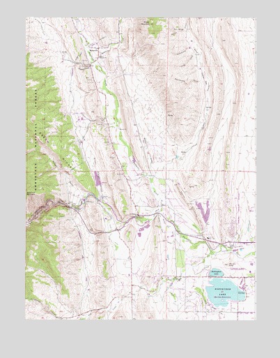
Masonville, CO USGS Topographic Map
Click on map above to begin viewing in our Map Viewer.

This topographic map contains these locations and features:
Feature Name Type Latitude Longitude GNIS ID View Map
Big Thompson CanyonValleyN40.4212°W105.2246°177649View Map
Big Thompson Elementary SchoolSchoolN40.4184°W105.1889°177693View Map
Big Thompson Power PlantLocaleN40.4211°W105.2233°177697View Map
Big Thompson SiphonCanalN40.4208°W105.2264°177698View Map
Boedecker LakeReservoirN40.3850°W105.1308°177704View Map
Boothroyd - Hutchinson CemeteryCemeteryN40.4198°W105.2091°2036977View Map
Buckhorn CreekStreamN40.4208°W105.1753°177345View Map
Buckhorn MineMineN40.4861°W105.2242°1683561View Map
Buckhorn Presbyterian ChurchChurchN40.4833°W105.2111°177686View Map
Buckingham LakeReservoirN40.3933°W105.1428°177703View Map
Buffman CanyonValleyN40.4799°W105.2152°177687View Map
Calvary United Reformed ChurchChurchN40.3789°W105.1316°2057453View Map
Carter Family CemeteryCemeteryN40.4539°W105.2061°2036943View Map
Carter Tunnel MineMineN40.4989°W105.2189°1683562View Map
Chance Family CemeteryCemeteryN40.4605°W105.2086°2036944View Map
Charles Hansen Feeder CanalCanalN40.4750°W105.2255°202460View Map
Colorado Stone Company PitMineN40.4869°W105.2108°1683563View Map
Devils BackboneRidgeN40.4208°W105.1597°177691View Map
Dille TunnelTunnelN40.4178°W105.2339°177701View Map
Dogtown FlatsFlatN40.4750°W105.1533°177680View Map
Dry CreekStreamN40.4022°W105.1478°177705View Map
Eden Valley Resthaven CemeteryCemeteryN40.4608°W105.2308°2036950View Map
George Rist DamDamN40.3933°W105.1439°200324View Map
George Rist DitchCanalN40.3914°W105.1533°202490View Map
George Rist ReservoirReservoirN40.3946°W105.1464°200325View Map
Graveyard GulchValleyN40.4825°W105.1545°177683View Map
Green Ridge GladeValleyN40.4233°W105.2073°177694View Map
Horsetooth Supply CanalCanalN40.4428°W105.2194°2677364View Map
Indian CreekStreamN40.4325°W105.1822°177688View Map
Langston Family CemeteryCemeteryN40.4044°W105.1478°2036961View Map
Little DamPopulated PlaceN40.4222°W105.2228°177696View Map
Long DrawValleyN40.4820°W105.1564°177682View Map
Loveland DivisionCivilN40.4315°W105.1890°1935516View Map
Loveland Filtration PlantLocaleN40.4258°W105.2089°177695View Map
Loveland QuarryMineN40.4155°W105.1639°1683560View Map
Loveland Sandstone QuarryMineN40.4344°W105.1997°1683564View Map
Loveland Water Storage DamDamN40.4247°W105.2106°199670View Map
Loveland Water Storage ReservoirReservoirN40.4251°W105.2113°199671View Map
Loveland Water TanksLocaleN40.4092°W105.1511°177692View Map
Mariana ButteSummitN40.3980°W105.1403°177702View Map
Mariano DamDamN40.3850°W105.1322°198484View Map
Mariano ReservoirReservoirN40.3865°W105.1423°198485View Map
Mason Ranch MineMineN40.4997°W105.2255°1683565View Map
MasonvillePopulated PlaceN40.4875°W105.2108°204676View Map
Masonville CemeteryCemeteryN40.4547°W105.1980°2036931View Map
Masonville MineMineN40.4861°W105.2255°1683566View Map
Masonville Post OfficePost OfficeN40.4821°W105.2128°203935View Map
Milner GladeValleyN40.4346°W105.1801°177689View Map
Milner MountainSummitN40.4975°W105.1825°177685View Map
Mint QuarryMineN40.4583°W105.2200°1683567View Map
MYM PitMineN40.4214°W105.1544°1683568View Map
Pillar of HerculesPillarN40.4242°W105.2303°177700View Map
Rattlesnake GulchValleyN40.4724°W105.1520°177681View Map
Redstone CreekStreamN40.4772°W105.2083°177373View Map
Redstone QuarryMineN40.4869°W105.2108°1683569View Map
Rhodes Family CemeteryCemeteryN40.4836°W105.2106°2036942View Map
Sprague AirportAirportN40.4743°W105.2202°2443919View Map
Sulzer GulchValleyN40.4242°W105.2098°177679View Map
Sunrise Ranch CemeteryCemeteryN40.4441°W105.2122°2036910View Map
The KeyholeArchN40.4231°W105.1625°177690View Map
The NarrowsValleyN40.4214°W105.2255°177699View Map
Troupe QuarryMineN40.4869°W105.2108°1683570View Map
Twin SpringsSpringN40.4950°W105.1647°177684View Map
Victory Irrigation CanalCanalN40.4773°W105.2110°2724385View Map
Weaver QuarryMineN40.4869°W105.2108°1683571View Map
White QuarryMineN40.4869°W105.2108°1683572View Map

Note: Coordinates in the location and feature list above are referenced to NAD83 datum.


Copyright (C) 2008-2024 Ryan Niemi / Sunset Dynamics ... All Rights Reserved