TopoQuest Logo
Do you find TopoQuest useful?
Help keep TopoQuest running and adding new maps/features by donating!
Bitcoin:  19c7KJd3qBynnjoSw5npx9KScwjBe4ifkT
Litecoin:  LXs6TkuXGGXo1vDsWCkWVdjQX94eUKd6ui
Home View Maps Find Maps Find Places Resources & Links


Buckhorn Reservoir, Utah Topographic Map

USGS Map Title: Buckhorn Reservoir, UT
USGS Map MRC: 39110B7
DRG (GeoTIFF) Download: o39110b7.tif


Neighboring USGS Topographic Map Quads:


  Huntington, UT  
39110C8
 

  Cleveland, UT  
39110C7
 

  Cow Flats, UT  
39110C6
 

  Hadden Holes, UT  
39110B8
 

  Buckhorn Reservoir, UT  
39110B7
 

  Bob Hill Knoll, UT  
39110B6
 

  Horn Silver Gulch, UT  
39110A8
 

  Sids Mountain, UT  
39110A7
 

  Bottleneck Peak, UT  
39110A6


Map MRC Location:

N40°
W111°
N40°
W110°
H8 H7 H6 H5 H4 H3 H2 H1
G8 G7 G6 G5 G4 G3 G2 G1
F8 F7 F6 F5 F4 F3 F2 F1
E8 E7 E6 E5 E4 E3 E2 E1
D8 D7 D6 D5 D4 D3 D2 D1
C8 C7 C6 C5 C4 C3 C2 C1
B8 B7 B6 B5 B4 B3 B2 B1
A8 A7 A6 A5 A4 A3 A2 A1
N39°
W111°
N39°
W110°

Buckhorn Reservoir, UT USGS 1:24K Topographic Map Preview:
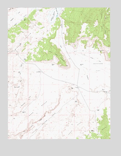
Buckhorn Reservoir, UT USGS Topographic Map
Click on map above to begin viewing in our Map Viewer.

This topographic map contains these locations and features:
Feature Name Type Latitude Longitude GNIS ID View Map
Blue PondLakeN39.1887°W110.8603°1425817View Map
Buckhorn DamDamN39.2416°W110.8124°1434735View Map
Buckhorn FlatFlatN39.1830°W110.7621°1426070View Map
Buckhorn ReservoirReservoirN39.2416°W110.8124°1434734View Map
Buckhorn ReservoirReservoirN39.2452°W110.8179°1426072View Map
Buckhorn WellWellN39.1741°W110.7899°1426076View Map
Bull Hollow WashValleyN39.2427°W110.8146°1426124View Map
Cat PondLakeN39.1746°W110.8684°1426405View Map
Chalk HillsSummitN39.1305°W110.7960°1426519View Map
Cloyds PondLakeN39.1524°W110.7671°1426732View Map
Drought Relief ReservoirReservoirN39.1689°W110.7546°1427494View Map
Favorite HillsSummitN39.1630°W110.8504°1427895View Map
Guymon PondLakeN39.1959°W110.8227°1428454View Map
Hadden ReefRidgeN39.2494°W110.8710°1428466View Map
J J ReservoirReservoirN39.2477°W110.8401°1429071View Map
Jim Wilson ReservoirReservoirN39.2086°W110.7640°1429168View Map
Job Corps PondReservoirN39.1951°W110.7881°1429174View Map
Jorgensen PondLakeN39.1510°W110.8582°1429250View Map
Little Cedar MountainSummitN39.1950°W110.8043°1429691View Map
Lynns PondLakeN39.2392°W110.8560°1430026View Map
Petes HoleLakeN39.2156°W110.8616°1431198View Map
Red KnollSummitN39.1730°W110.7993°1431658View Map
Red SeepSpringN39.2004°W110.8560°1431698View Map
Sand BenchBenchN39.1528°W110.8413°1432181View Map
Sand PondLakeN39.1608°W110.7941°1432202View Map
The Red LedgesCliffN39.1433°W110.8374°1433409View Map
Wedge OverlookLocaleN39.1350°W110.7702°1455575View Map
Wedge Pond Number 1LakeN39.1330°W110.7748°1454553View Map
White RocksPillarN39.1897°W110.8354°1434197View Map

Note: Coordinates in the location and feature list above are referenced to NAD83 datum.


Copyright (C) 2008-2024 Ryan Niemi / Sunset Dynamics ... All Rights Reserved