TopoQuest Logo
Do you find TopoQuest useful?
Help keep TopoQuest running and adding new maps/features by donating!
Bitcoin:  19c7KJd3qBynnjoSw5npx9KScwjBe4ifkT
Litecoin:  LXs6TkuXGGXo1vDsWCkWVdjQX94eUKd6ui
Home View Maps Find Maps Find Places Resources & Links


Cleveland, Utah Topographic Map

USGS Map Title: Cleveland, UT
USGS Map MRC: 39110C7
DRG (GeoTIFF) Download: o39110c7.tif


Neighboring USGS Topographic Map Quads:


  Poison Spring Bench, UT  
39110D8
 

  Elmo, UT  
39110D7
 

  Olsen Reservoir, UT  
39110D6
 

  Huntington, UT  
39110C8
 

  Cleveland, UT  
39110C7
 

  Cow Flats, UT  
39110C6
 

  Hadden Holes, UT  
39110B8
 

  Buckhorn Reservoir, UT  
39110B7
 

  Bob Hill Knoll, UT  
39110B6


Map MRC Location:

N40°
W111°
N40°
W110°
H8 H7 H6 H5 H4 H3 H2 H1
G8 G7 G6 G5 G4 G3 G2 G1
F8 F7 F6 F5 F4 F3 F2 F1
E8 E7 E6 E5 E4 E3 E2 E1
D8 D7 D6 D5 D4 D3 D2 D1
C8 C7 C6 C5 C4 C3 C2 C1
B8 B7 B6 B5 B4 B3 B2 B1
A8 A7 A6 A5 A4 A3 A2 A1
N39°
W111°
N39°
W110°

Cleveland, UT USGS 1:24K Topographic Map Preview:
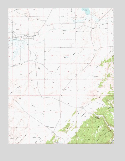
Cleveland, UT USGS Topographic Map
Click on map above to begin viewing in our Map Viewer.

This topographic map contains these locations and features:
Feature Name Type Latitude Longitude GNIS ID View Map
Big HillSummitN39.3147°W110.8299°1425494View Map
Bull HollowValleyN39.2800°W110.7771°1426121View Map
Bull Hollow CorralLocaleN39.2780°W110.7768°1426122View Map
Bull Hollow SpringSpringN39.2737°W110.7683°1426123View Map
C C C PondReservoirN39.3118°W110.7744°1426242View Map
ClevelandPopulated PlaceN39.3489°W110.8516°1426712View Map
Cleveland CemeteryCemeteryN39.3525°W110.8438°1435313View Map
Cleveland Elementary SchoolSchoolN39.3482°W110.8544°1435315View Map
Cleveland Fire DepartmentBuildingN39.3489°W110.8545°2627137View Map
Cleveland Post OfficePost OfficeN39.3489°W110.8575°1455221View Map
Desert LakeLakeN39.3735°W110.7828°1427348View Map
Desert Lake WashValleyN39.3675°W110.7818°1427350View Map
Desert Lake Waterfowl Management AreaParkN39.3691°W110.7904°1427351View Map
Goat SpringSpringN39.2832°W110.7536°1428215View Map
Greasewood FlatFlatN39.2797°W110.7804°1428376View Map
Hadden PitLakeN39.2652°W110.8262°1428465View Map
Hadden ReservoirReservoirN39.2657°W110.8277°1428467View Map
Jackass FlatFlatN39.2791°W110.8421°1429086View Map
Old Ramage PondLakeN39.3300°W110.8057°1430985View Map
Russel PondReservoirN39.3068°W110.8210°1432059View Map
Sand WashValleyN39.3555°W110.8104°1432215View Map
Shoemaker WashValleyN39.3583°W110.7840°1432415View Map
The Church of Jesus Christ of Latter Day SaintsChurchN39.3502°W110.8585°1436863View Map
The PeaksSummitN39.3197°W110.8407°1433396View Map
The RocksSummitN39.3000°W110.8099°1433415View Map
Timothy WashValleyN39.3661°W110.7840°1433532View Map
Town of ClevelandCivilN39.3494°W110.8555°2413214View Map

Note: Coordinates in the location and feature list above are referenced to NAD83 datum.


Copyright (C) 2008-2025 Ryan Niemi / Sunset Dynamics ... All Rights Reserved