TopoQuest Logo
Do you find TopoQuest useful?
Help keep TopoQuest running and adding new maps/features by donating!
Bitcoin:  19c7KJd3qBynnjoSw5npx9KScwjBe4ifkT
Litecoin:  LXs6TkuXGGXo1vDsWCkWVdjQX94eUKd6ui
Home View Maps Find Maps Find Places Resources & Links


Hadden Holes, Utah Topographic Map

USGS Map Title: Hadden Holes, UT
USGS Map MRC: 39110B8
DRG (GeoTIFF) Download: o39110b8.tif


Neighboring USGS Topographic Map Quads:


  Red Point, UT  
39111C1
 

  Huntington, UT  
39110C8
 

  Cleveland, UT  
39110C7
 

  Castle Dale, UT  
39111B1
 

  Hadden Holes, UT  
39110B8
 

  Buckhorn Reservoir, UT  
39110B7
 

  Molen, UT  
39111A1
 

  Horn Silver Gulch, UT  
39110A8
 

  Sids Mountain, UT  
39110A7


Map MRC Location:

N40°
W111°
N40°
W110°
H8 H7 H6 H5 H4 H3 H2 H1
G8 G7 G6 G5 G4 G3 G2 G1
F8 F7 F6 F5 F4 F3 F2 F1
E8 E7 E6 E5 E4 E3 E2 E1
D8 D7 D6 D5 D4 D3 D2 D1
C8 C7 C6 C5 C4 C3 C2 C1
B8 B7 B6 B5 B4 B3 B2 B1
A8 A7 A6 A5 A4 A3 A2 A1
N39°
W111°
N39°
W110°

Hadden Holes, UT USGS 1:24K Topographic Map Preview:
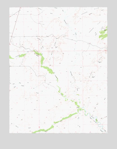
Hadden Holes, UT USGS Topographic Map
Click on map above to begin viewing in our Map Viewer.

This topographic map contains these locations and features:
Feature Name Type Latitude Longitude GNIS ID View Map
Black HillsSummitN39.1905°W110.8860°1425665View Map
Cat CanyonValleyN39.1261°W110.8771°1426396View Map
Cedar HollowValleyN39.2025°W110.9110°1426454View Map
Cottonwood CreekStreamN39.1491°W110.9129°1440015View Map
Dutchmans WashValleyN39.2044°W110.9579°1427640View Map
Ferron CreekStreamN39.1491°W110.9129°1441029View Map
Fivemile WashValleyN39.2408°W110.9279°1441106View Map
Gunnison TrailTrailN39.1936°W110.9952°1435636View Map
Hadden FlatFlatN39.2383°W110.8771°1428462View Map
Hadden HolesSpringN39.2275°W110.8799°1428464View Map
Hambrick BottomBendN39.1389°W110.8916°1428494View Map
Huntington CreekStreamN39.1491°W110.9129°1441953View Map
Johansen PondLakeN39.1952°W110.8873°1429195View Map
Merrials PondLakeN39.1806°W110.8954°1430233View Map
Oil Well DomeSummitN39.2102°W110.9418°1430960View Map
Peavine WashValleyN39.1289°W110.9643°1431161View Map
Red Seep WashValleyN39.1405°W110.8888°1431699View Map
Rock CanyonValleyN39.1639°W110.9374°1445051View Map
Rock Canyon CreekStreamN39.1630°W110.9349°1445053View Map
South WashValleyN39.1733°W110.9835°1445933View Map
The BreaksCliffN39.2016°W110.9618°1433277View Map
Wilberg WashValleyN39.2400°W110.9313°1447340View Map
Wilsonville CemeteryCemeteryN39.1758°W110.9492°2769390View Map

Note: Coordinates in the location and feature list above are referenced to NAD83 datum.


Copyright (C) 2008-2025 Ryan Niemi / Sunset Dynamics ... All Rights Reserved