TopoQuest Logo
Do you find TopoQuest useful?
Help keep TopoQuest running and adding new maps/features by donating!
Bitcoin:  19c7KJd3qBynnjoSw5npx9KScwjBe4ifkT
Litecoin:  LXs6TkuXGGXo1vDsWCkWVdjQX94eUKd6ui
Home View Maps Find Maps Find Places Resources & Links


Buckley, Illinois Topographic Map

USGS Map Title: Buckley, IL
USGS Map MRC: 40088E1
DRG (GeoTIFF) Download: o40088e1.tif


Neighboring USGS Topographic Map Quads:


  Buckley NW, IL  
40088F2
 

  Onarga West, IL  
40088F1
 

  Onarga East, IL  
40087F8
 

  Melvin East, IL  
40088E2
 

  Buckley, IL  
40088E1
 

  Cissna Park, IL  
40087E8
 

  Perdueville, IL  
40088D2
 

  Paxton, IL  
40088D1
 

  Rankin, IL  
40087D8


Map MRC Location:

N41°
W89°
N41°
W88°
H8 H7 H6 H5 H4 H3 H2 H1
G8 G7 G6 G5 G4 G3 G2 G1
F8 F7 F6 F5 F4 F3 F2 F1
E8 E7 E6 E5 E4 E3 E2 E1
D8 D7 D6 D5 D4 D3 D2 D1
C8 C7 C6 C5 C4 C3 C2 C1
B8 B7 B6 B5 B4 B3 B2 B1
A8 A7 A6 A5 A4 A3 A2 A1
N40°
W89°
N40°
W88°

Buckley, IL USGS 1:24K Topographic Map Preview:
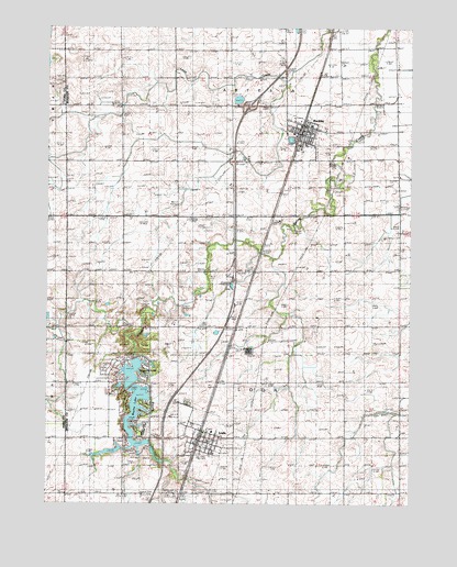
Buckley, IL USGS Topographic Map
Click on map above to begin viewing in our Map Viewer.

This topographic map contains these locations and features:
Feature Name Type Latitude Longitude GNIS ID View Map
Bayles LakeReservoirN40.5237°W88.0941°1747972View Map
Bayles LakeReservoirN40.5381°W88.0971°1691258View Map
Bayles Lake DamDamN40.5384°W88.0967°1691257View Map
Bayles Lake Landing Strip (historical)AirportN40.5195°W88.0903°1747973View Map
Brown Hill School (historical)SchoolN40.5184°W88.0228°404950View Map
BuckleyPopulated PlaceN40.5970°W88.0381°405136View Map
Buckley Fire Protection District - Buckley Ambulance ServiceBuildingN40.5967°W88.0374°2681888View Map
Buckley Post OfficePost OfficeN40.5993°W88.0370°2788909View Map
Drake School (historical)SchoolN40.5973°W88.0998°407378View Map
Grohler FarmsLocaleN40.5811°W88.0433°2741071View Map
Holmes School (historical)SchoolN40.5023°W88.0328°410408View Map
Immanuel Lutheran ChurchChurchN40.5181°W88.0681°1993513View Map
Interchange 272CrossingN40.6045°W88.0559°1815560View Map
Iroquois LakeReservoirN40.5344°W88.0955°1747991View Map
Lake Iroquois DamDamN40.5400°W88.0950°1691255View Map
LodaPopulated PlaceN40.5175°W88.0720°412500View Map
Loda Cemetery Prairie Nature PreserveParkN40.5273°W88.0759°1993298View Map
Loda Elementary SchoolSchoolN40.5189°W88.0678°1815575View Map
Loda Fire Protection DistrictBuildingN40.5181°W88.0727°2681914View Map
Loda Post OfficePost OfficeN40.5180°W88.0714°2741068View Map
Loda United Methodist ChurchChurchN40.5148°W88.0717°1993514View Map
McFarland School (historical)SchoolN40.5017°W88.0889°413260View Map
Mulberry Lane FarmLocaleN40.5231°W88.0775°2516599View Map
Pine Ridge CemeteryCemeteryN40.5267°W88.0770°415707View Map
Saint John Lutheran ChurchChurchN40.5992°W88.0359°1993507View Map
Saint John's Lutheran CemeteryCemeteryN40.5892°W88.0273°1951696View Map
Schumacher FarmLocaleN40.6058°W88.0614°2741074View Map
Shannon School (historical)SchoolN40.5606°W88.0373°418285View Map
Streff School (historical)SchoolN40.5600°W88.0992°419216View Map
Tavenner FarmsLocaleN40.5764°W88.0378°2741072View Map
Township of ArtesiaCivilN40.6139°W88.0206°428603View Map
Township of LodaCivilN40.5316°W88.0566°429273View Map
Village of BuckleyCivilN40.5975°W88.0375°2397485View Map
Village of LodaCivilN40.5162°W88.0759°2398464View Map
Widner LakeReservoirN40.5137°W88.1034°1692465View Map
Widner Lake DamDamN40.5150°W88.1000°1692464View Map

Note: Coordinates in the location and feature list above are referenced to NAD83 datum.


Copyright (C) 2008-2025 Ryan Niemi / Sunset Dynamics ... All Rights Reserved