TopoQuest Logo
Do you find TopoQuest useful?
Help keep TopoQuest running and adding new maps/features by donating!
Bitcoin:  19c7KJd3qBynnjoSw5npx9KScwjBe4ifkT
Litecoin:  LXs6TkuXGGXo1vDsWCkWVdjQX94eUKd6ui
Home View Maps Find Maps Find Places Resources & Links


Rankin, Illinois Topographic Map

USGS Map Title: Rankin, IL
USGS Map MRC: 40087D8
DRG (GeoTIFF) Download: o40087d8.tif


Neighboring USGS Topographic Map Quads:


  Buckley, IL  
40088E1
 

  Cissna Park, IL  
40087E8
 

  Claytonville, IL  
40087E7
 

  Paxton, IL  
40088D1
 

  Rankin, IL  
40087D8
 

  East Lynn, IL  
40087D7
 

  Gifford, IL  
40088C1
 

  Penfield, IL  
40087C8
 

  Potomac, IL  
40087C7


Map MRC Location:

N41°
W88°
N41°
W87°
H8 H7 H6 H5 H4 H3 H2 H1
G8 G7 G6 G5 G4 G3 G2 G1
F8 F7 F6 F5 F4 F3 F2 F1
E8 E7 E6 E5 E4 E3 E2 E1
D8 D7 D6 D5 D4 D3 D2 D1
C8 C7 C6 C5 C4 C3 C2 C1
B8 B7 B6 B5 B4 B3 B2 B1
A8 A7 A6 A5 A4 A3 A2 A1
N40°
W88°
N40°
W87°

Rankin, IL USGS 1:24K Topographic Map Preview:
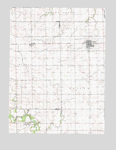
Rankin, IL USGS Topographic Map
Click on map above to begin viewing in our Map Viewer.

This topographic map contains these locations and features:
Feature Name Type Latitude Longitude GNIS ID View Map
Centennial School (historical)SchoolN40.4142°W87.9139°1764531View Map
ClarencePopulated PlaceN40.4639°W87.9709°406143View Map
Flagg School (historical)SchoolN40.3859°W87.9139°1764533View Map
Flagg School (historical)SchoolN40.4139°W87.9684°1810575View Map
Middle Fork River County Forest PreserveParkN40.3850°W87.9748°1748040View Map
Mount Olive ChurchChurchN40.4098°W87.9895°414022View Map
Mount Olivet CemeteryCemeteryN40.4100°W87.9900°1748023View Map
Parker Center School (historical)SchoolN40.4998°W87.9545°1815579View Map
Patton CemeteryCemeteryN40.3818°W87.9378°415450View Map
PellvillePopulated PlaceN40.4614°W87.9225°1764540View Map
Pellville CemeteryCemeteryN40.4611°W87.9245°415518View Map
Pleasant Grove CemeteryCemeteryN40.4064°W87.9839°415781View Map
Pleasant Grove United Methodist ChurchChurchN40.3998°W87.9659°415795View Map
RankinPopulated PlaceN40.4650°W87.8964°416385View Map
Rankin CemeteryCemeteryN40.4726°W87.8862°1764547View Map
Rankin City HallBuildingN40.4636°W87.8970°1764545View Map
Rankin Fire Protection District RankinBuildingN40.4645°W87.8973°2682546View Map
Rankin High SchoolSchoolN40.4598°W87.8953°1764502View Map
Rankin Post OfficePost OfficeN40.4641°W87.8970°1764546View Map
Sugar Grove School (historical)SchoolN40.3848°W87.9506°1802108View Map
Township of ButtonCivilN40.4431°W87.9874°428746View Map
Village of RankinCivilN40.4644°W87.8959°2399040View Map
Waite School (historical)SchoolN40.4420°W87.9514°1810607View Map

Note: Coordinates in the location and feature list above are referenced to NAD83 datum.


Copyright (C) 2008-2024 Ryan Niemi / Sunset Dynamics ... All Rights Reserved