TopoQuest Logo
Do you find TopoQuest useful?
Help keep TopoQuest running and adding new maps/features by donating!
Bitcoin:  19c7KJd3qBynnjoSw5npx9KScwjBe4ifkT
Litecoin:  LXs6TkuXGGXo1vDsWCkWVdjQX94eUKd6ui
Home View Maps Find Maps Find Places Resources & Links


Paxton, Illinois Topographic Map

USGS Map Title: Paxton, IL
USGS Map MRC: 40088D1
DRG (GeoTIFF) Download: o40088d1.tif


Neighboring USGS Topographic Map Quads:


  Melvin East, IL  
40088E2
 

  Buckley, IL  
40088E1
 

  Cissna Park, IL  
40087E8
 

  Perdueville, IL  
40088D2
 

  Paxton, IL  
40088D1
 

  Rankin, IL  
40087D8
 

  Rantoul, IL  
40088C2
 

  Gifford, IL  
40088C1
 

  Penfield, IL  
40087C8


Map MRC Location:

N41°
W89°
N41°
W88°
H8 H7 H6 H5 H4 H3 H2 H1
G8 G7 G6 G5 G4 G3 G2 G1
F8 F7 F6 F5 F4 F3 F2 F1
E8 E7 E6 E5 E4 E3 E2 E1
D8 D7 D6 D5 D4 D3 D2 D1
C8 C7 C6 C5 C4 C3 C2 C1
B8 B7 B6 B5 B4 B3 B2 B1
A8 A7 A6 A5 A4 A3 A2 A1
N40°
W89°
N40°
W88°

Paxton, IL USGS 1:24K Topographic Map Preview:
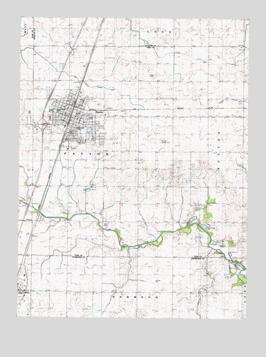
Paxton, IL USGS Topographic Map
Click on map above to begin viewing in our Map Viewer.

This topographic map contains these locations and features:
Feature Name Type Latitude Longitude GNIS ID View Map
Alpha Omega SchoolSchoolN40.4606°W88.1042°420867View Map
Augustana College (historical)SchoolN40.4548°W88.0898°1810559View Map
Belson ParkParkN40.4489°W88.1006°1748018View Map
Big Four DitchStreamN40.4161°W88.0962°404406View Map
Blake School (historical)SchoolN40.4661°W88.0225°1810562View Map
Blanchard School (historical)SchoolN40.4192°W88.0984°1810563View Map
Burbank School (historical)SchoolN40.3853°W88.0595°1802052View Map
C D Maulding AirportAirportN40.4587°W88.0748°427657View Map
Church of Christ (historical)ChurchN40.4589°W88.0950°1866505View Map
Church of the NazareneChurchN40.4631°W88.0998°1810565View Map
City of PaxtonCivilN40.4565°W88.1018°2396167View Map
Clara Peterson Elementary SchoolSchoolN40.4536°W88.0906°415585View Map
Cow Creek FarmLocaleN40.4156°W88.0575°2564387View Map
Evangelical Covenant ChurchChurchN40.4578°W88.0934°1810569View Map
Federated ChurchChurchN40.4606°W88.1000°1810570View Map
First Congregational Church (historical)ChurchN40.4606°W88.1000°1866506View Map
First Lutheran ChurchChurchN40.4564°W88.0898°1810572View Map
First Southern Baptist ChurchChurchN40.4548°W88.0889°1810574View Map
Ford County JailBuildingN40.4631°W88.0998°1866507View Map
Ford County Sheriff's OfficeBuildingN40.4631°W88.0991°2757033View Map
Fulton ParkParkN40.4531°W88.0953°1748019View Map
Gallagher School (historical)SchoolN40.3853°W88.0975°1802068View Map
Glazik FarmsLocaleN40.4447°W88.0775°2703759View Map
Glen CemeteryCemeteryN40.4500°W88.0912°409054View Map
Hall CemeteryCemeteryN40.4146°W88.0773°1748021View Map
Hall SchoolSchoolN40.4156°W88.0595°409660View Map
Harwood Chapel CemeteryCemeteryN40.3865°W88.0218°420682View Map
Hasselbring AirportAirportN40.4129°W88.0645°2679074View Map
Huffman CemeteryCemeteryN40.3906°W88.0498°410657View Map
Interchange 261CrossingN40.4553°W88.1123°1810583View Map
Middlecoff MansionBuildingN40.4592°W88.0914°1810586View Map
Miller School (historical)SchoolN40.4409°W88.1175°1810587View Map
Moffett SchoolLocaleN40.4453°W88.0609°413704View Map
PaxtonPopulated PlaceN40.4603°W88.0953°415468View Map
Paxton Carnegie LibraryBuildingN40.4589°W88.0984°1810590View Map
Paxton Church of ChristChurchN40.4550°W88.1059°1810591View Map
Paxton City HallBuildingN40.4598°W88.0975°1810592View Map
Paxton Community Hospital (historical)HospitalN40.4603°W88.0887°1866508View Map
Paxton Fire Protection DistrictBuildingN40.4636°W88.0965°2682342View Map
Paxton High SchoolSchoolN40.4611°W88.1087°1748024View Map
Paxton Post OfficePost OfficeN40.4594°W88.0977°2788241View Map
Paxton Public School (historical)SchoolN40.4595°W88.0950°1866509View Map
Paxton United Methodist ChurchChurchN40.4600°W88.1000°1810593View Map
Paxton-Buckley-Loda Junior High SchoolSchoolN40.4592°W88.0939°1810594View Map
Pells ParkCemeteryN40.4582°W88.0875°415517View Map
Prairie CreekStreamN40.4036°W88.0184°416125View Map
Prospect CemeteryCemeteryN40.4454°W88.0973°416236View Map
Prospect Cemetery Prairie Nature PreserveParkN40.4453°W88.0973°1992806View Map
Saint Marys Catholic ChurchChurchN40.4625°W88.1025°1810597View Map
Strayer School (historical)SchoolN40.4236°W88.0023°1810601View Map
Teds Place Airport (historical)AirportN40.4256°W88.0006°427658View Map
Trickel Grove School (historical)SchoolN40.4220°W88.0298°1810604View Map
Trickle Grove CemeteryCemeteryN40.4150°W88.0311°1748027View Map
Webber School (historical)SchoolN40.4209°W88.0211°1802114View Map
Westminister Presbyterian ChurchChurchN40.4586°W88.0945°1810608View Map
White School (historical)SchoolN40.4736°W88.0598°1810610View Map
WPXN-FM (Paxton)TowerN40.4531°W88.1031°428523View Map

Note: Coordinates in the location and feature list above are referenced to NAD83 datum.


Copyright (C) 2008-2024 Ryan Niemi / Sunset Dynamics ... All Rights Reserved