TopoQuest Logo
Do you find TopoQuest useful?
Help keep TopoQuest running and adding new maps/features by donating!
Bitcoin:  19c7KJd3qBynnjoSw5npx9KScwjBe4ifkT
Litecoin:  LXs6TkuXGGXo1vDsWCkWVdjQX94eUKd6ui
Home View Maps Find Maps Find Places Resources & Links


Buda NE, Illinois Topographic Map

USGS Map Title: Buda NE, IL
USGS Map MRC: 41089D5
DRG (GeoTIFF) Download: o41089d5.tif


Neighboring USGS Topographic Map Quads:


  New Bedford, IL  
41089E6
 

  Walnut, IL  
41089E5
 

  Ohio, IL  
41089E4
 

  Manlius, IL  
41089D6
 

  Buda NE, IL  
41089D5
 

  Princeton North, IL  
41089D4
 

  Buda, IL  
41089C6
 

  Wyanet, IL  
41089C5
 

  Princeton South, IL  
41089C4


Map MRC Location:

N42°
W90°
N42°
W89°
H8 H7 H6 H5 H4 H3 H2 H1
G8 G7 G6 G5 G4 G3 G2 G1
F8 F7 F6 F5 F4 F3 F2 F1
E8 E7 E6 E5 E4 E3 E2 E1
D8 D7 D6 D5 D4 D3 D2 D1
C8 C7 C6 C5 C4 C3 C2 C1
B8 B7 B6 B5 B4 B3 B2 B1
A8 A7 A6 A5 A4 A3 A2 A1
N41°
W90°
N41°
W89°

Buda NE, IL USGS 1:24K Topographic Map Preview:
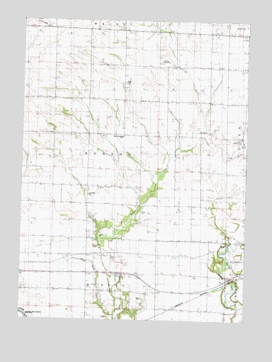
Buda NE, IL USGS Topographic Map
Click on map above to begin viewing in our Map Viewer.

This topographic map contains these locations and features:
Feature Name Type Latitude Longitude GNIS ID View Map
Aldrich Family CemeteryCemeteryN41.4056°W89.5815°1720958View Map
Bureau CountyCivilN41.4042°W89.5287°424207View Map
Bureau Township SchoolSchoolN41.4517°W89.5690°422189View Map
Community ChurchChurchN41.4273°W89.5876°1720966View Map
Corss CemeteryCemeteryN41.4200°W89.5584°1720969View Map
Farmora School (historical)SchoolN41.3870°W89.5948°422180View Map
Harrington School (historical)SchoolN41.4534°W89.6029°422181View Map
Heatons Point CemeteryCemeteryN41.4509°W89.5031°1720981View Map
Kauffman School (historical)SchoolN41.3898°W89.5206°422183View Map
Krause PondReservoirN41.4090°W89.5854°1691489View Map
Krause Pond DamDamN41.4100°W89.5868°1691488View Map
Latta School (historical)SchoolN41.4239°W89.6098°422184View Map
Lime CreekStreamN41.4514°W89.5273°422185View Map
Maple Grove CreekStreamN41.3770°W89.5720°1721002View Map
Maple Grove School (historical)SchoolN41.4014°W89.6029°422186View Map
Naffziger Landing Strip (historical)AirportN41.4825°W89.5457°1721007View Map
Prior School (historical)SchoolN41.4234°W89.5295°422187View Map
Roggy CemeteryCemeteryN41.4741°W89.5680°1721016View Map
Sapp CemeteryCemeteryN41.3842°W89.5570°1721021View Map
Sapp School (historical)SchoolN41.3875°W89.5534°422188View Map
Township of BureauCivilN41.4522°W89.5695°428735View Map

Note: Coordinates in the location and feature list above are referenced to NAD83 datum.


Copyright (C) 2008-2025 Ryan Niemi / Sunset Dynamics ... All Rights Reserved