TopoQuest Logo
Do you find TopoQuest useful?
Help keep TopoQuest running and adding new maps/features by donating!
Bitcoin:  19c7KJd3qBynnjoSw5npx9KScwjBe4ifkT
Litecoin:  LXs6TkuXGGXo1vDsWCkWVdjQX94eUKd6ui
Home View Maps Find Maps Find Places Resources & Links


Buena Vista NW, Georgia Topographic Map

USGS Map Title: Buena Vista NW, GA
USGS Map MRC: 32084D6
DRG (GeoTIFF) Download: o32084d6.tif


Neighboring USGS Topographic Map Quads:


  Midland, GA  
32084E7
 

  Upatoi, GA  
32084E6
 

  Geneva, GA  
32084E5
 

  Ochillee, GA  
32084D7
 

  Buena Vista NW, GA  
32084D6
 

  Buena Vista NE, GA  
32084D5
 

  Cusseta, GA  
32084C7
 

  Glen Alta, GA  
32084C6
 

  Buena Vista, GA  
32084C5


Map MRC Location:

N33°
W85°
N33°
W84°
H8 H7 H6 H5 H4 H3 H2 H1
G8 G7 G6 G5 G4 G3 G2 G1
F8 F7 F6 F5 F4 F3 F2 F1
E8 E7 E6 E5 E4 E3 E2 E1
D8 D7 D6 D5 D4 D3 D2 D1
C8 C7 C6 C5 C4 C3 C2 C1
B8 B7 B6 B5 B4 B3 B2 B1
A8 A7 A6 A5 A4 A3 A2 A1
N32°
W85°
N32°
W84°

Buena Vista NW, GA USGS 1:24K Topographic Map Preview:
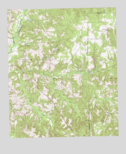
Buena Vista NW, GA USGS Topographic Map
Click on map above to begin viewing in our Map Viewer.

This topographic map contains these locations and features:
Feature Name Type Latitude Longitude GNIS ID View Map
Averetts PondReservoirN32.4894°W84.7237°310682View Map
Brown Springs ChurchChurchN32.4782°W84.6358°344093View Map
Carhart Store (historical)LocaleN32.4174°W84.6996°351009View Map
County Line ChurchChurchN32.3913°W84.6577°355336View Map
Culpepper Store (historical)LocaleN32.3846°W84.6816°351017View Map
Favorsville School (historical)SchoolN32.4707°W84.7238°351021View Map
Fellowship Church (historical)ChurchN32.4799°W84.7149°351022View Map
Gallups Mill (historical)LocaleN32.4340°W84.6999°351025View Map
Gallups MillpondSwampN32.4337°W84.6983°314494View Map
Little Pine Knot CreekStreamN32.4368°W84.7019°317148View Map
McMath PondReservoirN32.4595°W84.6943°317957View Map
Mount Pilgrim Church (historical)ChurchN32.4524°W84.7299°351047View Map
Mount Zion Church (historical)ChurchN32.4413°W84.6671°351048View Map
Peachtree BranchStreamN32.4382°W84.6541°344114View Map
Pine Knot School (historical)SchoolN32.4096°W84.6999°351054View Map
Pope PondReservoirN32.4521°W84.7054°321018View Map
Sally BranchStreamN32.4338°W84.7369°322376View Map
Snelling PondReservoirN32.4659°W84.7266°323190View Map
Spring CreekStreamN32.4399°W84.7155°323375View Map
Thomas Mill (historical)LocaleN32.4585°W84.6941°351068View Map
Underwood Mill (historical)LocaleN32.4135°W84.7271°351070View Map
Willetts LakeReservoirN32.4451°W84.6499°341470View Map
Willietts Lake DamDamN32.4451°W84.6499°341469View Map
Woodruff PondReservoirN32.4215°W84.7380°325545View Map

Note: Coordinates in the location and feature list above are referenced to NAD83 datum.


Copyright (C) 2008-2024 Ryan Niemi / Sunset Dynamics ... All Rights Reserved