TopoQuest Logo
Do you find TopoQuest useful?
Help keep TopoQuest running and adding new maps/features by donating!
Bitcoin:  19c7KJd3qBynnjoSw5npx9KScwjBe4ifkT
Litecoin:  LXs6TkuXGGXo1vDsWCkWVdjQX94eUKd6ui
Home View Maps Find Maps Find Places Resources & Links


Midland, Georgia Topographic Map

USGS Map Title: Midland, GA
USGS Map MRC: 32084E7
DRG (GeoTIFF) Download: o32084e7.tif


Neighboring USGS Topographic Map Quads:


  Mulberry Grove, GA  
32084F8
 

  Cataula, GA  
32084F7
 

  Waverly Hall, GA  
32084F6
 

  Fortson, GA  
32084E8
 

  Midland, GA  
32084E7
 

  Upatoi, GA  
32084E6
 

  Columbus, GA  
32084D8
 

  Ochillee, GA  
32084D7
 

  Buena Vista NW, GA  
32084D6


Map MRC Location:

N33°
W85°
N33°
W84°
H8 H7 H6 H5 H4 H3 H2 H1
G8 G7 G6 G5 G4 G3 G2 G1
F8 F7 F6 F5 F4 F3 F2 F1
E8 E7 E6 E5 E4 E3 E2 E1
D8 D7 D6 D5 D4 D3 D2 D1
C8 C7 C6 C5 C4 C3 C2 C1
B8 B7 B6 B5 B4 B3 B2 B1
A8 A7 A6 A5 A4 A3 A2 A1
N32°
W85°
N32°
W84°

Midland, GA USGS 1:24K Topographic Map Preview:
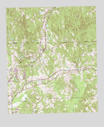
Midland, GA USGS Topographic Map
Click on map above to begin viewing in our Map Viewer.

This topographic map contains these locations and features:
Feature Name Type Latitude Longitude GNIS ID View Map
Aaron Cohn Regional Youth Detention CenterBuildingN32.5292°W84.8525°2735738View Map
Beaver LakeReservoirN32.5408°W84.8633°357249View Map
Beaver RunPopulated PlaceN32.5440°W84.8608°357251View Map
Bethel ChurchChurchN32.5524°W84.8697°311178View Map
Bonifay LakesReservoirN32.5777°W84.7625°311645View Map
Britton PondsLakeN32.5154°W84.8532°311811View Map
Bull Creek Reservoir Number 26ReservoirN32.5001°W84.7966°337556View Map
Bull Creek Reservoir Number OneReservoirN32.5401°W84.8483°337541View Map
Bull Creek Watershed Dam Number 21DamN32.5718°W84.8733°337550View Map
Bull Creek Watershed Lake Number 21ReservoirN32.5729°W84.8738°337551View Map
Bull Creek Watershed Structure Number 24 DamDamN32.5285°W84.8633°337552View Map
Central ChurchChurchN32.6210°W84.8035°312516View Map
Church of GodChurchN32.6212°W84.8169°350951View Map
Columbus DivisionCensusN32.5110°W84.8749°1936194View Map
Columbus Fire and Emergency Medical Services Station 5BuildingN32.5420°W84.8400°2604566View Map
Columbus Police Department Northside PrecinctBuildingN32.5390°W84.8447°2734186View Map
Commonwealth (historical)Populated PlaceN32.5399°W84.8119°357306View Map
Cunningham LakeReservoirN32.5850°W84.8333°340400View Map
Cunningham Lake DamDamN32.5851°W84.8349°340399View Map
Debrabant LakeReservoirN32.5282°W84.8630°337553View Map
Deer Run LakeReservoirN32.6140°W84.7746°340390View Map
Deer Run Lake DamDamN32.6118°W84.7749°340389View Map
Dozier CreekStreamN32.5026°W84.7844°313613View Map
Faulkner LakeReservoirN32.5889°W84.8160°314084View Map
Faulkner Lake DamDamN32.5868°W84.8149°338432View Map
Fieldcrest LakeReservoirN32.5983°W84.8171°340398View Map
Fieldcrest Lake DamDamN32.5985°W84.8166°340397View Map
Flat RockPopulated PlaceN32.5510°W84.8705°355826View Map
FoxrunPopulated PlaceN32.5363°W84.8722°357356View Map
Gates DamDamN32.5518°W84.7883°340425View Map
Gates LakeReservoirN32.5520°W84.7898°340426View Map
GordydalePopulated PlaceN32.6229°W84.8149°350966View Map
Hardaway DamDamN32.5668°W84.8533°340417View Map
Hardaway LakeReservoirN32.5680°W84.8540°340418View Map
Hedleys Pond DamDamN32.5051°W84.8416°338545View Map
Jenkin CemeteryCemeteryN32.5821°W84.8313°316068View Map
Jenkins DamDamN32.5635°W84.8349°340419View Map
Jenkins LakeReservoirN32.5635°W84.8349°340420View Map
Kitten LakeReservoirN32.5428°W84.8666°357405View Map
Lake CoraReservoirN32.5887°W84.8675°312970View Map
Lake PinesReservoirN32.5389°W84.8268°320666View Map
Locust Hill ChurchChurchN32.5660°W84.8424°317278View Map
Lynch Road SchoolSchoolN32.5574°W84.8410°317500View Map
Mahaffey LakeReservoirN32.6035°W84.8180°340396View Map
Mahaffey Lake DamDamN32.6018°W84.8183°340395View Map
McFarlan CemeteryCemeteryN32.5799°W84.7646°317908View Map
Medleys PondReservoirN32.5029°W84.8388°317994View Map
MidlandPopulated PlaceN32.5749°W84.8272°318098View Map
Mount Commodoe ChurchChurchN32.6115°W84.8647°318625View Map
Muscogee Youth Detention CenterBuildingN32.5292°W84.8523°2735775View Map
Pitts ChapelChurchN32.5557°W84.8405°320771View Map
Pratt and Whitney Aircraft HeliportAirportN32.5432°W84.8319°351716View Map
Quick Start Vocational SchoolSchoolN32.5168°W84.8735°357450View Map
Russel CemeteryCemeteryN32.5685°W84.8366°322010View Map
SchatulgaPopulated PlaceN32.5140°W84.8705°332991View Map
Spring Head LakeReservoirN32.6193°W84.8264°323405View Map
Spring Head Lake DamDamN32.6196°W84.8280°340393View Map
Stonewall Jackson DamDamN32.5118°W84.8166°340423View Map
Stonewall Jackson LakeReservoirN32.5118°W84.8166°340424View Map
Thornton DamDamN32.5368°W84.8316°340421View Map
Thornton LakeReservoirN32.5380°W84.8304°340422View Map
Widgeon LakeReservoirN32.5445°W84.8625°357517View Map
Willis CemeteryCemeteryN32.5787°W84.8046°325392View Map
Willis LakeReservoirN32.6249°W84.8025°325398View Map
Woodruff DamDamN32.5385°W84.8633°337561View Map
Woodruff LakeReservoirN32.5947°W84.8707°340388View Map
Woodruff LakeReservoirN32.5385°W84.8633°337562View Map
Woodruff Lake DamDamN32.5935°W84.8699°340387View Map
Woodruff North DamDamN32.5435°W84.8633°340068View Map
Woodruff North LakeReservoirN32.5445°W84.8625°340069View Map

Note: Coordinates in the location and feature list above are referenced to NAD83 datum.


Copyright (C) 2008-2024 Ryan Niemi / Sunset Dynamics ... All Rights Reserved