TopoQuest Logo
Do you find TopoQuest useful?
Help keep TopoQuest running and adding new maps/features by donating!
Bitcoin:  19c7KJd3qBynnjoSw5npx9KScwjBe4ifkT
Litecoin:  LXs6TkuXGGXo1vDsWCkWVdjQX94eUKd6ui
Home View Maps Find Maps Find Places Resources & Links


Allendale, California Topographic Map

USGS Map Title: Allendale, CA
USGS Map MRC: 38121D8
DRG (GeoTIFF) Download: o38121d8.tif


Neighboring USGS Topographic Map Quads:


  Monticello Dam, CA  
38122E1
 

  Winters, CA  
38121E8
 

  Merritt, CA  
38121E7
 

  Mount Vaca, CA  
38122D1
 

  Allendale, CA  
38121D8
 

  Dixon, CA  
38121D7
 

  Fairfield North, CA  
38122C1
 

  Elmira, CA  
38121C8
 

  Dozier, CA  
38121C7


Map MRC Location:

N39°
W122°
N39°
W121°
H8 H7 H6 H5 H4 H3 H2 H1
G8 G7 G6 G5 G4 G3 G2 G1
F8 F7 F6 F5 F4 F3 F2 F1
E8 E7 E6 E5 E4 E3 E2 E1
D8 D7 D6 D5 D4 D3 D2 D1
C8 C7 C6 C5 C4 C3 C2 C1
B8 B7 B6 B5 B4 B3 B2 B1
A8 A7 A6 A5 A4 A3 A2 A1
N38°
W122°
N38°
W121°

Allendale, CA USGS 1:24K Topographic Map Preview:
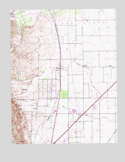
Allendale, CA USGS Topographic Map
Click on map above to begin viewing in our Map Viewer.

This topographic map contains these locations and features:
Feature Name Type Latitude Longitude GNIS ID View Map
AllendalePopulated PlaceN38.4446°W121.9430°218147View Map
Allendale Census Designated PlaceCensusN38.4427°W121.9814°2582932View Map
Allendale Fire StationBuildingN38.4221°W121.9536°1799879View Map
Browns Valley Elementary SchoolSchoolN38.4088°W121.9711°219914View Map
Casbar FarmsLocaleN38.4514°W121.8992°2676141View Map
Drakes PointSummitN38.3766°W121.9886°253691View Map
Dry ArroyoStreamN38.4757°W121.9364°222602View Map
Eldridge FarmLocaleN38.4961°W121.9569°2703416View Map
English CreekStreamN38.4255°W121.9822°223214View Map
Grant SchoolLocaleN38.4466°W121.9150°224426View Map
Green Tree Golf CourseLocaleN38.3791°W121.9366°1799908View Map
HartleyPopulated PlaceN38.4171°W121.9469°252687View Map
Hartley Census Designated PlaceCensusN38.4202°W121.9523°2583031View Map
Los PutosCivilN38.3902°W121.9666°227686View Map
McCune CreekStreamN38.4974°W121.9977°228338View Map
Nut Tree AirportAirportN38.3759°W121.9608°1654080View Map
Olive SchoolSchoolN38.4949°W121.9989°230007View Map
Pleasant CreekStreamN38.4782°W121.9914°230797View Map
Putah South CanalCanalN38.3935°W121.9627°231103View Map
Sacramento Valley National CemeteryCemeteryN38.4167°W121.8780°2498897View Map
Union ChapelChurchN38.4444°W121.9455°236786View Map
Vaca Dixon SubstationLocaleN38.4007°W121.9205°1654500View Map
Vaca Valley RacewayLocaleN38.4074°W121.8994°1654501View Map
Vaca-Dixon Gliderport (historical)AirportN38.4057°W121.9061°1653404View Map
Vacaville Fire Department Station 73BuildingN38.3956°W121.9608°1799897View Map
Vacaville Fire Protection District Station 64BuildingN38.3775°W121.9943°2623779View Map
Vacaville Fire Protection District Station 67BuildingN38.4173°W121.9950°1799892View Map
Violet (historical)Populated PlaceN38.3841°W121.9719°1670842View Map

Note: Coordinates in the location and feature list above are referenced to NAD83 datum.


Copyright (C) 2008-2025 Ryan Niemi / Sunset Dynamics ... All Rights Reserved