TopoQuest Logo
Do you find TopoQuest useful?
Help keep TopoQuest running and adding new maps/features by donating!
Bitcoin:  19c7KJd3qBynnjoSw5npx9KScwjBe4ifkT
Litecoin:  LXs6TkuXGGXo1vDsWCkWVdjQX94eUKd6ui
Home View Maps Find Maps Find Places Resources & Links


Dixon, California Topographic Map

USGS Map Title: Dixon, CA
USGS Map MRC: 38121D7
DRG (GeoTIFF) Download: o38121d7.tif


Neighboring USGS Topographic Map Quads:


  Winters, CA  
38121E8
 

  Merritt, CA  
38121E7
 

  Davis, CA  
38121E6
 

  Allendale, CA  
38121D8
 

  Dixon, CA  
38121D7
 

  Saxon, CA  
38121D6
 

  Elmira, CA  
38121C8
 

  Dozier, CA  
38121C7
 

  Liberty Island, CA  
38121C6


Map MRC Location:

N39°
W122°
N39°
W121°
H8 H7 H6 H5 H4 H3 H2 H1
G8 G7 G6 G5 G4 G3 G2 G1
F8 F7 F6 F5 F4 F3 F2 F1
E8 E7 E6 E5 E4 E3 E2 E1
D8 D7 D6 D5 D4 D3 D2 D1
C8 C7 C6 C5 C4 C3 C2 C1
B8 B7 B6 B5 B4 B3 B2 B1
A8 A7 A6 A5 A4 A3 A2 A1
N38°
W122°
N38°
W121°

Dixon, CA USGS 1:24K Topographic Map Preview:
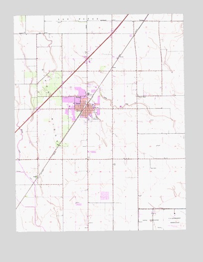
Dixon, CA USGS Topographic Map
Click on map above to begin viewing in our Map Viewer.

This topographic map contains these locations and features:
Feature Name Type Latitude Longitude GNIS ID View Map
Anderson Elementary SchoolSchoolN38.4479°W121.8181°222873View Map
BataviaPopulated PlaceN38.4063°W121.8597°1655814View Map
C A Jacobs Middle SchoolSchoolN38.4470°W121.8355°226106View Map
City of DixonCivilN38.4467°W121.8249°2410343View Map
Cornerstone Baptist ChurchChurchN38.4402°W121.8230°1799884View Map
Dickson CreekStreamN38.3760°W121.7541°217917View Map
DixonPopulated PlaceN38.4455°W121.8233°1655973View Map
Dixon City HallBuildingN38.4452°W121.8161°1799885View Map
Dixon Community ChurchChurchN38.4452°W121.8230°1799886View Map
Dixon DivisionCivilN38.4239°W121.8019°1935074View Map
Dixon Fire DepartmentBuildingN38.4577°W121.8202°2623660View Map
Dixon High SchoolSchoolN38.4370°W121.8180°1799887View Map
Dixon May FairgroundsParkN38.4396°W121.8205°1799888View Map
Dixon Methodist ChurchChurchN38.4469°W121.8252°1799889View Map
Dixon Neighborhood ChurchChurchN38.4527°W121.8283°1799890View Map
Dixon Police DepartmentBuildingN38.4452°W121.8241°2755924View Map
Dixon Post OfficePost OfficeN38.4452°W121.8244°1799958View Map
Dixon Public LibraryBuildingN38.4469°W121.8222°1799891View Map
Dixon RidgeRidgeN38.4480°W121.8483°222441View Map
Eatwell FarmLocaleN38.4950°W121.8742°2676142View Map
Family Christian CenterChurchN38.4527°W121.8244°1799893View Map
Freese FarmsLocaleN38.3986°W121.8458°2676140View Map
Gibson Canyon CreekStreamN38.3891°W121.8619°224150View Map
Hall Memorial ParkParkN38.4416°W121.8175°1799909View Map
KLCQ-FM (Davis)TowerN38.4957°W121.8080°1662846View Map
Maine Prairie AirportAirportN38.3821°W121.8237°1653403View Map
Neighborhood Christian SchoolSchoolN38.4404°W121.8219°1799918View Map
Northwest ParkParkN38.4552°W121.8327°1799919View Map
Redeille FarmsLocaleN38.4650°W121.8372°2676143View Map
Saint Peters Catholic ChurchChurchN38.4455°W121.8211°1799933View Map
Silveyville CemeteryCemeteryN38.4377°W121.8238°1799937View Map
Silveyville Primary SchoolSchoolN38.4491°W121.8330°237455View Map
SucroPopulated PlaceN38.4696°W121.8047°1656337View Map
The Church of Jesus Christ of Latter Day SaintsChurchN38.4471°W121.8369°1799882View Map
Tremont SchoolSchoolN38.4524°W121.7861°236534View Map
Veterans Memorial HallBuildingN38.4471°W121.8227°1799955View Map
Westside ParkParkN38.4482°W121.8341°1799956View Map
Womens Improvement Club ParkParkN38.4474°W121.8225°1799957View Map

Note: Coordinates in the location and feature list above are referenced to NAD83 datum.


Copyright (C) 2008-2024 Ryan Niemi / Sunset Dynamics ... All Rights Reserved