TopoQuest Logo
Do you find TopoQuest useful?
Help keep TopoQuest running and adding new maps/features by donating!
Bitcoin:  19c7KJd3qBynnjoSw5npx9KScwjBe4ifkT
Litecoin:  LXs6TkuXGGXo1vDsWCkWVdjQX94eUKd6ui
Home View Maps Find Maps Find Places Resources & Links


Dozier, California Topographic Map

USGS Map Title: Dozier, CA
USGS Map MRC: 38121C7
DRG (GeoTIFF) Download: o38121c7.tif


Neighboring USGS Topographic Map Quads:


  Allendale, CA  
38121D8
 

  Dixon, CA  
38121D7
 

  Saxon, CA  
38121D6
 

  Elmira, CA  
38121C8
 

  Dozier, CA  
38121C7
 

  Liberty Island, CA  
38121C6
 

  Denverton, CA  
38121B8
 

  Birds Landing, CA  
38121B7
 

  Rio Vista, CA  
38121B6


Map MRC Location:

N39°
W122°
N39°
W121°
H8 H7 H6 H5 H4 H3 H2 H1
G8 G7 G6 G5 G4 G3 G2 G1
F8 F7 F6 F5 F4 F3 F2 F1
E8 E7 E6 E5 E4 E3 E2 E1
D8 D7 D6 D5 D4 D3 D2 D1
C8 C7 C6 C5 C4 C3 C2 C1
B8 B7 B6 B5 B4 B3 B2 B1
A8 A7 A6 A5 A4 A3 A2 A1
N38°
W122°
N38°
W121°

Dozier, CA USGS 1:24K Topographic Map Preview:
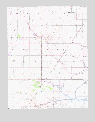
Dozier, CA USGS Topographic Map
Click on map above to begin viewing in our Map Viewer.

This topographic map contains these locations and features:
Feature Name Type Latitude Longitude GNIS ID View Map
Alamo CreekStreamN38.3366°W121.8180°218056View Map
Barker SloughStreamN38.2605°W121.7752°218672View Map
BinghamtonPopulated PlaceN38.3513°W121.8227°252630View Map
BunkerPopulated PlaceN38.3507°W121.7583°252643View Map
Calhoun CutCanalN38.2585°W121.8033°220393View Map
Campbell RanchLocaleN38.2886°W121.8258°2676144View Map
DozierPopulated PlaceN38.2855°W121.8166°252665View Map
Hastings CutCanalN38.2791°W121.7591°225002View Map
Hay Road LandfillLocaleN38.3114°W121.8372°2726408View Map
Maine PrairiePopulated PlaceN38.3080°W121.7588°252730View Map
Maine Prairie SchoolSchoolN38.3296°W121.7858°227972View Map
Maine Prairie SloughStreamN38.3080°W121.7591°227973View Map
Maine Prarie Number 3 1040 DamDamN38.3349°W121.8161°1664194View Map
OlcottPopulated PlaceN38.2771°W121.8241°252756View Map
Sweany CreekStreamN38.3482°W121.8350°235880View Map
The Big DitchStreamN38.2532°W121.7691°236149View Map
ValePopulated PlaceN38.3202°W121.7855°1656382View Map

Note: Coordinates in the location and feature list above are referenced to NAD83 datum.


Copyright (C) 2008-2025 Ryan Niemi / Sunset Dynamics ... All Rights Reserved